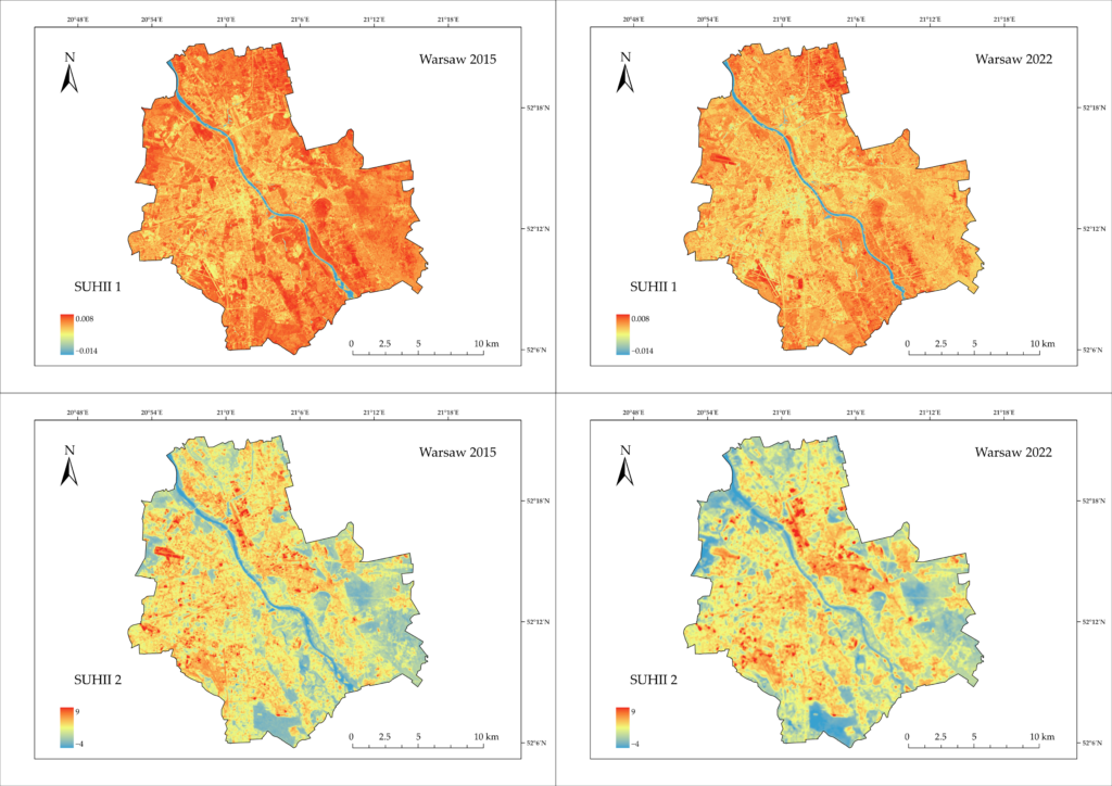

The journal Applied Sciences, issued by MDPI, has published an article titled “Comparative Analysis of Calculation Methods for Surface Urban Heat Island Intensity: A Case Study of Warsaw, Poland,” which addresses the evaluation and comparison of various methods for estimating surface urban heat island intensity (SUHII) in Warsaw. This publication is the result of collaboration between researchers from the Center of Applied Geomatics and the Center of Remote Sensing at the Institute of Geodesy and Cartography (Dr. Anna Markowska, M.Sc. Eng. Julia Baranowska, M.Sc. Konrad Wróblewski), the Military University of Technology (Dr. Elżbieta Bielecka, Ph.D., Eng.) and the Warsaw University of Technology (Dr. Katarzyna Osińska-Skotak, Ph.D., Eng.).
The study compared six methods for determining SUHII based on satellite images captured during heat waves. It was shown that the choice of algorithm is crucial for the results obtained, and the method that best suited the specific conditions of Warsaw was the one that eliminated the cooling effect of water bodies, such as the Vistula River. Attention was also drawn to how extreme weather conditions and severe drought in suburban vegetation can drastically reduce the thermal contrast between urban areas and their green surroundings.
We invite you to read the article.
Link to the publication: https://www.mdpi.com/2076-3417/16/16/8195