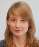
An employee of the Institute of Geodesy and Cartography since 2017, in the position of assistant professor since 2019. At the same time expert at the Central Examination Commission for the baccalaureate and eighth-grade exams in geography. Previously research and analysis specialist at the Institute of Educational Research (geography), an assistant at the Faculty of Geography and Regional Studies of the UW (Department of Cartography), documentalist at the Institute of History of the Polish Academy of Sciences (Historical Atlas Workshop), GIS specialist at WS Atkins (environmental impact assessments) and cartographer at Carta Blanka publishing house. Graduated from the Doctoral Program of the Faculty of Geography and Regional Studies of the UW (2015, PhD in Earth Sciences 2018). Completed postgraduate studies ‘Data Science in Python’ at the University of Warmia and Mazury, Faculty of Mathematics (2022).
Delegate of Poland in EIONET (European Network for Environmental Information and Observation) in the field of land cover (CORINE Land Cover). Thematic editor of the journal ‘Prace i Studia Geograficzne’ in the field of cartography and geoinformation. Member of the Polish Committee for Standardisation (PKN) Technical Committee 297, the Earth Observation Toolkit for Sustainable Cities and Communities programme working group, the Commission on Cognitive Issues in Geographic Information Visualization (International Cartographic Association), and the National Committee for the International Cartographic Association.
She is experienced in spatial analysis using spatial (GIS) and satellite data. He develops static maps, dynamic maps, and geoportals. She has experience in statistical analysis and the development of algorithms for the analysis of statistical and spatial data.
E-mail: anna.markowska@igik.edu.pl
ORCID orcid.org/0000-0001-8446-6171
ResearchGate: https://www.researchgate.net/profile/Anna-Markowska
Linkedin linkedin.com/in/anna-markowska-05a25b41
Latest projects:
2025- now: „CORINE Land Cover 2024 (CLC2024)”, European Environment Agency, Project Manager and GIS specialist
2025- now: „Smart Village Plus, Mazowieckie Voivodship, GIS specialist
2024- now: „ Satellite monitoring of agricultural drought 2024”, POLSA; GIS specialist
2024- now: „Open Data Framework for the Baltic Sea Drainage Basin”, European Commission, GIS specialist
2022-2024: AGRONAUCI, „Opracowanie innowacyjnej metody i technologii diagnostyki stanu odżywienia roślin zbożowych azotem i fosforem, ze szczególnym uwzględnieniem żyta, we wczesnych fazach rozwojowych z wykorzystaniem danych satelitarnych oraz jej wdrożenie w postaci narzędzia cyfrowego wspierającego innowacyjny proces produkcji, marketingu oraz sprzedaży produktów rolnych”, PROW, GIS specialist
2023: „ Satellite monitoring of agricultural drought 2023”, POLSA; GIS specialist
2022-2023: Automated development of a selected class of area cartograms; IGIK, kierownik projektu, GIS specialist
2022-2023: EOStat – Agriculture Poland. Support of Ukraine in collection of agricultural statistics using tools developed within EOStat project according to the State Statistics Service of Ukraine (SSSU) needs, ESA, GIS specialist
2022-2023: Developing a methodology for statistical monitoring of the environmental development potential of Polish cities; GIS specialist
2022: „Satellite monitoring of agricultural drought 2022”, POLSA; GIS specialist
2021-2023: GAUSS – Generating Advanced Usage of Earth Observation for Smart Statistics, ESA, GIS specialist
2020-2024: Common system and platform, based on Copernicus data and services, for Agricultural Agencies in Poland, European Commission, GIS specialist
2020-2024: Tools for information to farmers on grasslands yields under stressed conditions to support management practices (GRASSAT), NCBR, GIS specialist
2020-2022: 2nd update of the River Basin Management Plans; Project Manager IGIK and GIS specialist;
2020-2021: Development of a methodology for assessing the correctness of the development of selected classes of area cartograms, Project Manager;
2020-2021: Development of a methodology for designing animated cartographic teaching aids to support the teaching of geography and history in secondary schools, main contractor
2020: „Satellite monitoring of agricultural drought”, KOWR; GIS specialist
2019-2022: Civil topographic maps of the European Union and European Economic Area countries. Analysis and synthesis of assumptions, how to harmonise source information, how to generate studies from topographic databases and how to solve the main methodological and semiotic problems, main contractor (IGiK);
2019-2020: Modernisation and updating of the OGNIWO Geoportal. (Project financed by IGiK), Project Manager and GIS specialist;
Publications:
Markowska A., Paradowski K. “Use of Copernicus data for developing a geoportal to support agricultural management monitoring in Poland”, 2025. https://sciendo.com/pl/article/10.2478/pcr-2025-0002
Markowska A., Dąbrowska-Zielińska K., Wróblewski K., Wyczałek-Jagiełło M., Ziółkowski D., Goliński P. 2025. Application Maps in Precision Agriculture – Grassland Production Management in Poland. Quaestiones Geographicae, Adam Mickiewicz University, Vol. 44(1), 2025. https://doi.org/10.14746/quageo-2025-0008
Markowska, A. and Paradowski, K.: Possibilities of using satellite data in the development of geoportals depending on users’ needs, Abstr. Int. Cartogr. Assoc., 8, 17, https://doi.org/10.5194/ica-abs-8-17-2024 , 2024.
Panek-Chwastyk, E.; Dąbrowska-Zielińska, K.; Kluczek, M.; Markowska, A.; Woźniak, E.; Bartold, M.; Ruciński, M.; Wojtkowski, C.; Aleksandrowicz, S.; Gromny, E.; et al. Estimates of Crop Yield Anomalies for 2022 in Ukraine Based on Copernicus Sentinel-1, Sentinel-3 Satellite Data, and ERA-5 Agrometeorological Indicators. Sensors 2024, 24, 2257. https://doi.org/10.3390/s24072257
Panek-Chwastyk E.; Katarzyna Dąbrowska-Zielińska K.; Markowska A.; Kluczek A.; Pieniążek M., Advanced utilization of satellite and governmental data for determining the coverage and condition of green areas in Poland: An experimental statistics supporting the Statistics Poland, International Journal of Applied Earth Observation and Geoinformation, 2024. https://doi.org/10.1016/j.jag.2024.103883
Elżbieta Bielecka, Anna Markowska, Dariusz Dukaczewski, 2024, Applying Chorems in the Cartographic Presentation of Barriers to Socio-Economic Development in Poland, Quaestiones Geographicae, Tom 43 (2024): Zeszyt 3 (Wrzesień 2024), DOI https://doi.org/10.14746/quageo-2024-0030
Dąbrowska-Zielińska, K., Wróblewski, K., Goliński, P., Malińska, A., Bartold, M., Łągiewska, M., Markowska, A., Paradowski, K. (2024). Integrating Copernicus LMS with ground measurements data for leaf area index and biomass assessment for grasslands in Poland and Norway. International Journal of Digital Earth, 17(1). https://doi.org/10.1080/17538947.2024.2425165
Dariusz Dukaczewski, Elżbieta Bielecka and Anna Markowska, 2024, CHOREMATIC DIAGRAMS – A VISUAL REPRESENTATION OF THE REALITY, Proceedings, 9th International Conference on Cartography and GIS, 16-21 June 2024, Nessebar, Bulgaria ISSN: 1314-0604, Eds: Bandrova T., Konečný M., Marinova S. https://iccgis2024.cartography-gis.com/papers/9ICCGIS-Proceedings_Paper%20(23).pdf
Markowska, A. and Dukaczewski, D.: Qualitative and quantitative assessment of the correctness of the development of area cartograms, Abstr. Int. Cartogr. Assoc., 5, 130, https://doi.org/10.5194/ica-abs-5-130-2022 , 2022.
Dukaczewski D., Markowska A., 2021 “Urban Policy Observatory Programme for Sustainable Cities and Communities Mapping in Poland”, Abstracts of the ICA, No. 3, DOI: 10.5194/ica-abs-3-72-2021 https://ica-abs.copernicus.org/articles/3/72/2021/
Dukaczewski D., Markowska A., 2020, “GEO AND UN – HABITAT programme ‘Earth observation toolkit for sustainable cities and communities’ and ‘Urban policy observatory’ project”, Annals of Geomatics, T. XVIII, No 3 (90), pp. 165-185 http://rg.ptip.org.pl/index.php/rg/article/view/1766
Markowska A., 2019, „Badanie użyteczności kartograficznych anamorfoz powierzchniowych w szkołach., Instytut Geodezji i Kartografii, Warszawa, s. 184 (plus załączniki CD), ISBN 978-83-60024-25-6.
Markowska A., 2019, „Using Area Cartograms in Teaching Geography in Secondary Schools”, Abstr. Int. Cartogr. Assoc., 1, 240, https://doi.org/10.5194/ica-abs-1-240-2019 .
Ostrowski W., Dukaczewski D., Markowska A., 2019, „Presentation of build-up areas on topographic maps of selected European countries”, Polish Cartographical Review, Vol. 51, , no. 1, DOI: 10.2478/pcr-2019-0001. https://sciendo.com/pl/article/10.2478/pcr-2019-0001
Korycka-Skorupa J., Nowacki T., Gołębiowska I., Markowska A., Kowalski P., Pasławski J., 2015, „Kartografia w praktyce. Prezentacja danych ilościowych”, Wydawnictwo UMCS, Lublin (rozdziały 7 i 8).
Markowska A., Korycka-Skorpa J., 2015, “An evaluation of GIS tools for generating area cartograms”., Polish Cartographical Review, Vol. 47, no. 1, s. 19−29. DOI: 10.1515/pcr-2015-0002 . https://sciendo.com/pl/article/10.1515/pcr-2015-0002
Hałaczek J., Markowska A., Nowacki T., Opach T., Żmijewska J., 2014, „Kształtowanie umiejętności korzystania z map w gimnazjalnych podręcznikach do geografii”, Instytut Badań Edukacyjnych, Warszawa, 30 s.
Markowska A., 2014, „Inne spojrzenie na świat – kartograficzne anamorfozy powierzchniowe”, Edukacja Biologiczna i Środowiskowa, T. 50 nr 2, s. 41-52.
Markowska A., 2014, „Wykorzystanie aplikacji internetowych w badaniach kartograficznych z zakresu użyteczności kartograficznych anamorfoz powierzchniowych”. w:Kartografia w multimediach. Multimedia w kartografii, streszczenia, s. 68-69.
Markowska A., Lechowicz M., Grajkowski W., M. M. Chrzanowski, K. Spalik, J. Borgensztajn, E. B. Ostrowska, M. Musialik, 2014, „Błędne przekonania w nauczaniu przedmiotów przyrodniczych”, Edukacja Biologiczna i Środowiskowa, T. 53, nr 4, s. 56-67.
Atlas gór świata, 2013, opracowanie zbiorowe (w tym Faliszewska A.), Wydawnictwo Turystyczne ExpressMap, Warszawa, Fragmenty dotyczące Azji Południowej i Południowo-Wschodniej – s.244-247, 250-253, 256-261.
Faliszewska A., 2013, „Zarys historii anamorfoz kartograficznych”, Z dziejów kartografii, T. XVII, s.309-325, Wydawnictwa IHN PAN.
Faliszewska A., 2012, „Readability of Value-by-Area Maps”, Polish Cartographical Review, T. 44, nr 3, s. 225-238. https://yadda.icm.edu.pl/baztech/element/bwmeta1.element.baztech-article-BAR8-0020-0094/c/faliszewska_badania_3_2012.pdf
Mapy tematyczne do wersji angielskiej „Atlasu historycznego Polski”, redakcja i opracowanie map szczegółowych XVI wieku” wydanego przez Instytut Historii Polskiej Akademii Nauk, 2013: Main Roads in the End of 16th Century 1:500 000 / State and Ecclesiastical Borders in the End of 16th Century 1:500 000 / Distribution of Land Ownership in the End of 16th Century 1:500 000 / Protestant Communities in Cracow and Sandomierz Voivodeships in the End of 16th Century 1:500 000.
Faliszewska A, 2012, „Geological and tourist maps of the national parks. Warsaw PIG, 2010”, (rec), Polish Cartographical Review, T 44(2), 151-154.
Faliszewska A., 2012, „The atlas of the real world. Mapping the way we live”. Daniel Dorling, Mark Newman, Anna Barford. New York: Thames & Hudson, 2010 (rec.), Polish Cartographical Review, 44(3).
Faliszewska A., 2012, „Zastosowanie anamorfoz kartograficznych do prezentacji zjawisk społeczno-gospodarczych”, Nowe trendy w naukach humanistycznych i społeczno-ekonomicznych, Tom I, s. 161-173.
Faliszewska A., Korycka-Skorupa J., 2010, „Dorling Cartogram”. Polish Cartographical Review T. 42(2), 113-127

