Project IMAGE-UP
The goal of the IMAGE-UP project is to calibrate and validate the super-resolution reconstruction method, with the aim of further applying it to analyses dedicated to three customer sectors: precision agriculture, energy infrastructure managers, and urban space management institutions.
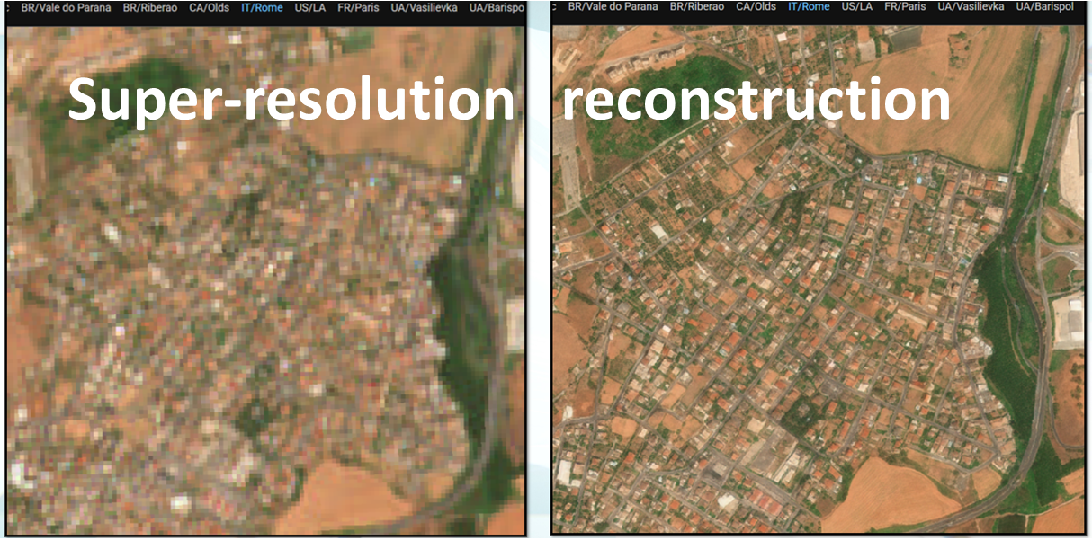
Super-resolution reconstruction involves increasing spatial resolution through the use of mathematical models. This procedure allows us to obtain greater image detail and is able to monitor objects much smaller than in the initial image. The project will use the super-resolution reconstruction method developed by Gamma Earth from Switzerland. This method allows for an increase in the resolution of Sentinel 2 images by up to 10 times. This means that the resolution of the original image of 10 m (a pixel is 10 by 10 m) is increased to 1-2 m.
The project hypothesizes that super-resolution reconstruction affects the accuracy of the spectral response of objects recorded by the satellite. In other words, the image after super-resolution reconstruction may contain incorrect information. To estimate the error and calibrate this method to reduce the error to a level acceptable to end users, the resulting images will be calibrated, meaning the model will be retrained for dedicated application areas, known as use cases. This will improve reconstruction accuracy, and the finished satellite images will therefore achieve higher analytical value.
Based on the calibration and subsequent validation (testing with end users), three algorithms, tailored to aforementioned end users, will be delivered. This process will increase end users’ confidence in this method, intensify the use of the Copernicus programme, and contribute to achieving the SDGs through the use of EO-based technologies.
The project’s results will consist of four new and commercially viable key results: a validated super-resolution reconstruction method and three algorithms based on this data, dedicated to the indicated sectors.
Project leader: Institute of Geodesy and Cartography
Partner: Gamma Earth Sarl / Switzerland
Implementation period: 2025–2028
Funding: National Center for Research and Development
The IMAGE-UP project is funded under the Second Swiss Contribution (Swiss-Polish Cooperation Programme), co-financed by the Government of the Swiss Confederation and the Government of the Republic of Poland, and implemented by the National Centre for Research and Development (NCBR).