Since 2022, the Institute of Geodesy and Cartography (IGiK) has been annually preparing satellite data and providing advanced maps and analyses as part of the service “Satellite Monitoring of Agricultural Drought”, commissioned by the Polish Space Agency (POLSA).
All developed products are published within the National Satellite Information System (NSIS) — a platform managed by POLSA. The portal provides free access to maps, analyses, and statistical tools for users across different sectors. The NSIS platform is available at: https://nsisplatforma.polsa.gov.pl
Scope of delivered products:
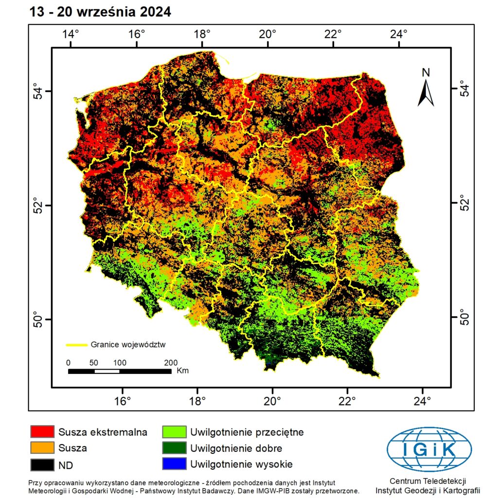
- Crop Growth Condition Maps (DISS) — generated annually for the vegetation season in 24 eight-day intervals (from March 30 to September 30), showing conditions on a five-level scale: extreme drought, drought, average moisture, good moisture, high moisture.
- Yield Reduction Assessment Maps — prepared for five groups of crops: winter cereals, spring cereals, root crops, maize, and winter oilseed rape. These products classify yield reduction into three levels: low, moderate, and high, based on the periods of the highest water demand.
With annual updates and continuous improvement of the methodology, the Institute of Geodesy and Cartography delivers a reliable tool supporting precision agriculture. The NSIS platform enables farmers, advisors, and public administration to easily access essential data for drought monitoring and decision-making in agricultural management.