Fire in Biebrza National Park
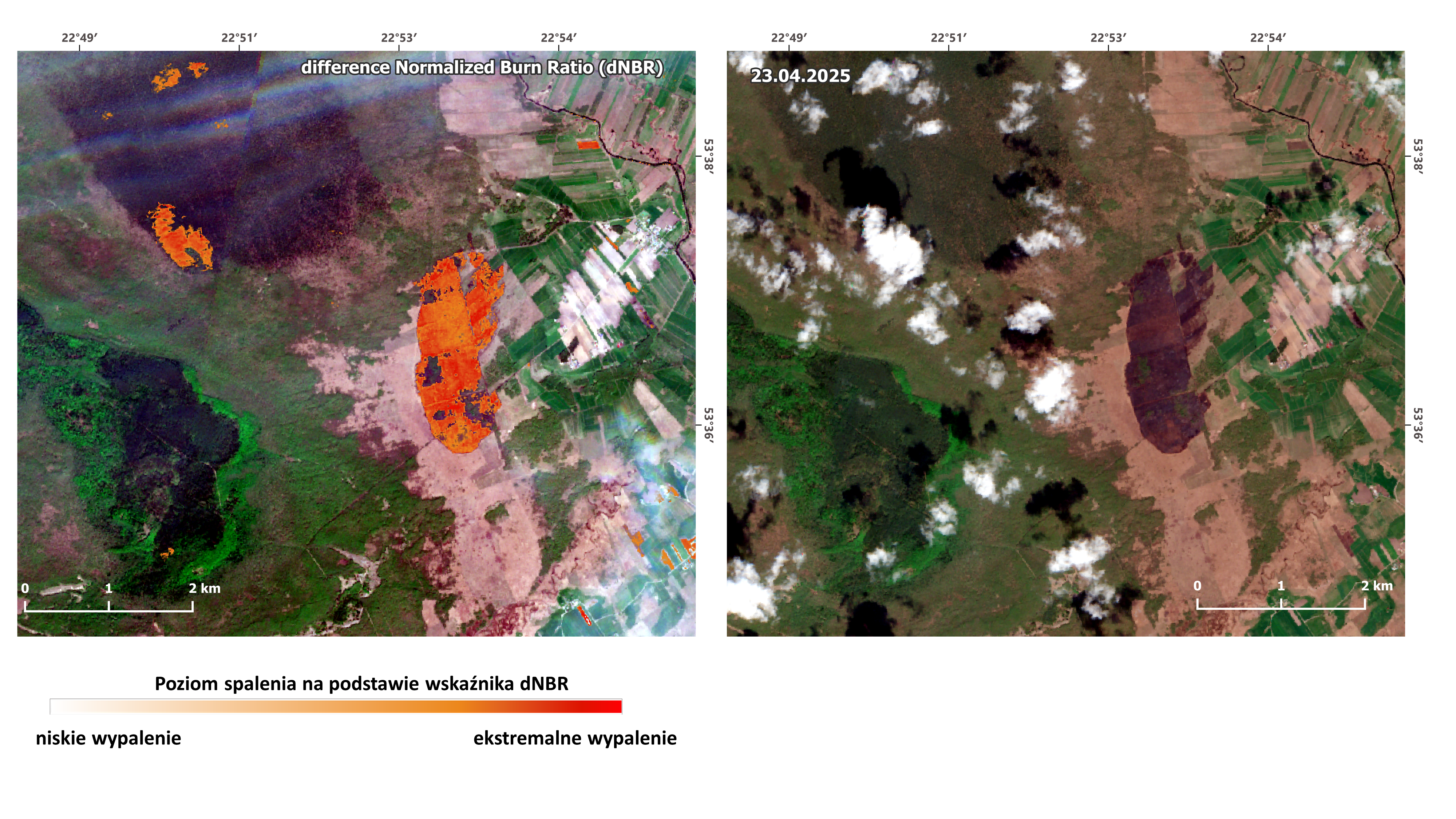
Between April 20 and 23, 2025, a fire occurred in the Biebrza National Park. According to information from the Biebrza National Park website, the firefighting operations covered an area of approximately 450 hectares. The fire consumed 185 hectares of ecologically valuable wetland and peatland areas near the village of Polkowo, causing significant damage to the local ecosystem. As a result of the fire, the automatic meteorological station of the Remote Sensing Center of the Institute of Geodesy and Cartography (IGiK), located in the Biebrza National Park wetlands, was completely destroyed. The station was equipped with an Eddy-Covariance system and a set of meteorological and environmental sensors used to monitor greenhouse gas exchange, atmospheric conditions, solar radiation, soil parameters, and vegetation status. For many years, the Institute of Geodesy and Cartography has been conducting research in the Biebrza National Park area, monitoring environmental changes using satellite data and field measurements. Following this year's fire, Sentinel-2 satellite imagery was used to assess the extent of the damage. Based on imagery taken before and after the fire, we calculated the dNBR (difference Normalized Burn Ratio) index. This remote sensing tool allows us to assess the severity of fire impact on a given area. The higher the dNBR value, the greater the damage to vegetation and soil. Significant damage to habitats, including areas protected under the Natura 2000 network, was observed. Detailed damage assessment and planning for the reconstruction of research infrastructure are currently underway.