Classification of urban areas
Development of the method for classifying urban areas with the use of high-resolution, new generation satellite images
Grant No 4 T12E 043 26 (G78)
Project leader: dr Zbigniew Bochenek
Project duration: 18.03.2004 – 17.09.2006
The aim of the project was to study various approaches aimed at preparation of the optimum method for classifying urban areas with the use of high-resolution, new generation satellite images. Three types of satellite data, characterized by various spatial and spectral resolutions, were used: Landsat ETM+, Terra ASTER and QuickBird. Different methods of digital analysis and classification of high-resolution data were analyzed:
- Method of spectral mixture analysis;
- Method of determining structure of urban areas with the use of texture measures;
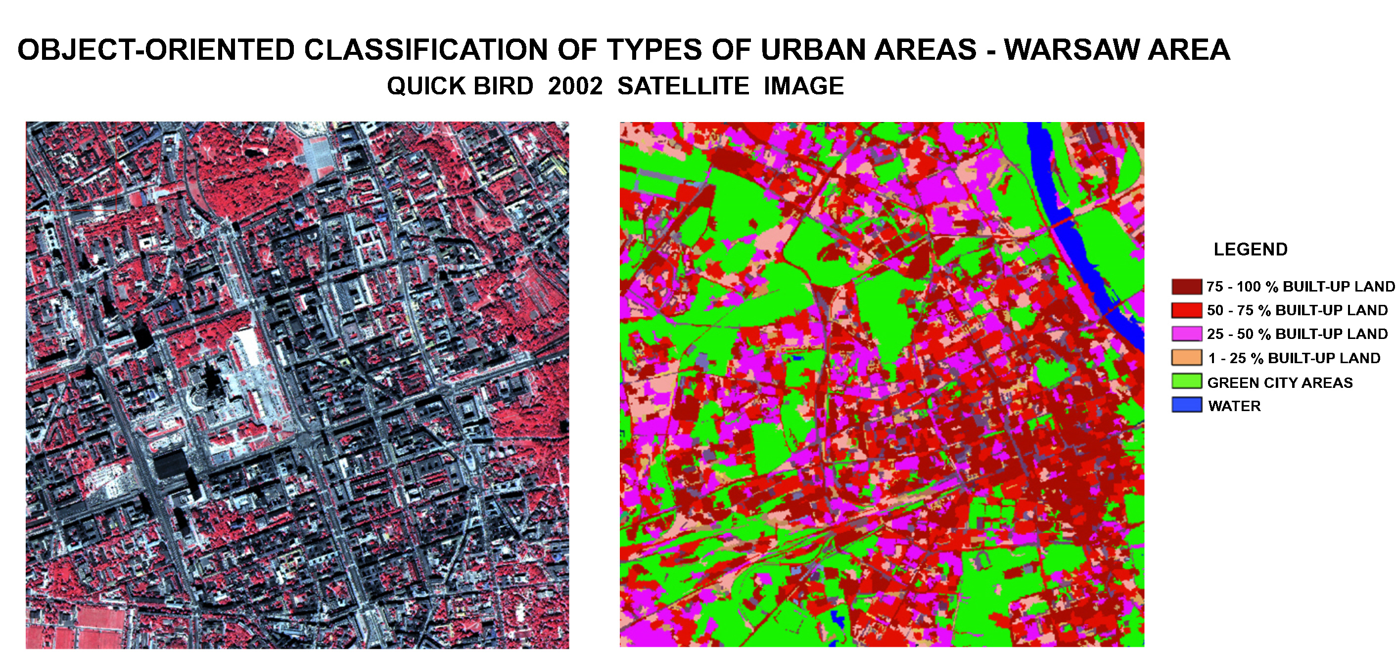
- Method of mapping urban areas with the use of object-oriented classification, applying multi-resolution segmentation and fuzzy logic approach;
- Method of classification with the use of artificial neural networks (ANN).
As a result of the conducted research works the assessment of usefulness of above mentioned methods was done, considering accuracy and level of detail of classification. It was found, that the hybrid method, which combined object-oriented approach and ANN approach is the most useful for classifying urban areas. Application of object-oriented approach enables to delineate spectrally and spatially homogeneous objects, through optimizing scale factor, as well as shape and density factors. Use of this approach based on eCognition software also allows to determine multiple object characteristics, such as shape and texture of objects and their inter-relations. This possibility was used in the process of developing the hybrid method. In the stage of applying object-oriented approach several parameters were derived, e.g. spectral reflectance, Normalized Difference Vegetation Index and texture measures. Table with these parameters was the input to the second stage of the works – classification with the use of Artificial Neural Networks (ANN). Selection of the appropriate input parameters and types of learning neural network enabled to achieve high quality of network learning, testing and validation and as a result to obtain high accuracy of classification.
Accuracy assessment with the use of test areas revealed, that built-up areas in urban agglomeration can be divided into three categories of density with the average level of recognition reaching 88%. Also for green city areas the categories of land cover can be discriminated with the average 85% accuracy. The obtained results indicate, that hybrid method for classification of high-resolution satellite image, which combine elements of object-oriented approach and neural network approach, can be the effective tool for preparation of land cover maps for urban areas. These maps can serve physical planners for rapid, general assessment of urban areas and for determining changes caused by urbanization processes.
Fig. Object-oriented classification of types of urban areas - Warsaw area. Credits: IGiK

