Research topics
Calibration and Validation of Earth Observation data
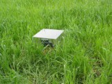
 Chlorophyll fluorescence measurements of peatbogs in Biebrza Valley
 JECAM Wielkopolska - study site for global agricultural monitoring
 Validation of soil moisture retrieval algorithms from Sentinel-1 data
 Validation of biophysical products from Proba-V and Sentinel-2/3 satellites
 Validation of Sentinel-1 soil moisture products
 BioPar - validation of global satellite-based biophysical products
Agriculture / Drought
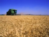 Crop growth monitoring and yield forecasting in Poland
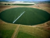 Satellite-based system for drought monitoring
 Implementation of Smart Villages concept in mazowieckie voivodeship
 Monitoring of crop growth conditions - project with KOWR
 Copernicus products and services for forecasting agricultural production
 FPCUP - success stories Poland
 SATMIROL Satellite-based crop identification and crop growth monitoring for agricultural statistics
 South Africa - Poland - crop growth monitoring and yield assessment system
 Services for Earth Observation-based statistical information for agriculture
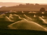
 System for irrigation of potato fields based on Earth Observation data
 Service for drought monitoring applying satellite data
 ALOS-2 PALSAR-2 for biomass and soil moisture assessment
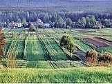 Satellite observations of autumn conditions for winter crops
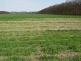 Satellite-based monitoring crop damages
 Estimation of crop yields in Europe
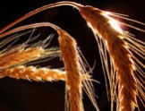 Crops identification by using satellite images
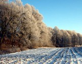 Observations of snow cover from satellites
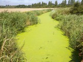 Agricultural water pollution derived from remote sensing data

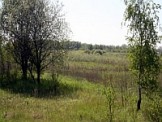
Wetlands and grasslands
 Remotely sensed chlorophyll fluorescence measurements in the Biebrza Valley
 Chlorophyll fluorescence measurements of peatbogs in Biebrza Valley
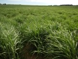
 GrasSat - complementary tool for managing grassland production
 Modelling the carbon balance at wetlands applying Sentinel-1/2/3
 Monitoring wetlands in the trans-boundary Biosphere Reserve West Polesie
 Soil moisture, grasslands productivity and crops - ALOS-2 PALSAR-2
 POLWET - system for monitoring Ramsar sites in Poland
 Validation of Sentinel-1 soil moisture products
 Cooperation with ESA, DLR and JAXA for purchasing microwave images
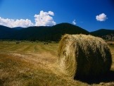 FINEGRASS - effect of climatic changes on grassland condition
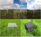 Modelling the carbon balance at wetlands
 MS.MONINA - Service for Monitoring NATURA 2000 Habitats
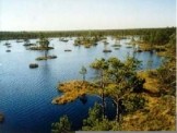 INTAS - Earth Observation systems to assess the status of Northern Eurasia's peatlands
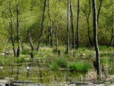 Wetlands monitoring - ALOS satellite
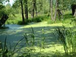 Evaluation of usefulness of ASAR and MERIS images over wetlands
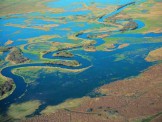 Method of determining areas with diversified SM within wetlands


Land-Cover / Land-Use
 GAUSS - Generating Advanced Usage of EO for Smart Statistics
 Implementation of Smart Villages concept in mazowieckie voivodeship
 Classification of agricultural areas
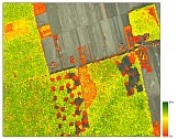
. Credits: SInCohMap") SInCohMap - land cover mapping using satellite radar interferometry
SInCohMap - land cover mapping using satellite radar interferometry and vegetation condition NDVI (right) over the city of Warsaw in 2018. Credits: IGiK") ADAPTCITY - strategy for adaptation to climate change of Warsaw
ADAPTCITY - strategy for adaptation to climate change of Warsaw Classification of wetland areas for MS.MONINA
 Crop recognition based on SAR satellite data
 Classification of urban areas
 GEOLAND 2 - towards operational land monitoring service
 GEOLAND - land monitoring service
Climate changes
 Satellite-based system for drought monitoring
 Modelling the carbon balance at wetlands applying Sentinel-1/2/3
 and vegetation condition NDVI (right) over the city of Warsaw in 2018. Credits: IGiK") ADAPTCITY - strategy for adaptation to climate change of Warsaw
ADAPTCITY - strategy for adaptation to climate change of Warsaw Variability and change of cloudiness diurnal cycle over the past 30 years
 Analysis of changes of cloudiness in Poland
 FINEGRASS - effect of climatic changes on grassland condition
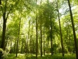 WICLAP - effects of winter climate change and air pollution on forests
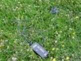 Soil moisture in Poland from SMOS satellite
 Remote sensing techniques for the assessment of carbon balance
Environmental Hazard
 Copernicus products and services for management of environment
 Geo4IRBM - surface derformation monitoring
 DefSAR - ground deformations
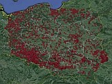 Fire Monitoring from Space
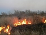 Fire Intensity Estimation
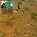 Local flooding with satellite images
 Satellite-based monitoring crop damages
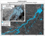 Flood extent mapping with microwave satellite images
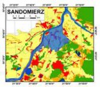 Flooding in the valleys of the Vistula and Odra rivers
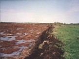 Degradation of wetland ecosystems caused by peatland fires
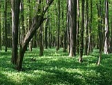 Forest fire risk assessment