Remotely sensed chlorophyll fluorescence measurements in the Biebrza Valley
Remotely sensed chlorophyll fluorescence measurements in the Biebrza Valley
The Project is funded by the IGIK Research Fund.
Project leader: dr Maciej Bartold
email: maciej.bartold@igik.edu.pl, tel. +48 22 3291970
Duration of the project: 9.05.2023 – 31.12.2023
Project goals:
The main goals of this project are as follows:
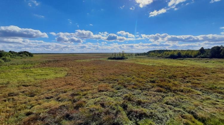
- to conduct a series of field campaigns to measure the vegetation condition of peatlands in the Biebrza Valley;
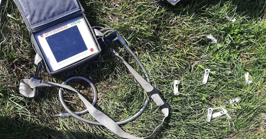
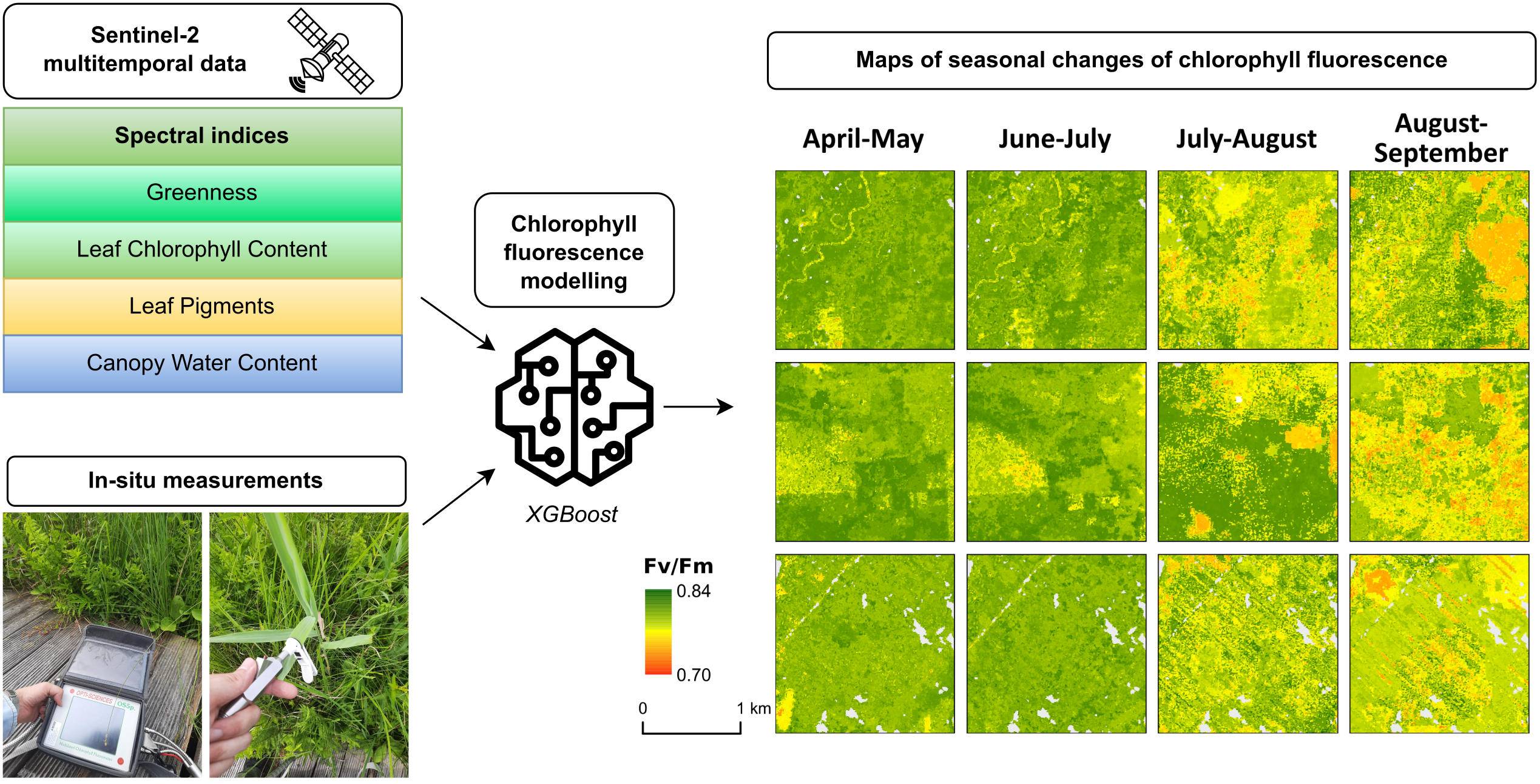
- collecting in situ chlorophyll fluorescence and vegetation-soil parameters such as plant chlorophyll content, soil moisture, leaf area index (LAI), and accumulated photosynthetically active radiation (APAR).;
- updating the soil moisture database for the year 2023, which includes permanent measurements recorded by probes as part of the international ISMN network;
- updating the meteorological database for the year 2023 with measurements from the automatic weather station AWS Campbell, including solar radiation, air temperature, air humidity, and total precipitation;
- developing a chlorophyll fluorescence model based on ground-based soil-plant measurements and satellite observations;
- publishing the obtained results in an international scientific journal.
Task description:
The results of the research on chlorophyll fluorescence estimation using machine learning techniques demonstrated the usefulness of Sentinel-2 satellite imagery in 2022 (Bartold and Kluczek in Remote Sensing). As part of the project, an algorithm will be refined for processing satellite imagery in the Google Earth Engine cloud platform. The algorithm will involve creating monthly mosaics generated from cloud-free Sentinel-2 satellite images registered over the period May-September 2023 and calculating vegetation indices. A new spatiotemporal prediction model for chlorophyll fluorescence will be adapted based on field data, recordings from automatic measurement stations AWS Campbell, ISMN probe network, and satellite vegetation indices. The final product will consist of a set of maps depicting spatiotemporal changes in the distribution of chlorophyll fluorescence values, representing the vegetation state and development of plants, as well as identifying unfavorable conditions determining the growth of peatland vegetation.
Project dissemination:
Bartold M., Kluczek M., 2024, Estimating of chlorophyll fluorescence parameter Fv/Fm for plant stress detection at peatlands under Ramsar Convention with Sentinel-2 satellite imagery, Ecological Informatics, 102603. https://doi.org/10.1016/j.ecoinf.2024.102603
Bartold M., Kluczek M., Chlorophyll Fluorescence in satellite-based monitoring of wetlands in the Biebrza River Valley , EnviLink – International platform for exchange of experience between young scientists in environmental research, Sękocin Stary, Poland, 15–17 May 2024. https://doi.org/10.48538/H2NB-P411
Kluczek M., Bartold M., 2023, Chlorophyll Fluorescence Mapping in Inland Wetlands through Machine Learning Techniques, FLEX Fluorescence Workshop 2023, 19 - 21 September 2023, ESA-ESRIN, Frascati (Rome), Italy.