GEOLAND 2 - towards operational land monitoring service
GEOLAND2 - towards operational GMES Land Monitoring Core Service
The goal of Geoland2 project is to prepare, validate and demonstrate pre-operational service chains and products that will underpin the Land Monitoring Core Service (LMCS) , and to propose and demonstrate a concrete functional organisation of the LMCS.
The architecture of Geoland2 project is made of two different layers, the Core Mapping Services (CMS) and the Core Information Services (CIS). The CMS produce 'basic' land cover, land cover change, and land state products which are of broad generic use and can be directly used for deriving more elaborated products. The CMS products cover a wide variety of thematic content, spatial scales from local to global, and update frequency, from 1 day to several years. The CIS are a set of thematic elements that start from CMS products and other data sources to produce elaborated information products addressing specific European policies.
Three Core Mapping Services (CMS) within Geoland2 are:
- Land Cover and Land Use - EUROLAND
- Biogeophysical Parameters - BioPar
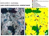
- Seasonal and Annual Change Monitoring - SATChMo
Seven Core Information Services (CIS) are included within Geoland2 project, namely:
- Spatial Planning
- Water
- Agri-Environment
- Forest
- Land Carbon
- Global Crop Monitoring (GCM)
- Natural Resource Monitoring in Africa (NARMA)
Institute of Geodesy and Cartography (IGiK) actively participates in development of three Geoland2 services: SATChMo, Global Crop Monitoring and BioPar.
SATCHMO CMS

BioPar CMS

The PASTiS57° systems were mounted in Poland, at Wielkopolska agriculture field sites over followed crops: winter wheat, winter rye, spring barley, spring oat, triticale, rape, corn, sugar beet, grass and alfalfa.
CROP CIS

