Satellite-based monitoring crop damages
Observations of areas with frozen winter cereals are made at the Department of Remote Sensing. There are applied optical images registered from satellites NOAA, Terra and WorldView-2.
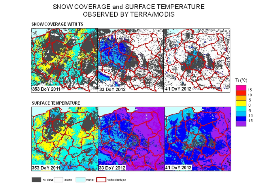
Terra.MODIS data are used to snow coverage and surface temperature observations. MODIS data are registered at 250-meter pixel resolution. They are ancillary data for correct recognize of areas where frozen winter cereals occured.
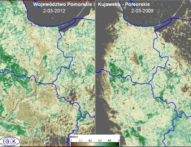
The maps of areas with frozen winter cereals in 2012 were performed applying NOAA.AVHRR images too.
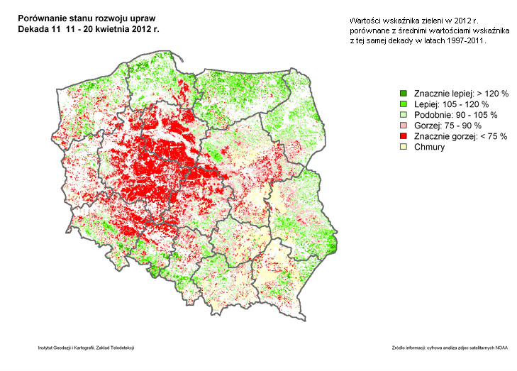 On the left: comparison of NDVI values between 2012 and average index values from 1997-2011. Legend: >120% much better, 105-120% better, 90-105% similarly, 75-90% worse, <75% much worse; clouds
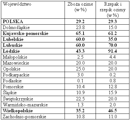
In relating to CSO assessments the greatest losses ot winter cereals were observed in the followed voivodeships: Kujawsko-pomorskie, Lubuskie, Lubelskie, Łódzkie and Wielkopolskie.
Table: Losses in areas of winter cereals within Polish voivodeships.
Source: CSO
Titles of columns: Voivodeship ; Winter crops (%); Rye and Agrimony (%)
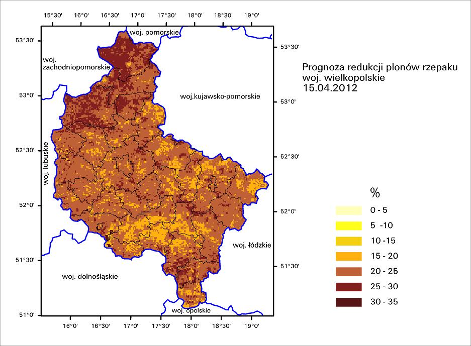 The forecast of rye crops reduction was produced too. The map on the right side show forecast ot rye crops reduction over Wielkopolskie voivodeship. The map was computed using NOAA.AVHRR images.
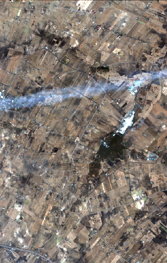
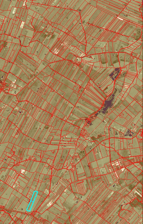
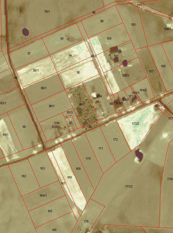
In addition WorldView-2 image were applied to analyzing frozen plants within crop parcels. WorldView-2 scenes are registered at 0.46-meter in panchromatic band and at 1.84-meter in eight spectral bands.
RGB composition NDVI image Zoomed NDVI image for
in near natural colours. with borders of parcels detailed recognizing frozen parcels.