SInCohMap - land cover mapping using satellite radar interferometry
EXPLOITATION OF SENTINEL-1 INTERFEROMETRIC COHERENCE FOR LAND COVER AND VEGETATION MAPPING – SInCohMap
Founded by: European Space Agency, ESA SEOM-S14SCI Land
Duration of the project: 2017 – 2020
Project consortium:
DARES TECHNOLOGY – leader of the project
The Universitat Politècnica de Catalunya (UPC)
The University of Alicante (UA)
EURAC
Institute of Geodesy and Cartography (IGiK)
The University of Rennes 1
The project evaluates the performance of using the interferometric coherence of S-1 time series for land cover and vegetation mapping. One of the main objectives of the project is to quantify the impact in using S-1 InSAR (Interferometric Synthetic Aperture Radar) data relative to traditional land cover and vegetation mapping using optical data (especially Sentinel-2, hereafter named S-2) or SAR-based (Synthetic Aperture Radar) approaches.
The classification of land cover was performed on three study areas: Doñana (Spain), Merano, South Tyrol (Italy), Wielkopolska (Poland).
 Doñana (Spain); b) Meran, South Tyrol (Italy); and, c) West Wielkopolska (Poland). Credits: SInCohMap") |
||
 |
 |
|
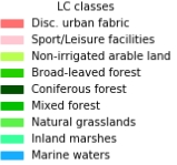
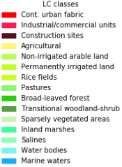
Fig. 1. RGB Optical images over the regions of interest in: a) Doñana (Spain); b) Meran, South Tyrol (Italy); and, c) West Wielkopolska (Poland). Illustration of the ground truth reference data in the CLC Level 3 for the correspondent site in d), e) and f).
The Round-Robin tournament was used to assess the performances of the different classification methodologies.

Fig. 2. Flow diagram of the Round Robin experience: from the analysis ready data to land cover classification maps. All the data are stored an accessed by all the participants, internal and external teams, exploiting the datacube data allocation using standard protocols as WCS/WCPS. Methodological approaches are developed under Jupyter notebooks which allows the participants to focus strictly on the classification methods.
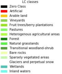
The results of this study indicate that the interferometric coherence provided in multi-temporal matrices is a formidable source of information for land cover mapping, as it has been proven by the fact that three different methodologies, developed by three different research groups, produced an overall accuracy of above 75% for all three study areas, the pixel-based eigenvalue decomposition with a random forest classifier, the KTH-SEG approach performing object based classification using the support vector machine and the SPKnnLab approach, creating super pixels that are labelled using kNN. It should be highlighted that in all study areas, more than ten different classes are present, covering almost every class from the Corine classification scheme.
. Credits: SInCohMap") |
||
|
|
|
Fig. 3. Comparison of pixel-based and object-based classification results based on the Object-based Image Classification (KTH-SEG). Row 1: pixel-based results from left: Doñana (15 classes), middle: Merano (15 classes), right: West-Wielkopolska (9 classes). Row 2: object-based results from left: Doñana (15 classes), middle: Merano (15 classes), right: West-Wielkopolska (9 classes). The zero class indicates layover and foreshortening effects due to the side-looking geometry in a strong topography.
Official SInCohMap project website: sincohmap.org
Dissemination:
Jacob A., Vicente-Guijalba F., Lopez-Martinez C., Lopez-Sanchez J.M., Litzinger M., Kristen H., Mestre-Quereda A., Ziółkowski D., Lavalle M., Notarnicola C., Suresh G., Antropov O., Ge S., Praks J., Ban Y., Pottier E., Mallorquí Franquet J.J., Duro J., Engdahl M.E., 2020, Sentinel-1 InSAR Coherence for Land Cover Mapping: A Comparison of Multiple Feature-Based Classifiers, IEEE Journal of Selected Topics in Applied Earth Observations and Remote Sensing, Vol. 13, pp.535-552. doi:10.1109/JSTARS.2019.2958847 PAPER
Vicente-Guijalba F., Jacob A., Lopez-Sanchez J.M., Lopez-Martínez C., Duro J., Notarnicola C., Ziolkowski D., Mestre-Quereda A., Pottier E., Mallorquí J.J., Lavalle M., Engdahl M., Sincohmap: Land-Cover and Vegetation Mapping Using Multi-Temporal Sentinel-1 Interferometric Coherence, Proceedings of 2018 IEEE International Geoscience & Remote Sensing Symposium (IGARSS), 22 - 27 July 2018, Valencia, Spain. doi:10.1109/IGARSS.2018.851792 PAPER
Vicente-Guijalba F., Duro J., Notarnicola C., Jacob A., Sonnenschein R., Mallorquí J.J., López-Martínez C., Ziólkowski D., Hoscilo A., Dabrowska-Zielinska K., Bochenek Z., Pottier E., Lavalle M., Lopez-Sanchez J.M., Engdahl M., 2017, Assessing hypertemporal SENTINEL-1 COHERENCE maps for LAND COVER monitoring. In: 2017 9th International Workshop on the Analysis of Multitemporal Remote Sensing Images (MultiTemp), 27-29 June 2017, Brugge, Belgium. doi:10.1109/Multi-Temp.2017.8035240 PAPER