Flood extent mapping with microwave satellite images
ESA C1P.7847: Application of microwave images for the area flooded in May and June 2010 in Poland
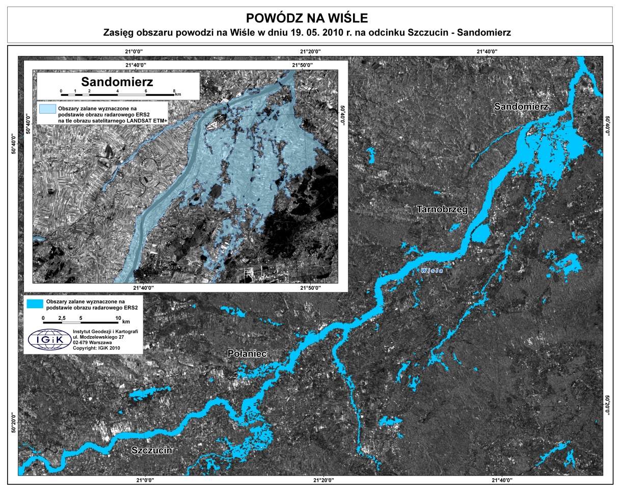
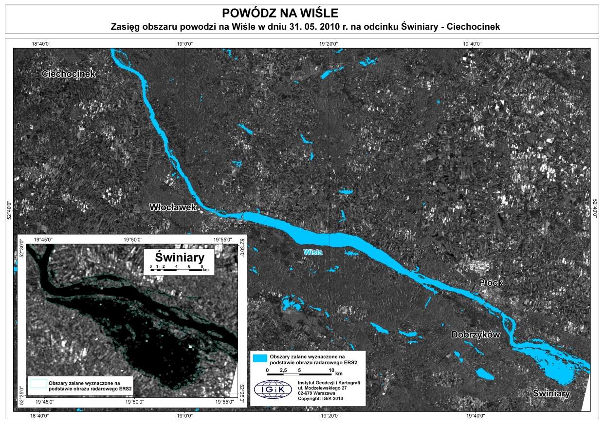
The aim of the project was to map the extents of the flooded areas in May and June 2010 in Poland. Within the framework microwave images registered from Japanese ALOS.PALSAR satellite as well as from European ENVISAT.ASAR and ERS-2.SAR satellites were used. In addition, optical satellite images ENVISAT.MERIS and ALOS.AVNIR-2/PRISM taken before and after the flood were used to determine the surface area flooded in specific land-use classes. Topographic maps and GIS data were also used for this purpose. The areas flooded as a result of the flood were also monitored after it receded. The project's subject matter fell within the interests of the Polish Government.
Project dissemination:
Dabrowska-Zielinska K., Ciolkosz A., Budzynska M., Malinska A., Bartold M., 2011, The System for Early Natural Disasters Monitoring in Agriculture, Proceedings of 34th International Symposium on Remote Sensing of Environment, 10-15 April, Sydney Australia, www.isrse34.org. PAPER
Turlej K., Bartold M., Lewiński S., 2010, Analysis of extent and effects caused by the flood wave in May and June 2010 in the Vistula and Odra River Valleys, Geoinformation Issues, Vol. 2, No. 1(2), pp. 49-57. doi:10.34867/gi.2010.5 PAPER