Land-Cover / Land-Use
GAUSS - Generating Advanced Usage of EO for Smart Statistics
The project aims is to present the possibility of using satellite data in official statistics in the field of monitoring: air quality, water resources, snow cover, and the range and condition of green areas in individual administrative units.
Implementation of Smart Villages concept in mazowieckie voivodeship

The project has pilot research character and its realization is aimed at preparation of Smart Villages concept for mazowieckie voivodeship and for strengthening collaboration between territorial units and research institutions.
Classification of agricultural areas
Annual land cover classifications of agricultural areas are performed as part of the projects conducted by the Institute of Geodesy and Cartography. JECAM study site located at the wielkopolskie voivodship is used as a pilot area.
SInCohMap - land cover mapping using satellite radar interferometry
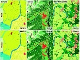
The project evaluates the performance of using the interferometric coherence of S-1 time series for land cover and vegetation mapping. One of the main objectives of the project is to quantify the impact in using S-1 InSAR (Interferometric Synthetic Aperture Radar) data relative to traditional land cover and vegetation mapping using optical data (especially Sentinel-2, hereafter named S-2) or SAR-based (Synthetic Aperture Radar) approaches.
ADAPTCITY - strategy for adaptation to climate change of Warsaw
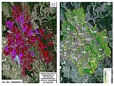
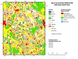
The aim of the project, conducted under the contract between the Institute for Sustainable Development and the Institute of Geodesy and Cartography, was to determine the state of the ecosystem of the Capital City of Warsaw in the period from the beginning of 2002 to the end of 2018. The analyses were performed for the needs of the final study in the field of monitoring the environmental problem within LIFE_ADAPTCITY_PL project.
Classification of wetland areas for MS.MONINA
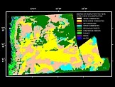
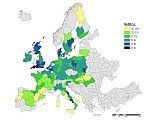
The aim of the project was to create a service for monitoring NATURA 2000 habitats with the use of various remote sensing data. The service was built at three levels: European, national and local level. 17 units representing the research institutions, enterprises and end-users participated in the project.
Crop recognition based on SAR satellite data
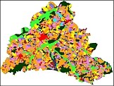
The methodology of classification of the main crops on the basis of ENVISAT ASAR images has been prepared within the project ordered by the Central Statistical Office. It will be applied for crop recognition with the use of recent radar images collected from fall 2014 by Sentinel-1. Research works were conducted using radar images with various polarizations (vertical and horizontal), collected in different parts of vegetation season. The aim of the work was to classify the main crops: winter cereals, spring cereals, corn, rape and sugar beets, using semi-automatic classification methods.
Classification of urban areas
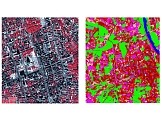
The aim of the project was to study various approaches aimed at preparation of the optimum method for classifying urban areas with the use of high-resolution, new generation satellite images. Three types of satellite data, characterized by various spatial and spectral resolutions, were used: Landsat ETM+, Terra ASTER and QuickBird. Different methods of digital analysis and classification of high-resolution data were analyzed.
GEOLAND - land monitoring service
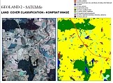
GEOLAND Integrated GMES Project on Land Cover and Vegetation
GMES products and services integrating EO monitoring capacities to support the implementation of European directives and policies to land cover and vegetation.
GMES products and services integrating EO monitoring capacities to support the implementation of European directives and policies to land cover and vegetation.

