Wetlands monitoring - ALOS satellite
Project leader: dr inż. Maria Budzynska
Grant No. N526 0217 33 (IGiK G-100)
Duration: 2007 - 2010
Preparation of the method for monitoring wetlands on the basis of images collected by ALOS satellite
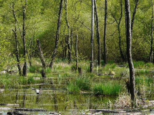
Launch of Japanese ALOS satellite gives new possibilities to apply remote sensing for studying large wetland areas. The aim of the project is to prepare method for monitoring wetland ecosystems and determining soil moisture / vegetation changes on the basis of satellite images. ALOS/PALSAR and ENVISAT/ASAR microwave images will be applied, as well as optical images collected by PRISM and AVNIR-2 radiometers installed on board of ALOS satellite. In the course of satellite acquisitions detailed measurements of soil-vegetation parameters will be done (LAI, biomass, water content in plants, soil moisture using TDR method) as well as spectral and radiometric measurements of wetland ecosystem of Biebrza Valley will be performed. Vegetation maps of Biebrza Marshlands prepared on the basis of Landsat ETM (2000), ASTER (2001) and MERIS (2003) will be used as a base material for preliminary recognition of reference areas needed for classifications based on PRISM and AVNIR-2 images. Applying vegetation map classes of roughness of vegetation canopies will be determined; this information will be used for elaborating method of assessment of soil moisture.
The method prepared in the course of the project will support selection of test sites for European mission SMOS (ESA project SVRT AO-3275) aimed at monitoring of areas characterized by different soil moisture.