Monitoring of crop growth conditions - project with KOWR

Application of satellite remote sensing for monitoring crop growth conditions, including agricultural drought detection and for estimating reduction of crop yields caused by unfavorable crop development in 2020
Project funded by: National Support Centre for Agriculture
Project leader: Prof. Katarzyna Dabrowska-Zielinska
email: katarzyna.dabrowska-zielinska@igik.edu.pl
Author’s team: MSc Karol Paradowski, Dr. Eng. Zbigniew Bochenek, Dr. Maciej Bartold, MSc Eng. Magdalena Łągiewska, MSc Alicja Malińska, MSc Radosław Gurdak
Project duration: July 2020 – September 2020
Project objectives:
The main goals of the project were to identify agricultural drought on the territory of Poland through monitoring of crop growth conditions within vegetation season and to estimate yield reduction caused by unfavorable conditions.
The project’s objectives were achieved through application of the method for identification of crop growth conditions based on the satellite drought index DISS. This approach enabled to determine:
- periods within 2020 vegetation season with the highest percent of drought occurrence;
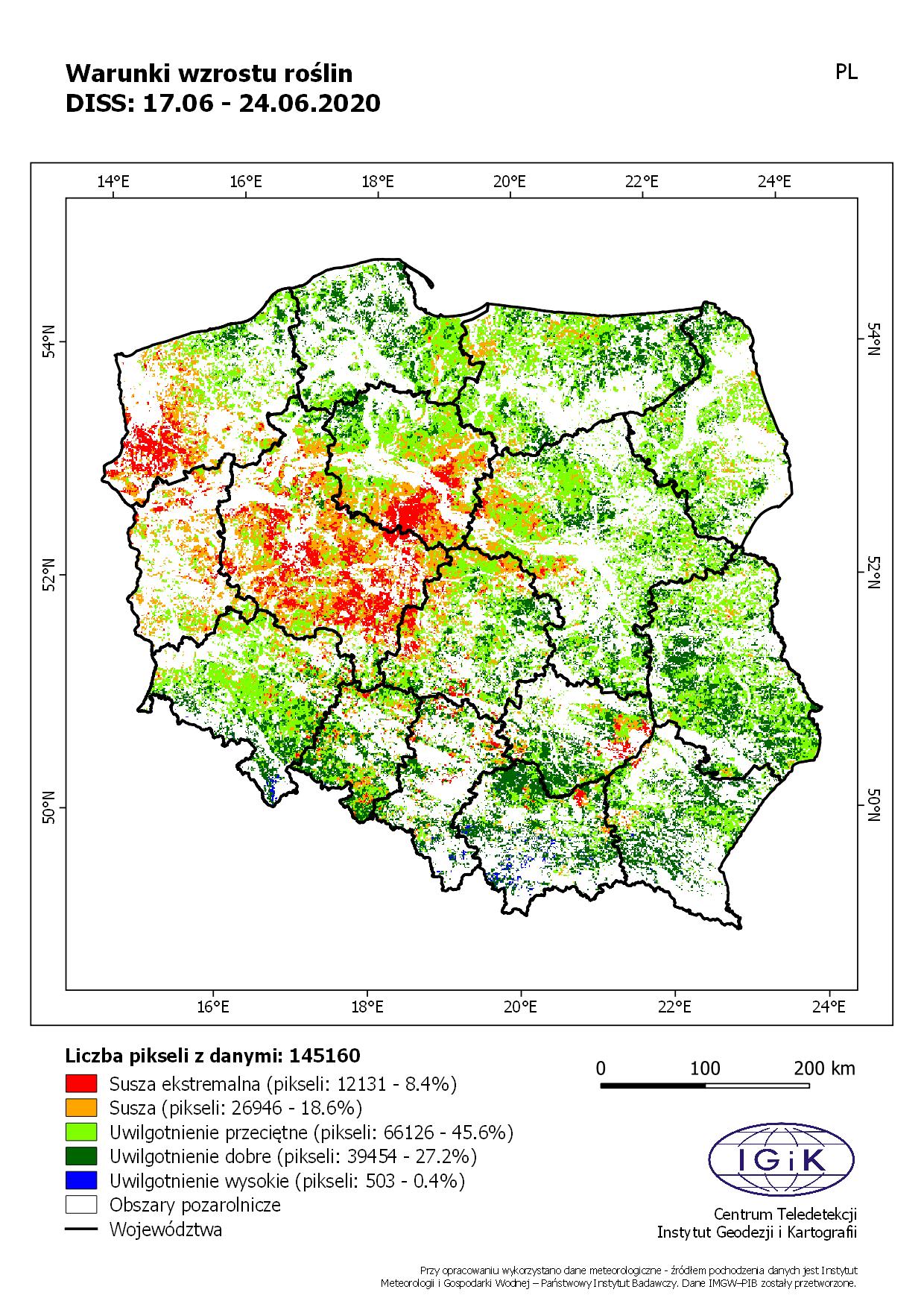
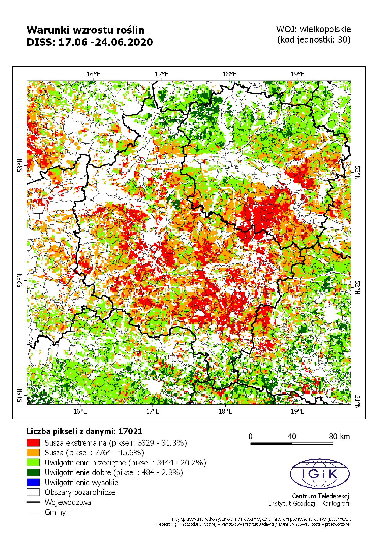
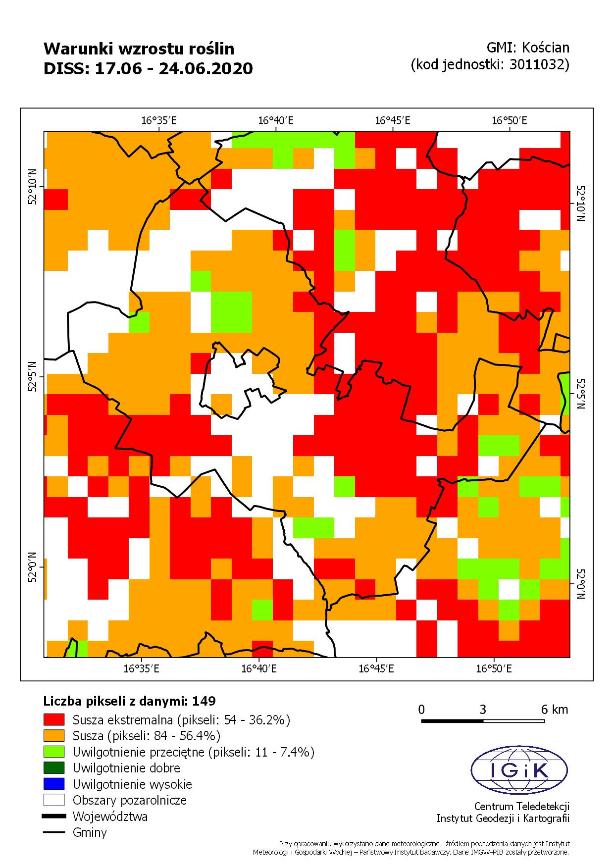
- regions of Poland – voivodeships and communes with the highest percent of areas threatened with agricultural drought.
Application of the method for estimating reduction of crop yields enabled to determine:
- type of reduction – low, moderate, high - for five types of crops – winter cereals, spring cereals, rape, root crops and maize;
- regions of Poland – voivodeships and communes with the highest percent of areas characterized by moderate and high reduction of crop yields.
The main project’s objectives were fulfilled through realization of the following tasks:
- elaboration of the methods for generating maps of crop growth conditions and for estimating reduction of crop yields; preparation of the Detailed Work Schedule;
- preparation and delivery of the databases with input data needed for generating maps of crop growth conditions;
- preparation and delivery of the catalogue of maps presenting crop growth conditions and reduction of crop yields for 2020 vegetation season.
Presented maps were realized within the framework of project "Application of satellite remote sensing for monitoring crop growth conditions, including agricultural drought detection and for estimating reduction of crop yields caused by unfavorable crop development in 2020" for National Support Centre for Agriculture.

