Geo4IRBM - surface derformation monitoring
Geo4IRBM - Geoinformational Support for Integrated River Basins Management
The Geo4IRBM project was carried out in a consortium of three institutions: GEOSYSTEMS Polska Sp. z o.o., (leader), Topologic Consulting, Institute of Geodesy and Cartography (Remote Sensing Centre) and financed by European Space Agency (ESA) under the Polish Industry Incentive Scheme.
The aim of the project was rapid elaboration and provision of certain informational products and services which will be further used for the needs of support of selected river basins management. The region of the project implementation was provisionally defined as selected rivers’ watersheds in the western part of Java island, Indonesia.
The project goals were defined in cooperation with the Jakarta office of the Asia Development Bank and reflects both requirements of the end-user organisation and the project consortium assessment of feasibility in the frame of short service provision time.
The objectives of the Geo4IRBM project cover four research areas areas:
- Land use and crop maps elaboration
- Surface water monitoring
- Surface derformation monitoring
- Environmental impact assessment
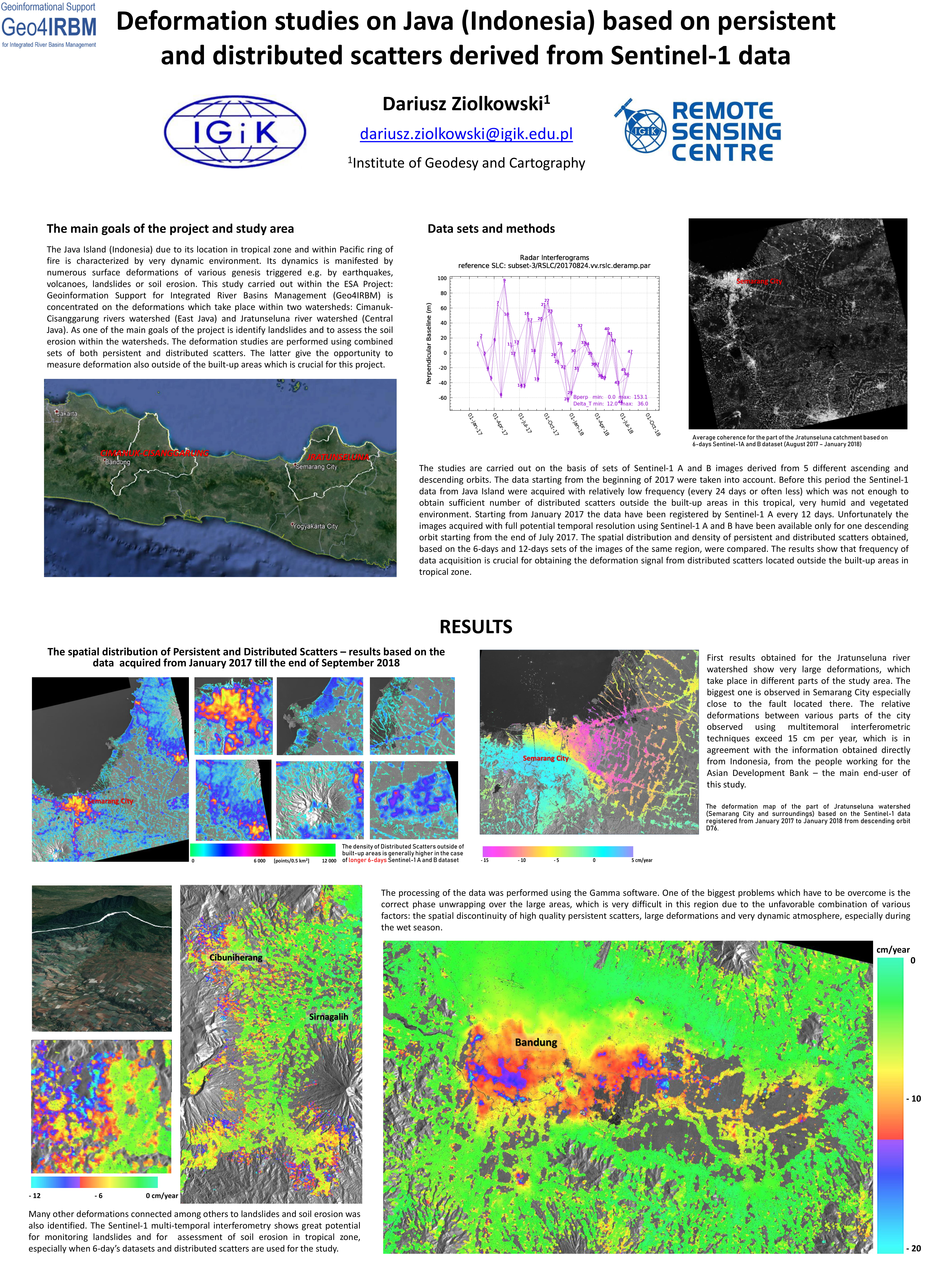
Within the Geo4IRBM project Institute of Geodesy and Cartography was responsible for surface deformation monitoring service. Surface deformation monitoring service aims at continuous detection and monitoring of deformations triggered by various reasons like geology, hydrology or landslides. Since the traditional Differential Interferometry has many limitations caused mainly by temporal decorrelation especially in vegetated areas and attenuation of the signal in the atmosphere (Atmospheric Phase Screen), the Multitemporal Interferometric Techniques (MTInSAR) - combined Persistent Scatterer Interferometry and Distributed Scatterer Interferometry were used.
Poster presenting the results obtained from Remote Sensing Centre within the Geo4IRBM project

