NOAA.AVHRR
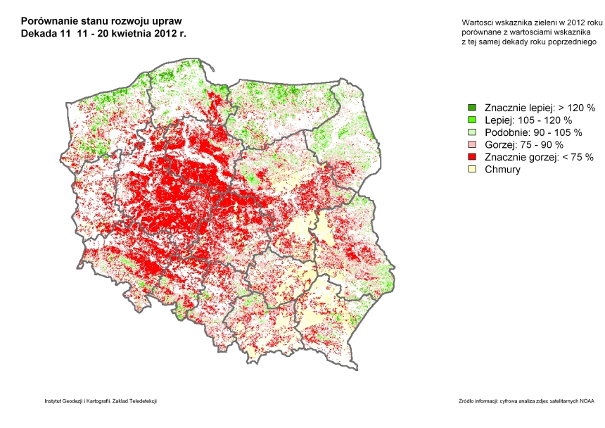
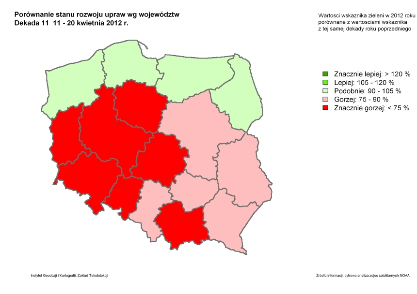
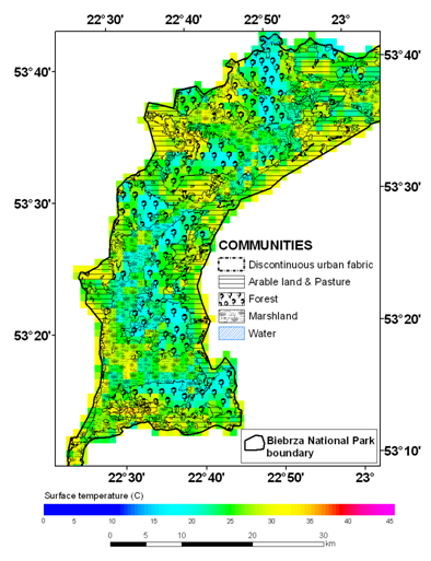
Department of Remote Sensing maintains database of satellite images and products derived from NOAA satellites. NOAA/AVHRR images are collected at the Institute of Geodesy and Cartography since 1996, using Quorum receiving station, installed at IGiK within joint Polish-Canadian project by Canada Centre for Remote Sensing (CCRS). These images are the core of system for crop condition assessment in Poland, which is based on analysis of vegetation indices derived from NOAA AVHRR data. The system is operational since 1997, delivering several products in the form of comparative maps, demonstrating vegetation growth in relation to average and previous year. These products are delivered every ten days to the Department of Agriculture, Head Statistical Office in two forms – raster maps (with 1000 m ground resolution) and vector maps with aggregated values of vegetation indices to administrative units (voivodeships). Exemplary maps which illustrate functioning of the crop condition assessment system (for 11 ten-day period time 2012) are presented in figures below.
|
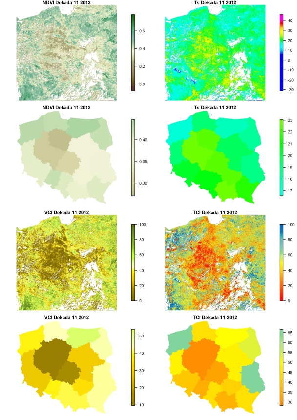
NDVI, VCI, Ts i TCI maps |
|
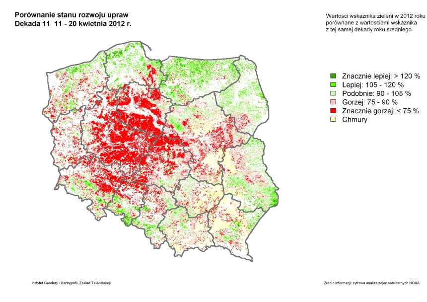 Map of NDVI distribution as compared to average year |
|
|
 Changes of NDVI by voivodeship as compared to average year |
Applications:
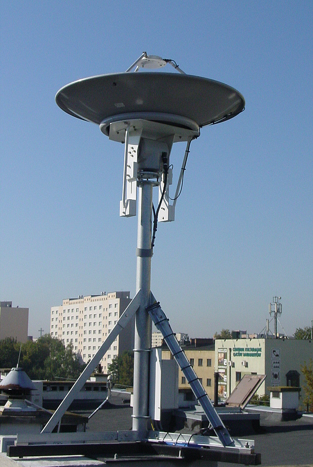 The works related to installation and implementation of the new system for capturing and processing data from meteorological satellites were performed at the Institute of Geodesy and Cartography, Department of Remote Sensing from March 19 till 23, 2012. The system has been purchased within OGNIWO project from DARTCOM company (UK), specializing in construction, production and sale of ground stations for receiving data from meteorological satellites.
System configuration consists of· 1.2 m parabolic dish with compact rotator, receiver rack and computers for data recording and processing. The system enables to record data in HRPT, CHRPT, SeaWiFS, AHRPT and LRD formats from NOAA, SeaStar, Metop and NPOESS polar-orbiting satellites. Its implementation will allow to further develop system for satellite data acquisition and processing, already functioning at the Institute of Geodesy and Cartography since 1996.