IGIK is celebrating the World Wetland Day 2023
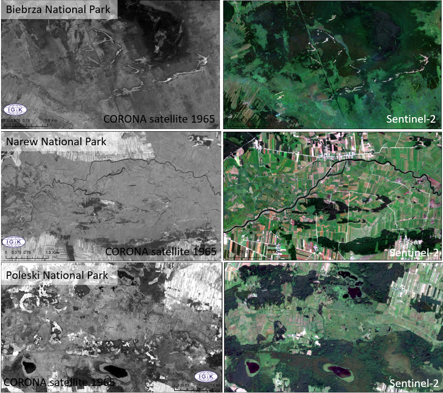
Since 1970, more than 35% of wetlands have been degraded, and this process is accelerating. Reversing this trend is crucial for the balance of nature and human functioning, including in the context of climate change adaptation. Thanks to satellite images from the CORONA program, taken in 1960-1972 by American reconnaissance missions, among others for the area of Poland, we can observe and analyze what changes wetlands have undergone over the past 60 years.
Below, there is an example of how wetlands in Biebrza National Park, Narew National Park and Polesie National Park (three Ramsar sites) have changed between 1965 – 2022, based on satellite images from CORONA and Sentinel-2.
Processing and analysis of archival images from the CORONA program is being carried out by scientists from the Centre for Applied Geomatics at IGiK.