IGiK has developed a drought geoservice for the Polish Space Agency
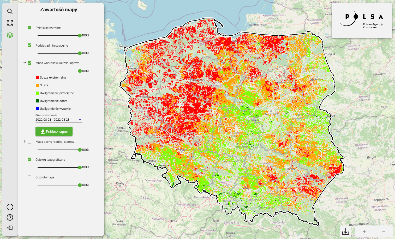
The Institute of Geodesy and Cartography delivered data and a web service as part of the "Satellite monitoring of agricultural drought" project commissioned by the Polish Space Agency (POLSA). The geoservice published by POLSA (suszarolnicza.polsa.gov.pl) gives convenient access to products presenting analyzes of drought conditions in 2022 in the form of maps of crop growth conditions and maps of yield reduction assessment of selected crops.
Maps of crop growth conditions (DISS) were generated for twenty-four 8-day periods of the 2022 growing season, from March 30 to September 30, presenting conditions in five classes: extreme drought, drought, average humidity, good humidity, high humidity .
Yield reduction assessment maps were elaborated for the indicated 5 crops/crop groups: winter cereals, spring cereals, root crops, maize and winter rapeseed. The assessment, based on the analysis of crop growth conditions in periods of maximum water demand for given crops/groups of crops, was presented in 3 classes of reduction: low, moderate and high.
All map products have been developed both for the country level and for administrative units: voivodships (NUTS 2), poviats (NUTS 4) and communes (NUTS 5), and the geoservice allows to generate reports containing both maps and statistical information for the indicated areas.