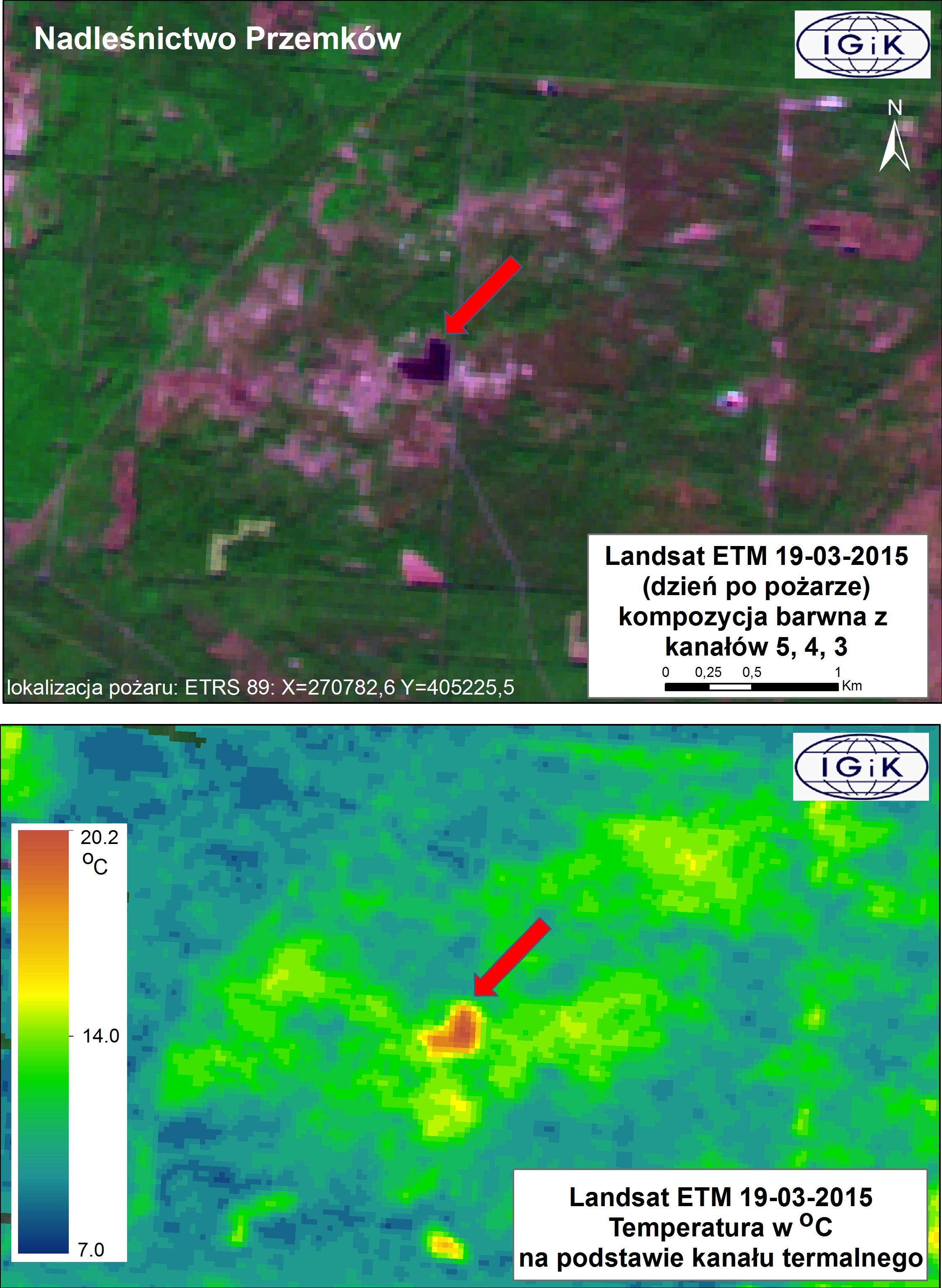
The first experimental burning in moorland in Poland recorded by Landsat satellite
 The first experimental burning in moorland was conducted by the State Forests on March, 18, 2015 in the Przemków Forest District (Dolnośląskie Voivodeship). The prescribed burning covered more than 5 hectares of moorland. Satellite image Landsat ETM+ acquired one day after the experimental burning (19 March 2015 at 9:50 UTC) clearly showed the burn scar and increased temperature.
Top image illustrates burn scar visible on Landsat ETM+ image that was acquired 19 March 2015, 9: 50 UTC (band composite 5, 4, 3). The image was obtained one day after the prescribed burning in moorlands in Poland.
Down image shows the temperature distribution (in degree Celsius) in the area affected by fire and surroundings. The temperature was calculated based on the thermal band recorded by Landsat ETM+ 19 March 2015. One day after the fire the burn scar was still warm.
The image was processed and analyzed in the Remote Sensing Centre at the Institute of Geodesy and Cartography in Warsaw.
For more information about fire-related projects conducted in the Remote Sensing Centre see LINK
