Modelling the carbon balance at wetlands
From 2010, the Department of Remote Sensing, IGiK, is conducting the research on estimation of carbon fluxes, and modeling of carbon balance using various satellite data over large homogenous wetlands communities located in the Biebrza National Park.
The carbon related projects:
- ESA PECS CARBON (2011-2013)
- Ongoing project started in 2011 (1600/B/T02/2011/40): "Application of new generation satellite data for the assessment of the impact of soil moisture and biomass on carbon balance.”
We have developed the Carbon Flux model based on remotely sensed data and in situ CO2 flux measurements. The Carbon Fluxes were measured on the ground using the Eddy Covariance Method and a static chamber method. The ground measurement are measured many times a year during the satellite overpass.
The Carbon Flux model has been developed based on data gathered during the field measurements companies, where two different study methods were utilized: The Eddy Covariance Method and a static chamber method.
The measurements of Carbon Flux using a static chamber method.
The measurements of Carbon Flux using Eddy Covariance Method (K. Klysik, K. Fortuniak, University of Lodz).
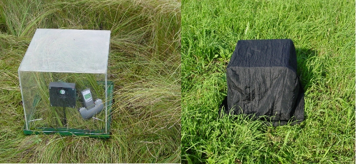
The set-up for measurement of CO2 Net Ecosystem Exchange (light conditions, left) and Respiration (dark conditions, right).
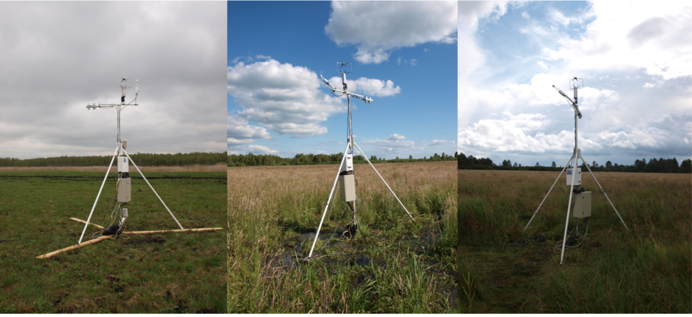
The measurements of CO2 fluxes with use of Eddy Covariance method were carried out at Biebrza Wetlands in periods of time:4-11 May, 21-28 June; 28 August-2 September.
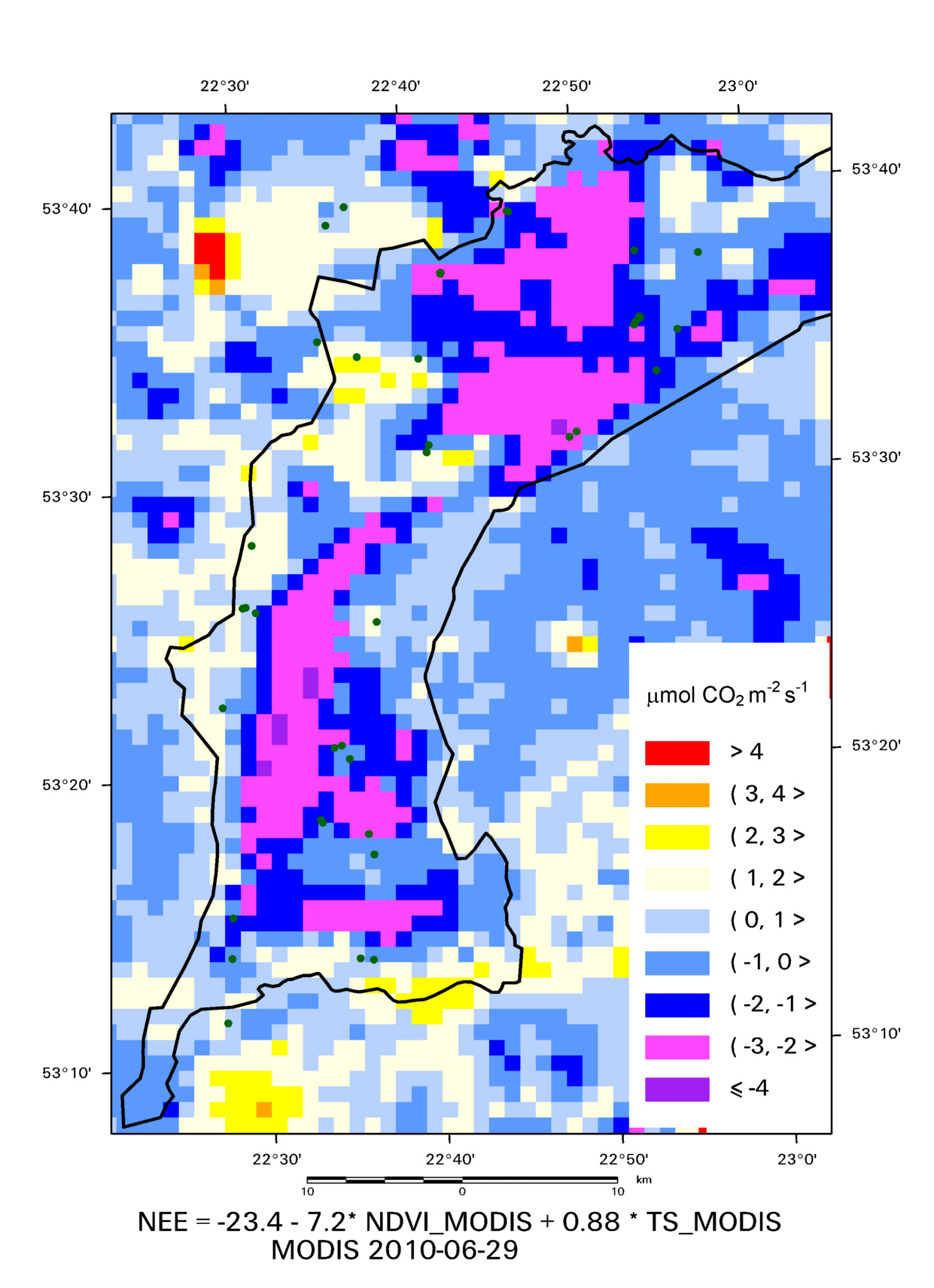
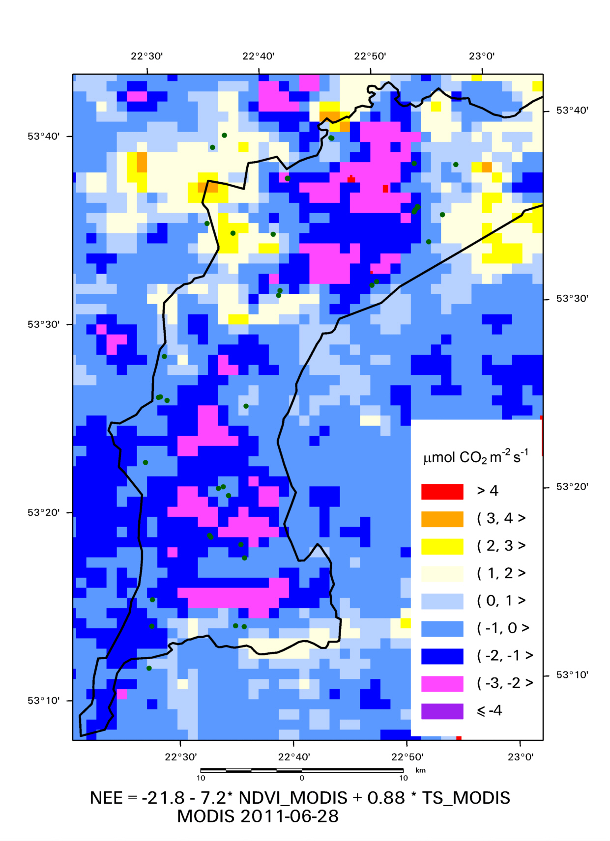
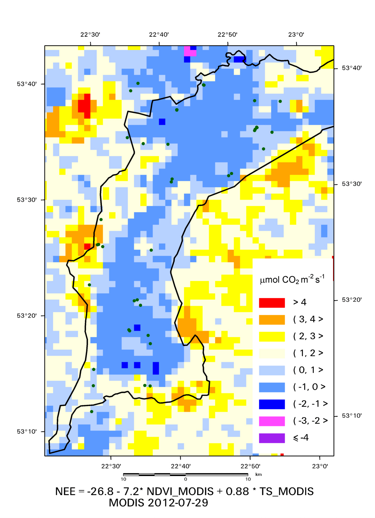
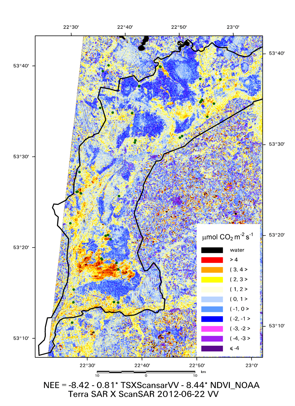
Remotely sensed data were used as an input to the model for assessing the carbon balance. A sets of satellite optical and radar data was also used to assess the influence of land cover types on carbon release and sequestration.. The Carbon Flux model requires the following inputs; such as soil moisture were calculated from ASAR.ENVISAT measurements. Biomass and height of vegetation were obtained from long microwave data as ALOS PALSAR. Also biomass was estimated using TerraSAR-X data and optical data acquired by following satellite sensors: VEGETATION, MERIS, AATSR installed on SPOT and ENVISAT satellites. Also the information on CO2 and CH4 atmospheric content derived from data collected by SCIAMACHY.ENVISAT sensor were very important source of information to estimate the carbon balance.
Exemplary maps of NEE values for selected dates calculated from MODIS.TERRA and TerraSAR-X satellite.
More information here: ESA PECS CARBON