Elaboration of models for assessment of cereal growth and development using remote sensing
Elaboration of models for assessment of cereal growth and development using remote sensing
Grant No 5 T12E 026 23
Project leader: prof. dr hab. Katarzyna Dabrowska - Zielinska
22.11.2002 - 21.11. 2005
The scientific goal of the project was elaboration of the crop growth models for cereals yield forecasting using NOAA satellite data which are registered every day and covers the whole Poland area. The first attempt was to apply model PROBE which calculates LAI and then crop production on the basis of meteorological data. The second method calculates LAI from the statistical correlation between LAI and soil-vegetation indices developed from satellite data. The third attempt was to feed the PROBE model using calculated LAI for improving accuracy of outputs. Then PROBE model has been modified to use as inputs only satellite and meteorological data.
The new model PLONSAT describes processes at the large agricultural areas. The study has been concentrated at the area localized in Wielkopolska region for which many remote sensing campaign have been performed. During field works the ground truth measurements of soil-vegetation as well as spectral and radiometric and meteorological parameters have been done. Also, crop structure, crop development phase and vegetation condition have been noticed.
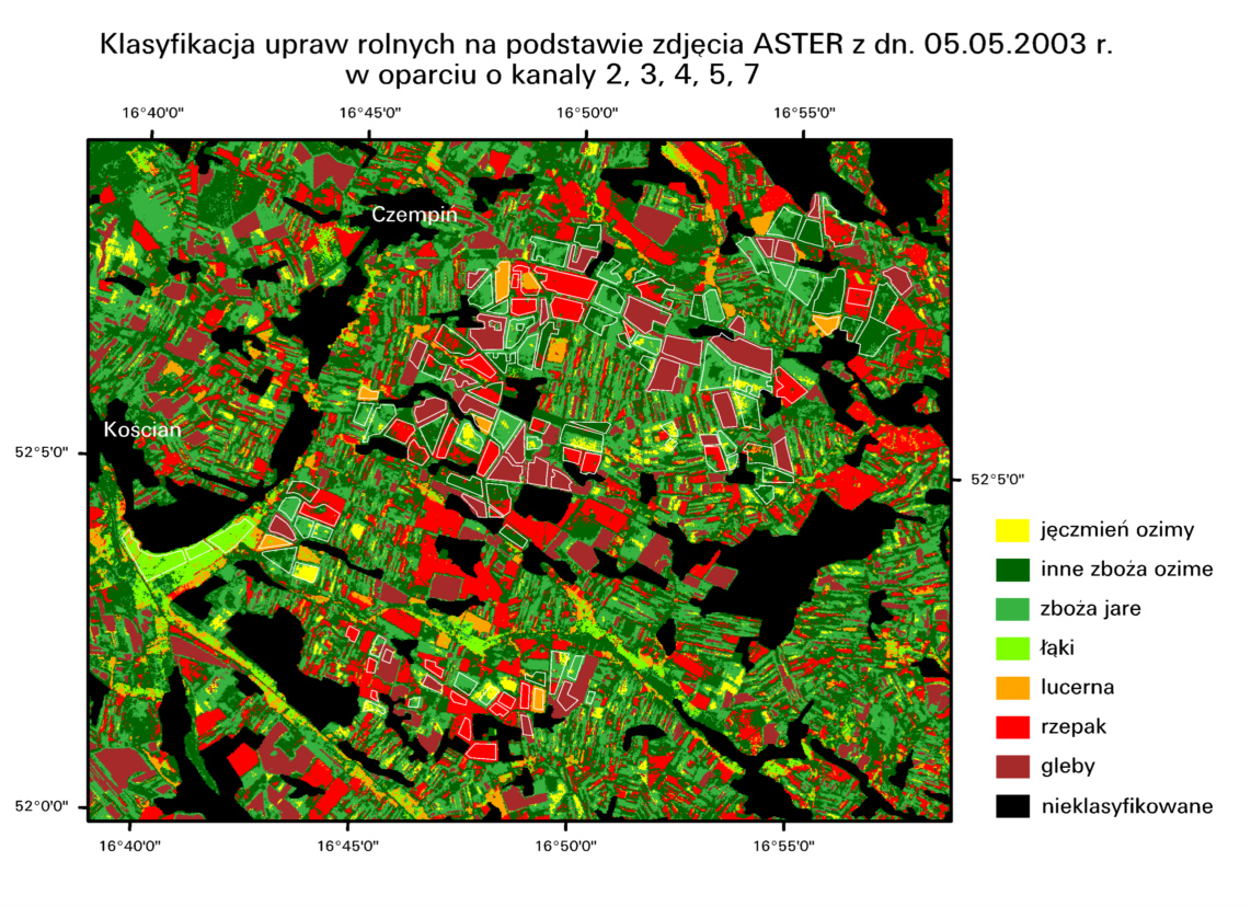
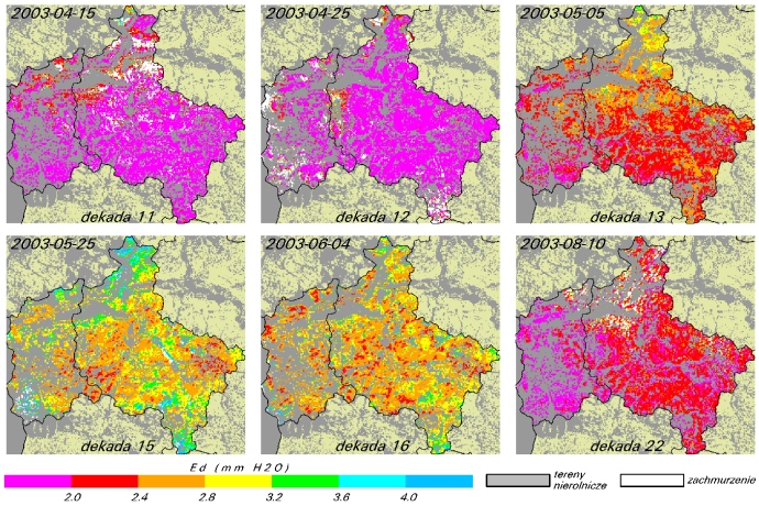
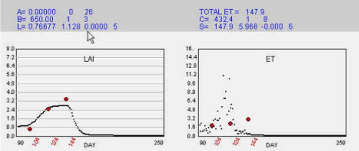
NOAA images registered in IGiK were atmospherically corrected using 6S program. ENVISAT MERIS images have been bought from ESA for CAT-1 1427 project and used for crop classification. These allowed the proper choice of "cereals" pixels on NOAA images. From NOAA data the vegetation index NDVI and soil moisture index H/LE have been developed. These indices were used for modeling APAR and LAI values. The algorithm for calculation of cereals yield from maximum LAI values has been elaborated using ground truth measurements. Then the PLONSAT model was fed with LAI and evapotranspiration values calculated from each of the cloud free NOAA data. As the results of running model the following outputs have been obtained: APAR, LAI, and evapotranspiration from which crop yield has been calculated for the chosen districts.
The new method of cereals yield assessment on the basis of crop growth models will deliver information apriori harvest. The forecast will allow governmental and other authorities to make an appriopriate economical decisions. According to EU policy these information can be used for proper management of the large agricultural areas in Poland.
 |
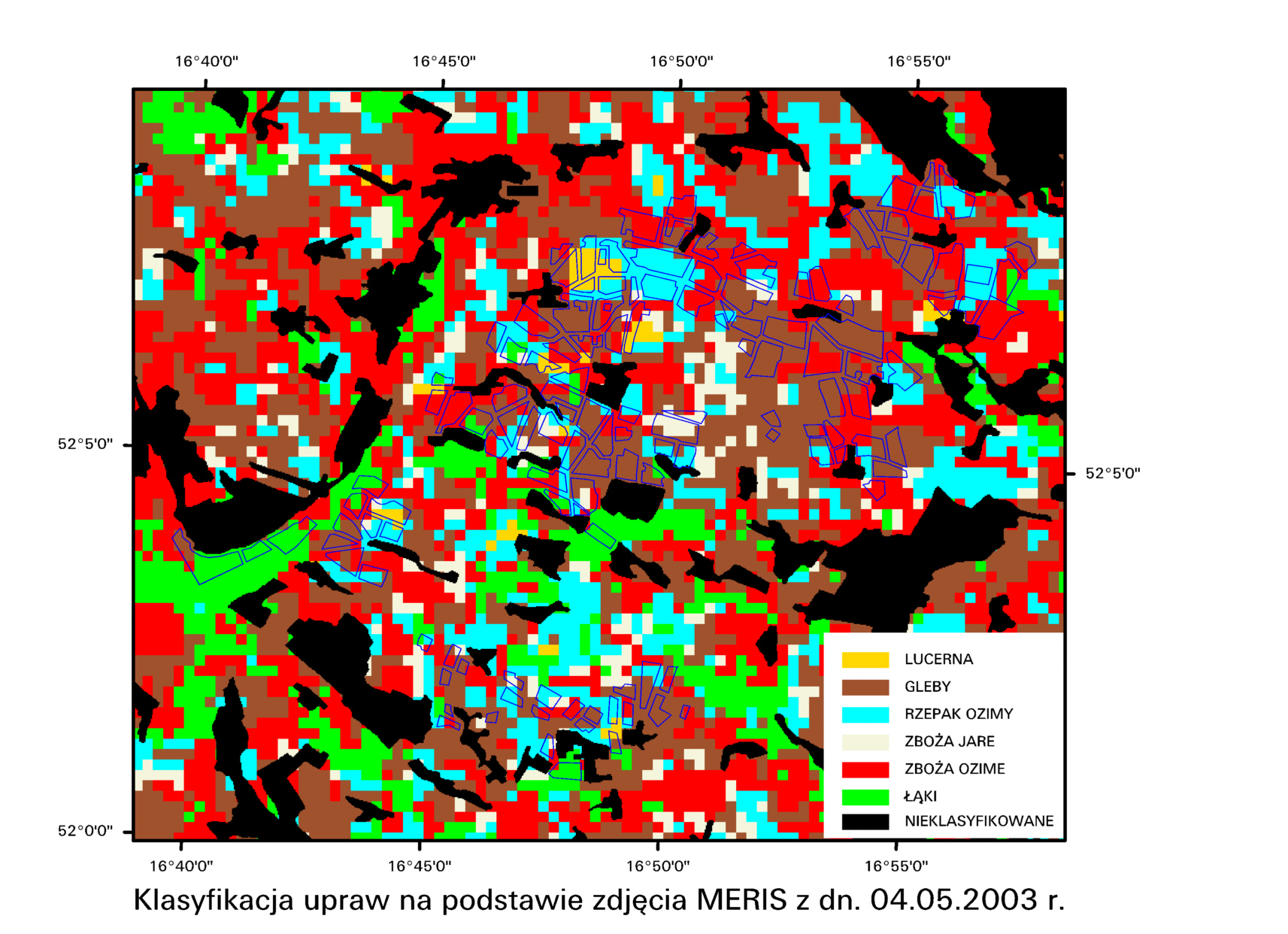 |
| Classification of crop plants based on ASTER image with bands 2 3 4 5 7 registered 05.05.2003 | Classification of crop plants based on MERIS image registered 04.05.2003 |
 |
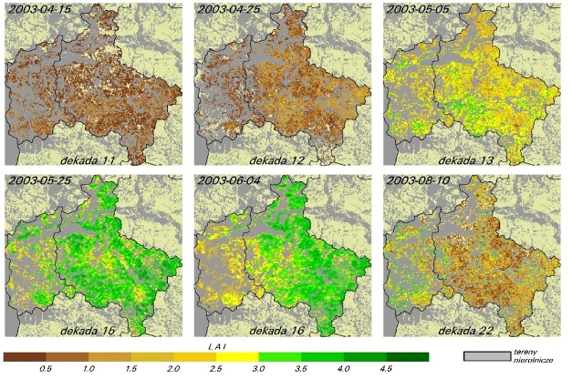 |
| Daily evapotranspiration for Lubusz and Wielkopolska voivodeships in 2003 | LAI values for Lubusz and Wielkopolska voivodeships in 2003 |
 |
|
| LAI and ET simulation based on model PROBE | |