GEOLAND - land monitoring service
 |
 |
 |
Sub-project I - Observatory Food Security & Crop Monitoring (OFM)
OFM aimed at developing methods and tools for a future GMES Crop monitoring service for providing near-real time information on crop yield outlook and estimated cultivated areas at the scale of provinces and countries as basis for regional crop production estimates. OFM work on yield estimation was organized as a contest between existing methods for generating yield indicators based remote sensing and modelling and combined methods.
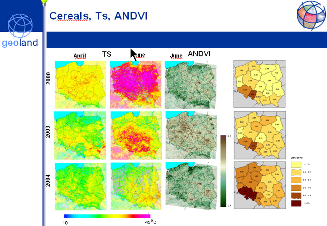
These yield indicators in the form of vegetation indices and modelled crop biomass were updated monthly and were used as predictor of the mean regional yield. Performance of particular methods was evaluated by research team from Joint Research Centre, Ispra, Italy. The overall conclusion of the yield estimation contest was that the performance of the various methods varied over the regions and years.
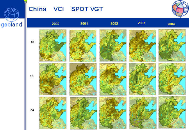
Institute of Geodesy and Cartography actively participated in developing methods based on remote sensing indicators derived from NOAA AVHRR and SPOT VEGETATION data. The works were carried out from 3 countries: Poland, Belgium and Spain. Several remote sensing indicators were tested in the course of the works: Vegetation Condition Index - VCI, Temperature Condition Index - TCI, Accumulated Normalized Difference Vegetation Index - ANDVI. They were correlated with yield of cereals and winter wheat in each decade in order to determine optimal periods for yield forecast.
In a second stage, the OFM methods have been applied successfully in operational automated data processing chains to assessing yield of wheat and maize crops in the North China plain with the use of MODIS and SPOT VEGETATION satellite images.
Sub-project II - Core Service Generic Land Cover (CSL)
CSL was divided into six main work packages:
- Collection of information concerning needs of European users of land cover maps and definition of state-of-the-art related to satellite based technology of land cover mapping
- Analysis of user needs and requirements concerning application of land cover maps and preliminary technical specification of map contents
- Presentation of concept of land cover maps and its discussion with end users in order to determine standard product in European level
- Preparation of prototype land cover maps at a scale of 1:100 000 for 4 selected test areas
- Presentation of prototype products - land cover maps for test areas - to the end users
- Evaluation of prototype products by users in order to improve technology of land cover mapping for European needs
Institute of Geodesy and Cartography participated in the first three stages of the project. In the first stage nationwide action was undertaken to collect information concerning needs of Polish users of land cover maps. Results of this survey were passed to the main coordinator of CSL action. After assessing users needs technical specifications concerning land cover / land use map were prepared and presented to users for verification. Finally, land cover / land use maps for 4 test areas (Germany, Sweden, France, Austria) were produced and evaluated by end users to create final version of technical specification for land cover mapping at European level.
