Institute of Geodesy and Cartography
Search:
Homepage
Institute
Programs
Seminars
Publications
Offer
BIP
Contact
View service WMS
Institute
About
News
Management
Scientific Council
Scientific Centers
Support Departments
Patents
Cooperation
Public Procurement
Contests
Work
Internship
News
Instytut Geodezji i Kartografii dołączył
read more >
Nabór na na stanowisko pracownika sekretariatu
read more >
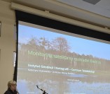
Konferencja „Woda dla mokradeł – retencja i
read more >
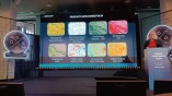
W dniach 6-7 listopada 2024 r. odbyła się kolejna edycja Forum Obserwacji Ziemi, organizowanego przez
read more >
Recruitment for the adjunct position at the Centre for Geodesy and Geodynamics
read more >
Nabór na stanowisko młodszego specjalisty w CGiG
read more >
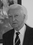
30 października zmarł profesor dr hab. Stanisław
read more >
GREENPACT European
read more >
Instytut ogłasza konkurs na stanowisko naukowe
read more >
Ogłoszenie o naborze na stanowisko adiunkta
read more >
1
2
3
4
5
6
7
8
9
10
...
47