Soil moisture in Poland from SMOS satellite
„Application of SMOS data for Biebrza Wetlands and for Wielkopolska agricultural region in Poland”
ESA C1P.10669
Principal Investigator: dr eng. Maria Budzynska, maria.budzynska@igik.edu.pl
Project duration: 03.01.2012-31.12.2014
Project objective:
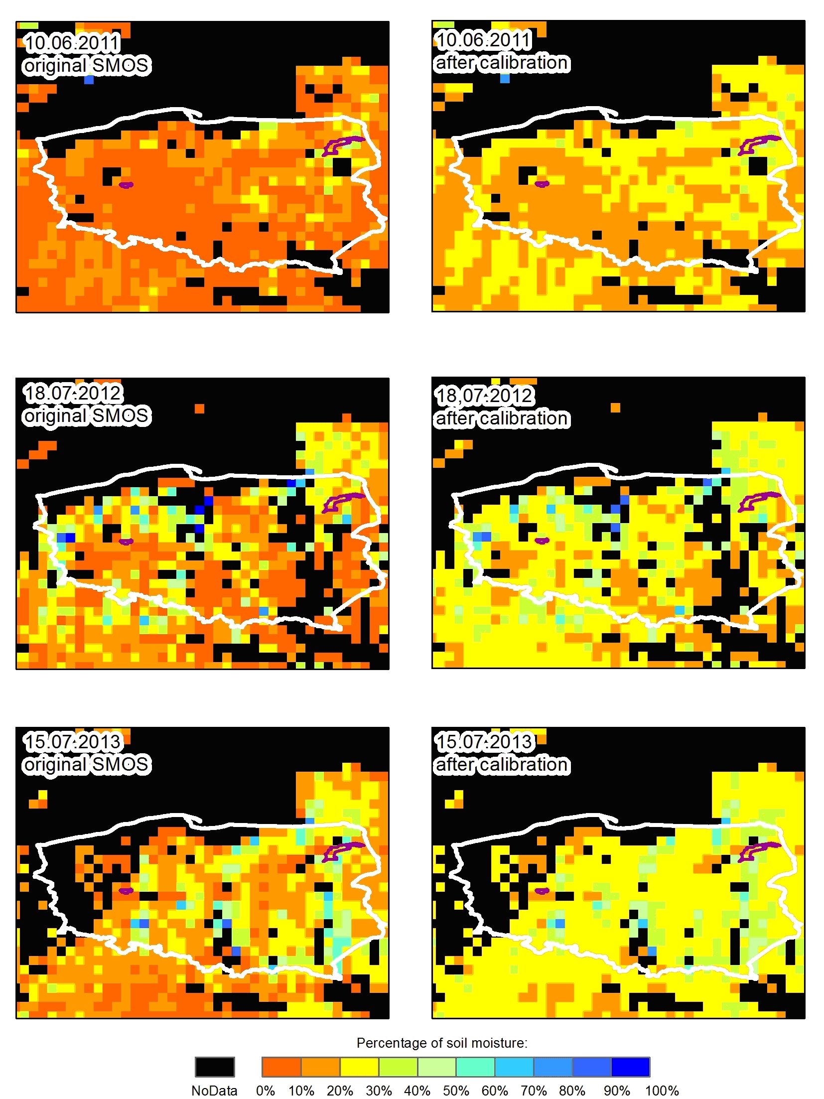
The objective of the project is the assessment of carbon balance for different biomasses and soil moisture conditions. Study are conducted at the two different test sites: in the Biebrza Wetland and in the Wielkopolska agricultural region. SMOS data are used along with ground truth measurements concerning soil moisture (TDR method), LAI (LAI-2000 Plant Canopy Analyzer), biomass (in laboratory from samples taken at the test site), height of the vegetation, carbon balance (chamber method). Also, type of vegetation and it’s development stage and growth conditions will be noted.
The relationships between SMOS data and in situ data are performed using statistical analyses and the results are used for soil moisture mapping. Figure below presents maps of soil moisture for Poland derived from SMOS data. Calibration has been done using derived relationship between ground truth and satellite data. The mean difference between rough and calibrated soil moisture data (which are higher) equals to 10%.