Forest Degradation
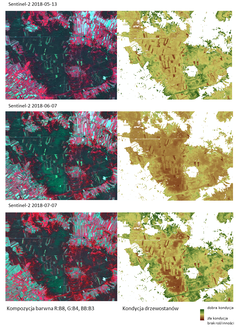
We are carrying out the analysis of the degradation of forest stands caused by prolonged periods of water shortage and insects and pathogens outbreaks using a time series of the European Sentinel-2 datasets. The health condition of the forest is monitored based of a combination of spectral indicators derived from the Sentinel-2 data. Integration of the satellite-based forest condition indicators and the information on the forest characteristics, age, species composition, forest history and habitats allow to better understand the vulnerability of the particular forest stands to prolonged droughts and gradation of insects. The forest condition indicator developed by our team is provided as one of the forest-related products in the SAT4EST application.
Przykład 1. W Centrum Geomatyki Stosowanej prowadzone są badania nad oceną kondycji drzewostanów.
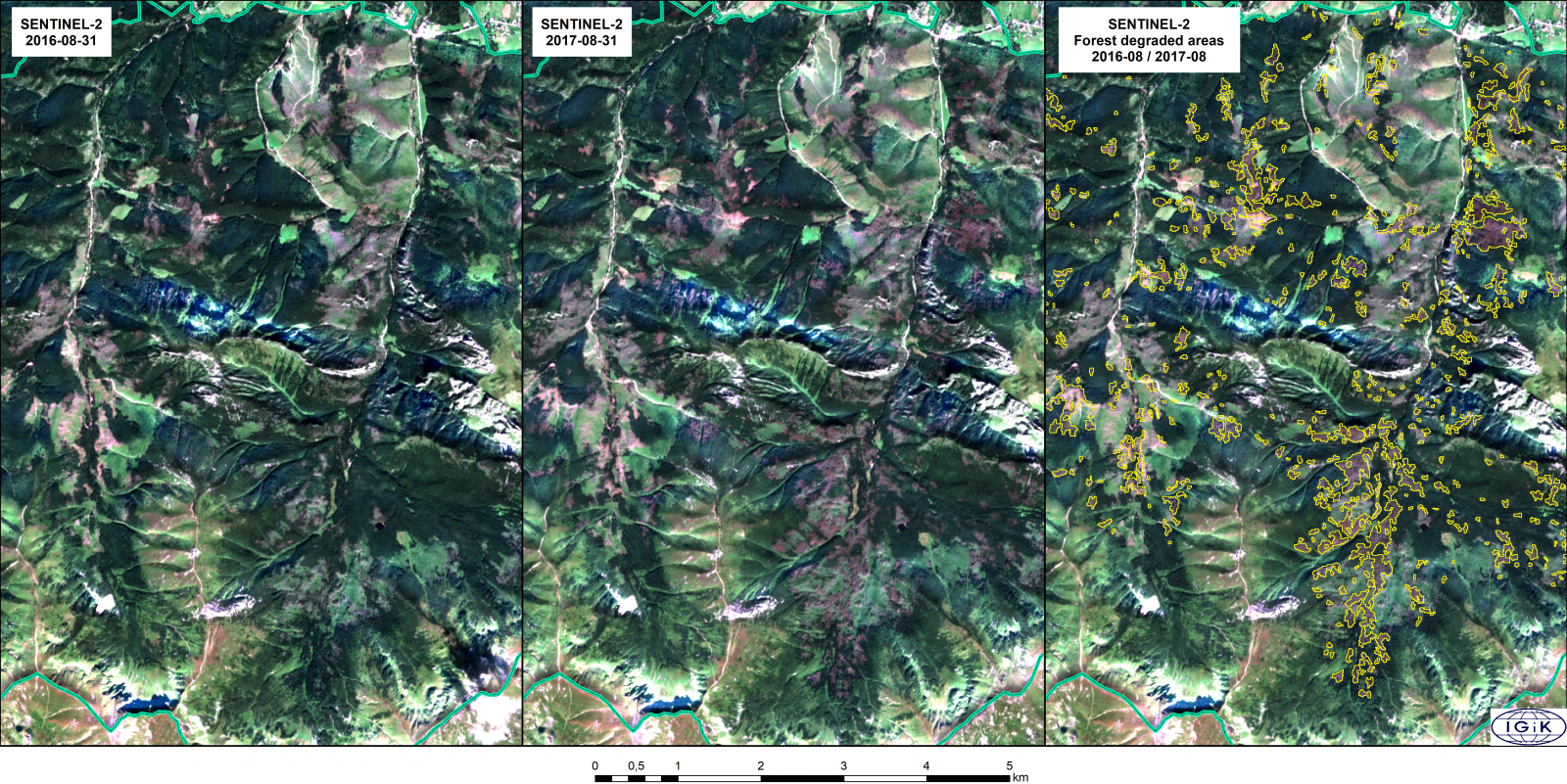
 Przykład 2. Na podstawie zdjęć z satelity Sentinel-2 wyznaczono zasięg drzewostanów zniszczonych wskutek gradacji kornika w Tatrzańskim Parku Narodowym między sierpniem 2016 i sierpniem 2017r. Zastosowano metodę detekcji zamian pomiędzy dwoma terminami rejestracji obrazu tego samego obszaru. Metoda umożliwia szybką ilościową ocenę postępujących zmian.