Current projects
Identification of forests on post-agricultural land
The subject of project is to perform the research on the identification of forests on former farmland based on available satellite datasets in Poland. It is a continuation of a pilot project that ended in 2020.
NCN Opus

Projekt badawczy: NCN OPUS21 pt.: „Ocena wpływu warunków meteorologicznych na stan zdrowotny lasów i zaburzenia w lasach w skali regionalnej i krajowej w oparciu o integrację danych naziemnych z danymi z satelitarnych systemów obserwacji Ziemi”.
OCRE - The Open Clouds for Research Environments

The Open Clouds for Research Environments project (OCRE), aims to accelerate cloud adoption in the European research community, by bringing together cloud providers, Earth Observation (EO) organisations and the research and education community, through ready-to-use service agreements.
UseEO

The project USeEO – Custom EO Tools for Resilience Management in Poland aims to develop and validate a set of customized Earth Observation (EO) derived information products to support the different stakeholders working in the resilience sector in Poland and verify the utility and benefits resulting from the use of these products.
Norway Grants - InCoNaDa
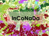
InCoNaDa - Enhancing the user uptake of Land Cover / Land Use information derived from the integration of Copernicus services and national databases. The main goal of the InCoNaDa project is to improve the user uptake of land cover and land use information derived from the integration of Copernicus Land Monitoring Services (CLMS) and national databases.
Copernicus Land Monitoring - Poland
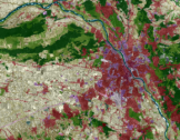
Instytut Geodezji i Kartografii, w ramach umowy ramowej z Europejską Agencją Środowiska (EEA) realizuje zadania dotyczące: analizy zmian pokrycia terenu i użytkowania ziemi w latach 2012-2018; produkcji krajowej bazy pokrycia terenu i użytkowania Ziemi CORINE Land Cover 2018; weryfikacji krajowych warstw wysokorozdzielczych (High Resolution Layers) obejmujących: tereny nieprzepuszczalne, lasy, trwałe użytki zielone, zbiorniki wodne i tereny podmokłe; weryfikacji produktów lokalnych tj. Urban Atlas, szczegółowego pokrycia terenu/użytkowania ziemi wzdłuż największych rzek (Riparian zones) oraz wybranych obszarów NATURA2000.
Forests on post-agricultural land
The aim of this research topic is to identify forests occurring on post-agricultural land based on archival and current satellite data. Satellite data allow to reconstruct an image of Earth surface and monitor changes in land use and land cover categories during last 60 years. Noteworthy are satellite images of CORONA program, made in 1960-1972 by American reconnaissance missions, among others for area of Poland (declassified at the end of 1990s). In 1972 the first civilian satellite of Landsat series was launched into orbit, providing images in several spectral channels.

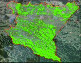
SAT4EST

The goal of the SAT4EST is to design and build non-state forest focused service dedicated to the local government administration in Poland. The proposed service promotes the use of various Copernicus data and products to the large community of end users at administrative level. Earth Observation based service provides a simple, intuitive and low cost tool in a form of a web-based application easy to use and expand for other dataset. It integrates EO based products, ancillary data and allows calculating statistics over a given area and generating simple reports.