Forests on post-agricultural land
Identification of forests on the post-agricultural land based on available satellite data
Leader: dr hab. inż. Agata Hościło
Duration of the project: 29.11.2018 - 29.11.2020
Funded by: Dyrekcja Generalna Lasów Państwowych (DGLP)
The subject of project was to perform the research on the identification of forests on former farmland based on available satellite datasets. The project covered forests of all forms of ownership located in the Regional Directorate of State Forests in Białystok and the Regional Directorate of State Forests in Krosno together with the national parks.
The project was carried out in four phases.
- the first phase included acquisition and pre-processing of archive satellite images of the CORONA program, Landsat series (MSS, 5 and 7) and images from the European Sentinel-2 satellites.
- the second phase included mapping the forest cover based on CORONA images and the development of the digital forest maps for the 1960s.
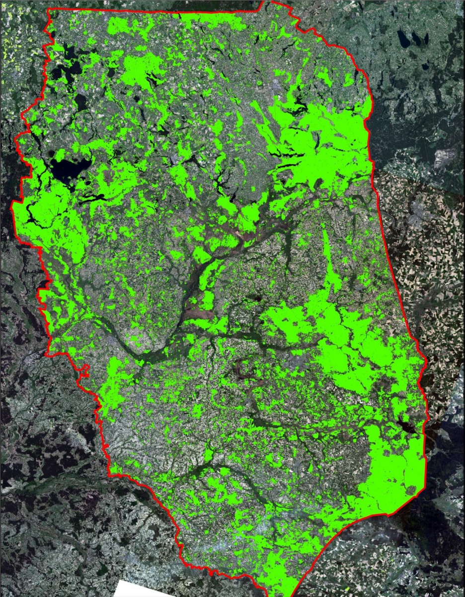
- during the third phase, forest classifications were carried out on the basis of a series of satellite data from the Landsat MSS (1980), Landsat 5, 7 (1990 and 2000) and Sentinel-2 (2018) missions, and then the numerical forest cover maps were developed for subsequent periods.
- the fourth phase concerned the development of forest change maps between the periods 1960–1980–1990–2000–2018, the performance of quantitative and qualitative analyses of the forest cover and forest changes, and the identification of forests on post-agricultural or other non-forest lands. Additionally, an assessment of the usefulness of satellite data used in the project for forest mapping was performed.

The forest cover in the 1960s was developed by the expert manual interpretation based on the satellite images of the CORONA program. In case of mapping forests extent in later periods, a modern classification method with the use of machine learning algorithms was applied, using not only static classifiers, but also deep learning. The obtained results confirmed the high accuracy of the classification models. Based on the digital maps of forest cover and forest changes, the identification of forests on post-agricultural or other non-forest land was performed. A spatio-temporal analysis allowed to determine not only the location and area of post-agricultural forests, but also to indicate in which period of time they were established.
The CORONA images proofed to the especially valuable for the detection of the forest on post-agricultural land. Among the analysed data, the Landsat MSS images showed to have the lowest usefulness in forest mapping. The Landsat 5 and 7 data series from 1990 and 2000 were comparable in quality. The Sentinel-2 data, due to their high spatial, spectral and temporal resolution as well as a wide swath, are particularly valuable for forest and forest change mapping, and monitoring the forest condition at local, regional and national scale.
Above - forest cover map Regional Directorate of State Forests Białystok based on Landsat ETM i TM; (IGIK)
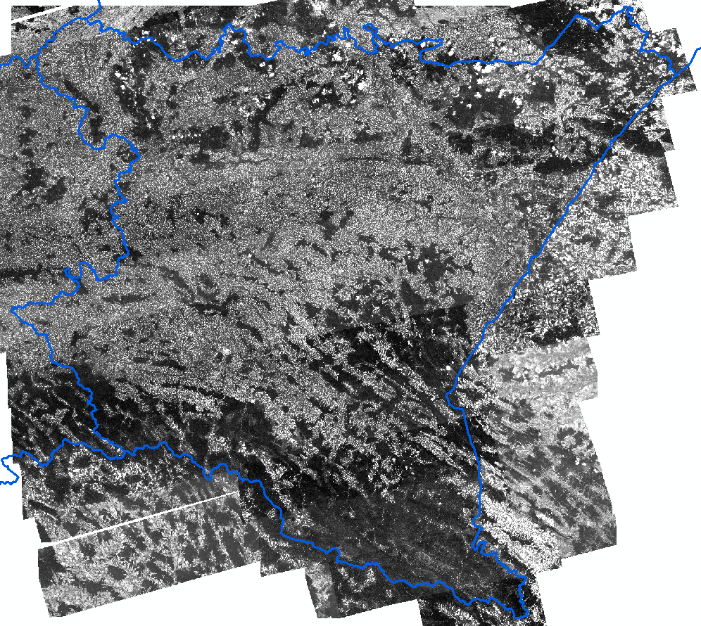
Left- Regional Directorate of State Forests in Krosno - CORONA images 1961-68 (IGIK)