Instytut Geodezji i Kartografii
Institute of Geodesy and Cartography
Search:
  • Homepage
  • Institute
  • Programs
  • Seminars
  • Publications
  • Offer
  • BIP
  • Contact
  • View service WMS
Institute
  • About
  • News
  • Management
  • Scientific Council
  • Scientific Centers
    • Geodesy and Geodynamics
    • Centre of Applied Geomatics
      • What we do
      • Current projects
      • Services
      • Papers and conferences
      • Team
    • Remote Sensing
    • Geographic Information Systems and Cartography
  • Support Departments
  • Patents
  • Cooperation
  • Public Procurement
  • Contests
  • Work
  • Internship

Services

Application SAT4EST

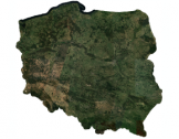
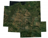
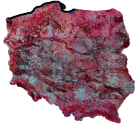
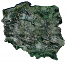
SAT4EST is a system supporting the management of non-state forests, using satellite Earth observation techniques.

Read more >

Sentinel-2 national mosaic

  • National mosaic of Sentinel-2 for 2018
  • National mosaic of Sentinel-2 for 2019
  • National mosaic of Sentinel-2 for 2020
  • National mosaic of Sentinel-2 for 2021
  • National mosaic of Sentinel-2 for 2022
Read more >

Sharing Copernicus HRL and national local components

Read more >
Copyright © Instytut Geodezji i Kartografii 2025 | Deklaracje dostępności | Polityka prywatności
Projekt i wykonanie: Agencja interaktywna Bull Design