Monitoring of forests and wooded areas


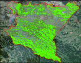
Inwentory of actual forest extent
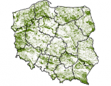
The aim of the project was to map the actual forest extent over Poland using the following spatial data sets: Digital Forest Map, Topographic Database, Database of Parcel Identification System, High Resolution Forests layer (HRL - Copernicus product), and Forest Data Bank.