Classification of agricultural areas
Classification of agricultural areas
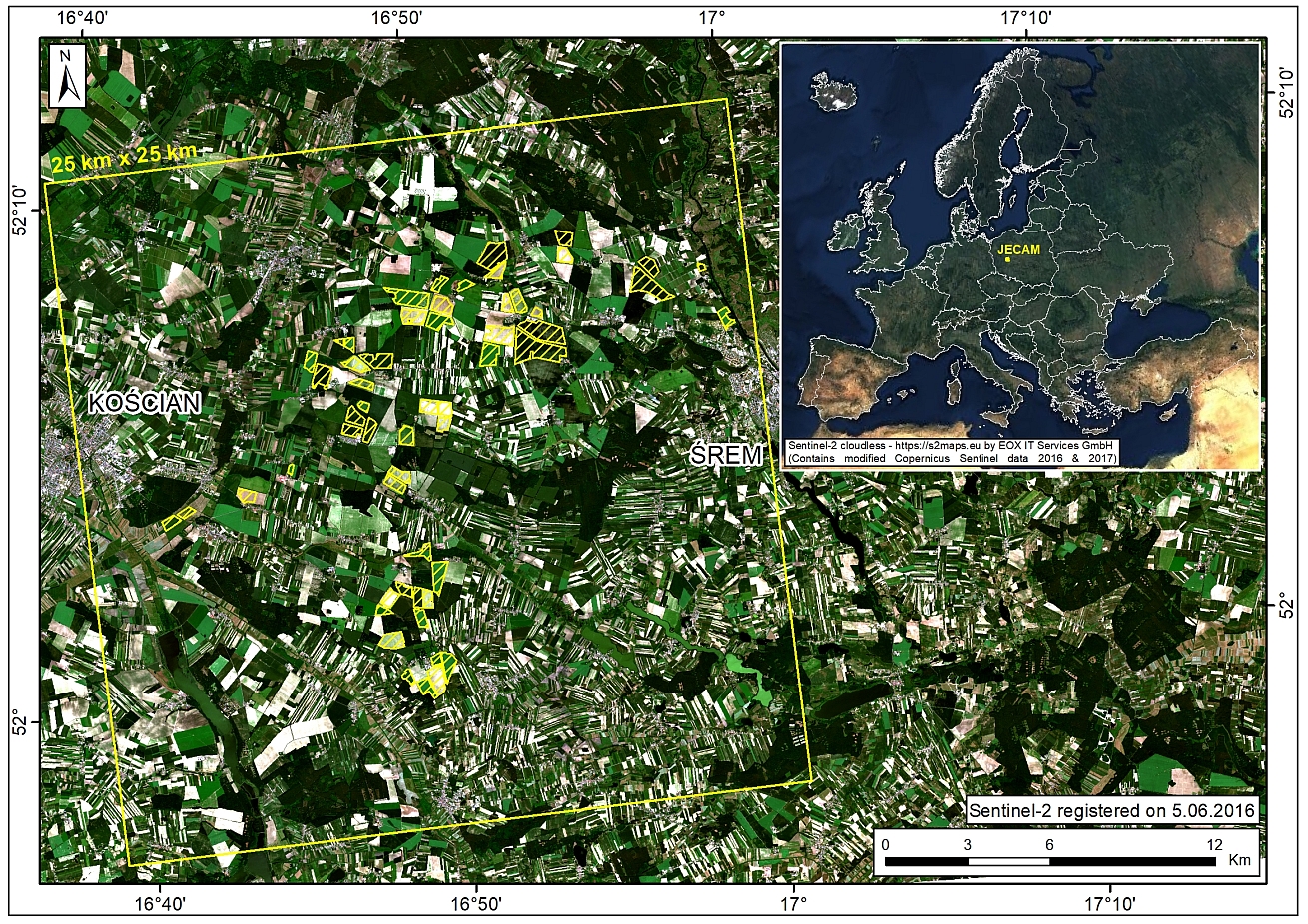
Annual land cover classifications of agricultural areas are performed as part of the projects conducted by the Institute of Geodesy and Cartography. JECAM study site located at the wielkopolskie voivodship is used as a pilot area.

Fig.1. Location of JECAM Study Site in Poland. Credits: IGiK
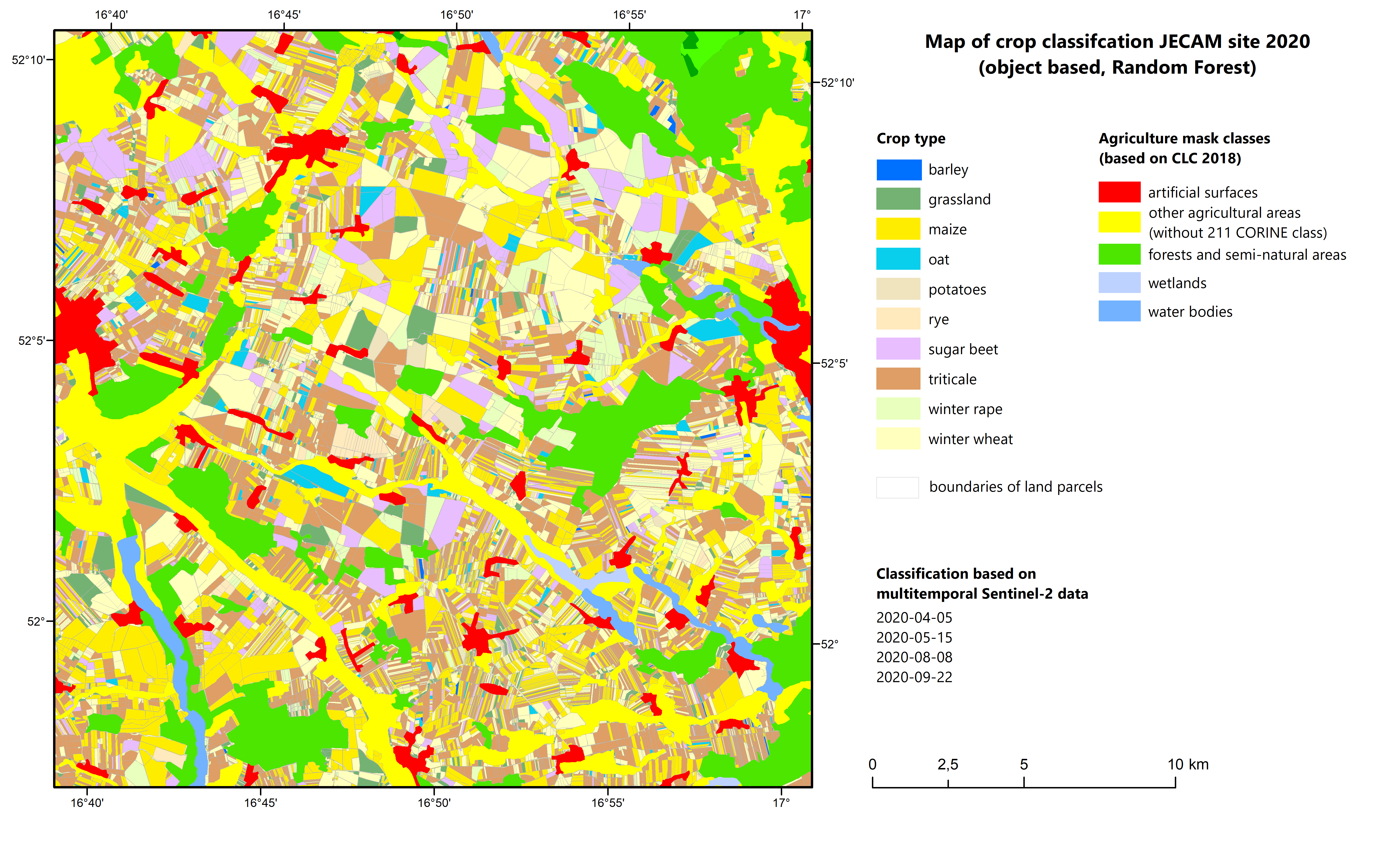
Crop mapping is the initial phase; it takes place at the beginning of April and is then is repeated in June. The following crop species are recognized:
- wheat,
- triticale,
- rye,
- barley,
- oats,
- rape,
- maize,
- sugar beet,
- potatoes,
- alfalfa.
The data set is divided into test and verification fields. The classification is based on different approaches:
- machine learning method Random Forest, RF;
- Support Vector Machine, SVM;
- algorithm of artificial neural networks, ANN.
The classification processes are carried out on optical images (Sentinel-2) and applying fusion of optical and radar data (Sentinel-1). The resulting classification image is transferred from the pixel level to the object level using the national land parcel integrated system (LPIS). All operations are performed in the R programming language environment.
Fig.2. Classification of agricultural area carried out on the basis of series of Sentinel-2 satellite images in 2020. Credits: IGiK
Publications:
Gurdak R., Bartold M., 2020, Remote sensing techniques to assess chlorophyll fluorescence in support of crop monitoring in Poland, Miscellanea Geographica, Vol.25, No.3. doi:10.2478/mgrsd-2020-0029 PAPER
Gurdak R., Grzybowski P., 2018, Feasibility study of vegetation indices derived from Sentinel-2 and PlanetScope satellite images for validating the LAI biophysical parameter to monitoring development stages of winter wheat, Geoinformation Issues, Vol. 10, No. 1(10), pp. 27-35. doi:10.34867/gi.2018.3 PAPER
Dabrowska-Zielinska K., Bartold M., Gurdak R., Gatkowska M., Kiryla W., Bochenek Z., Malinska A., 2018, Crop Yield Modelling Applying Leaf Area Index Estimated from Sentinel-2 and Proba-V Data at JECAM site in Poland, Proceedings of 2018 IEEE International Geoscience & Remote Sensing Symposium (IGARSS), 22 - 27 July 2018, Valencia, Spain. doi:10.1109/IGARSS.2018.8519120 PAPER - POSTER
Bochenek Z., Dąbrowska-Zielińska K., Gurdak R., Niro F., Bartold M., Grzybowski P., 2017, Validation of the LAI biophysical product derived from Sentinel-2 and Proba-V images for winter wheat in western Poland, Geoinformation Issues, Vol. 9, No. 1(9), pp. 15-26. doi:10.34867/gi.2017.2 PAPER

