SPOT-VGT
NEWS
|
|
On June 1st 2014, after 16 years of fully operated SPOT-VGT mission satellite retires. To preserve the SPOT-VGT mission follow up, new satellite PROBA-V was launched in 2013. From December 2013 till May 31, 2014 SPOT-VEGETATION and PROBA-V were operated simultaneously to ensure data from both of two satellites consistent. For more details on PROBA-V mission see VITO's portal or click HERE. |
In the database of Department of Remote Sensing IGiK there are maps derived from SPOT-VEGETATION data. These are ten-day compositions of NDVI and VCI vegetation indices. The database includes images from 1998 and is updated on a regular basis.
Below are sample maps derived from SPOT-VGT products. See further down the page for more examples.
|
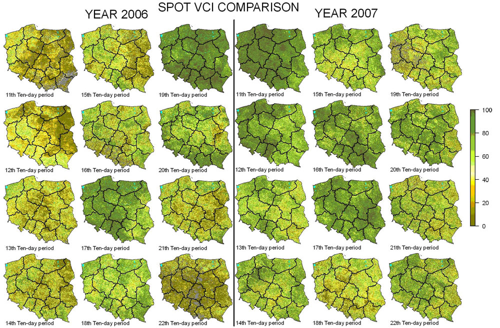
SPOT-VGT VCI comparison between 2006 and 2007 |
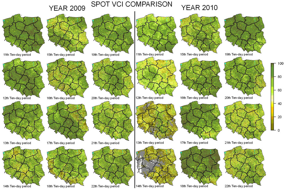
SPOT-VGT VCI comparison between 2009 and 2010 |
|
|
The VEGETATION programme was founded by the French space agency CNES in cooperation with Belgium, Italy and Sweden. The aim of this programme is observing of the global natural environment and the processes and changes in it. The financial support from the European Comission allowed to develop of modern instruments which would have supplied valuable informations about biosphere. The first of the two instruments in orbit, called VEGETATION as aboard the SPOT 4 satellite, launched on 24 March 1998. The second, called VEGETATION 2 is aboard SPOT 5, which was placed into orbit on 4 May 2002. For more informations about VEGETATION programme see: www.spot-vegetation.com |
VITO is worldwide distributor of SPOT-VEGETATION products. It offers two type of products: Primary (P) i Synthesis (S).
Primary and Synthesis products are archived. The main products are 10 day period synthesis - composites which are available free of charge after three months archiving. Other products are offered for a fee. For detailed descriptions of VGT products see VGT website SPOT-VEGETATION.
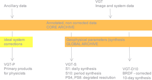
VGT products offered by VITO
http://www.spot-vegetation.com
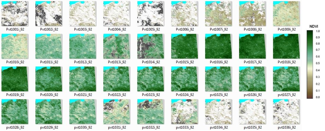
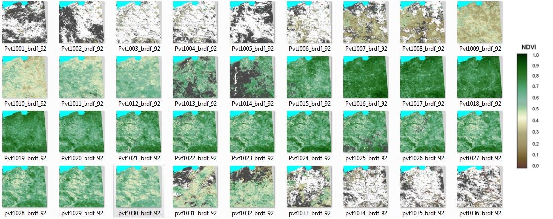
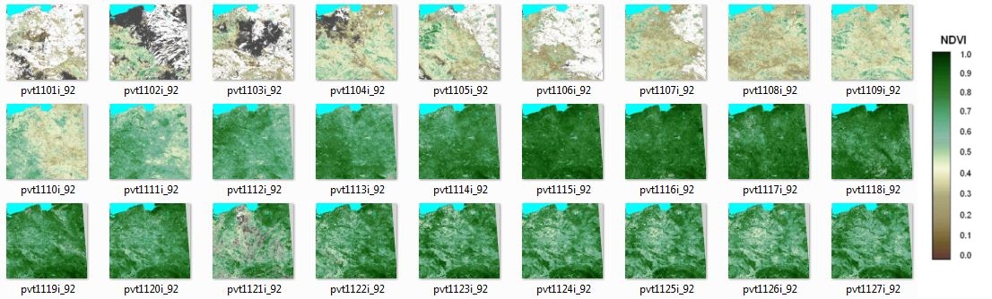
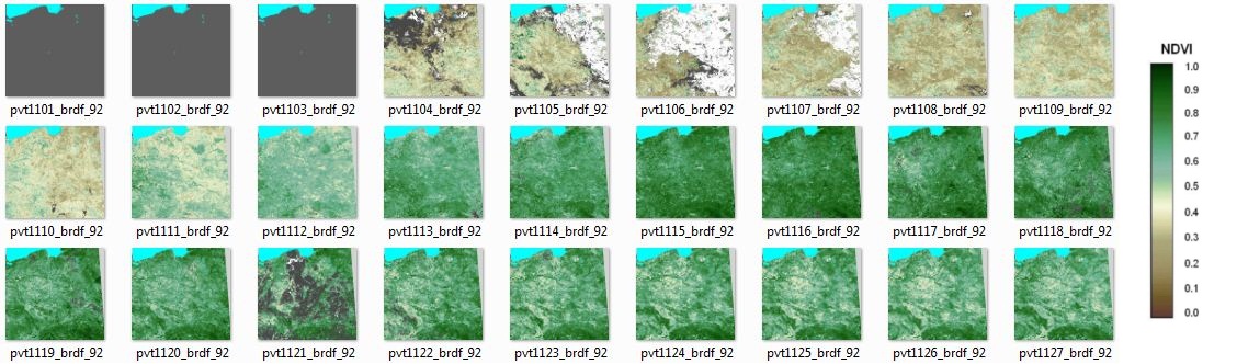
VGT-S10 and VGT-D10 products are downloaded from VITO server. The website http://free.vgt.vito.be/ gives you access to SPOT-VGT ten daily synthesis archive on 10 predefined regions of interest. In the IGiK database there are VGT data from 1998 up to actual date. These data are clipped to Poland area and masked with using Status Map files. SM file contains informations about observed clouds, snow/ice and classified pixels to land/water. VGT-S10 is NDVI product whereas VGT-D10 is NDVI with BRDF product. For next step they are used for VCI images obtaining. At the end there are computed mean NDVI and VCI values for Polish voivodeships. For this process there is applied arable land mask derived from CORINE LAND COVER 2006.
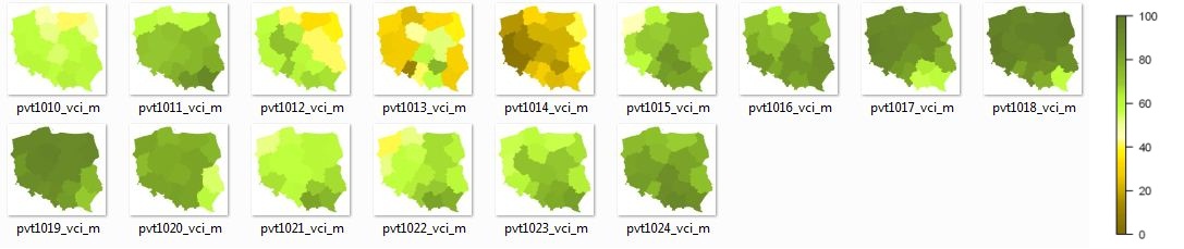
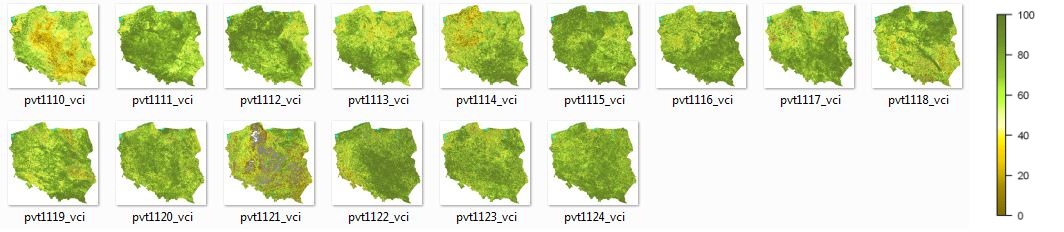
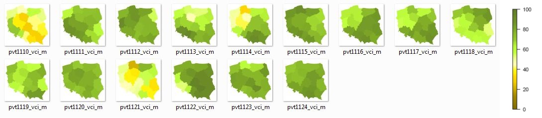
The results for 2010 and 2011 are presented below. Prepared by: Department of Remote Sensing IGiK
|
10-day 2010 NDVI compositions over Poland |
10-day 2010 NDVI compositions over Poland |
|
10-day 2011 NDVI compositions over Poland |
10-day 2011 NDVI compositions over Poland |
|
10-day 2010 VCI compositions over Poland |
Average 2010 VCI values over Polish voivodeships |
|
10-day 2011 VCI compositions over Poland |
Average 2011 VCI values over Polish voivodeships |