Terra.MODIS
In the database of Department of Remote Sensing IGiK there are maps derived from Terra.MODIS data. These are eight-day compositions of vegetation indices NDVI, VCI and temperature index TCI. The database includes images from 2000. This database is updated on a regular basis.
Below are sample maps derived from Terra.MODIS products. See further down the page for more examples.
|
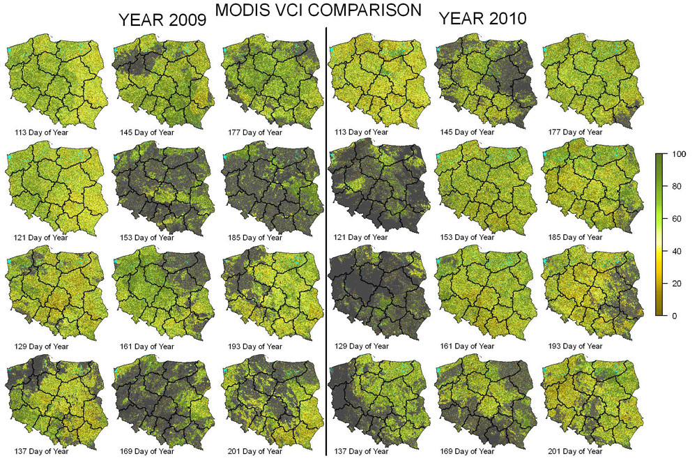
MODIS VCI comparison between 2009 and 2010 |
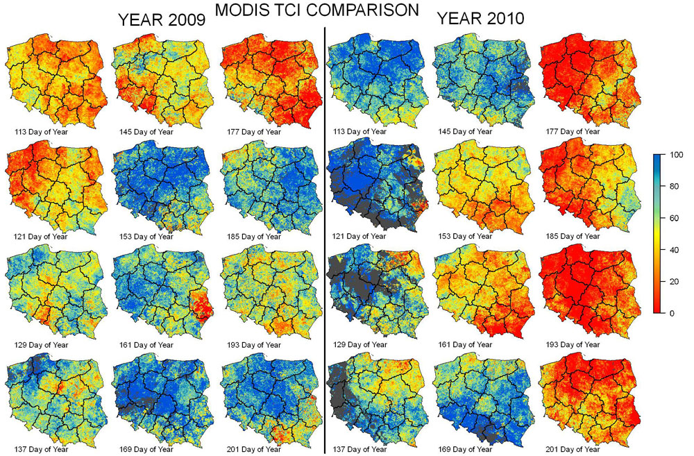
MODIS TCI comparison between 2009 and 2010 |
 |
Sensor MODIS (Moderate-Resolution Imaging Spectroradiometer) is a instrument aboard the Terra and Aqua satellites. Both satellites are developed under NASA Earth Observation System (EOS). The aim of EOS mission is monitoring of global dynamics and processes occuring on the land and in the oceans as well as assessing Earth system models and predictions based on daily observations. LP DAAC (Land Processes Distributed Active Archive Center) is a distributing center of registered data from Terra and Aqua satellites. It offers a wide range of (MODIS) products, which are radiometric, geometric and atmospheric pre-processes. MODIS data are available free of charge.
For a complete list of the available MODIS land products see: |
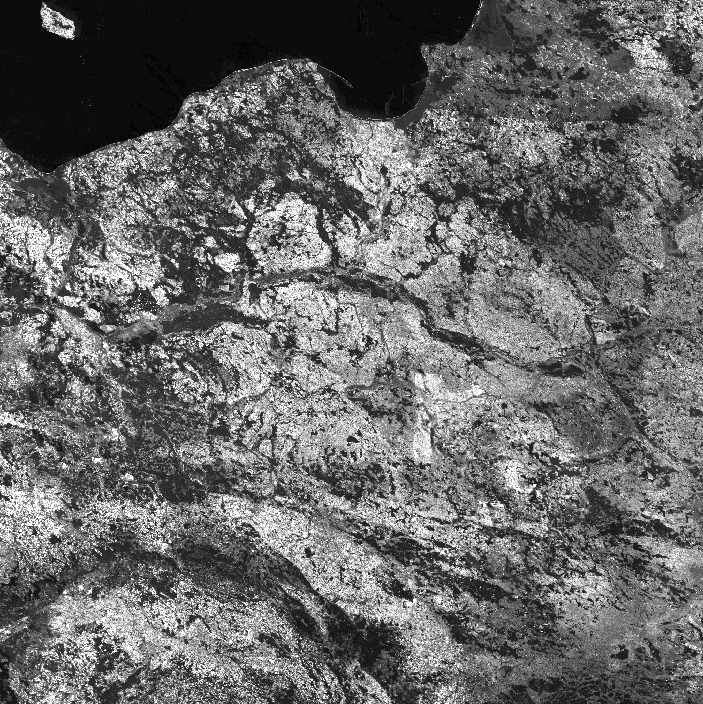 Poland subset after four tiles mosaicking
MOD09Q1 (band 1)
Date of registration: 233 day of 2009
MODIS data are downloaded from NASA server – Reverb ECHO. Poland area is located in four tiles of 10°x10° long./lat. in sinusoidal projection. Acquired data are processed in order to do followed analyses. The input tiles are mosaicked to a single scene which finally is clipped to Poland area. Auxiliary informations about clouds, snow are applied too. There are extracted from Quality Control band.
Terra.MODIS MOD09Q1 and MOD11A2 products are applied for drought monitoring and crops forecasting. First of one contains data about surface reflectance registered in RED and NIR bands. Second of one's data includes daily/night land surface temperature and emissivity. MOD09Q1 8-day products are provided at 250-meter resolution. MOD11A2 products are also eight-day compositions, but provided at 1000-meter resolution.
Vegetation maps (NDVI, VCI) are obtained from MOD09Q1 products. It is also extracted daily surface temperature and calculated TCI maps from MOD11A2 products. Arable land mask, derived from CORINE LAND COVER 2006 is applied for averaging of indices.
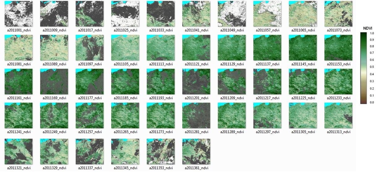
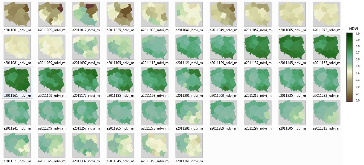
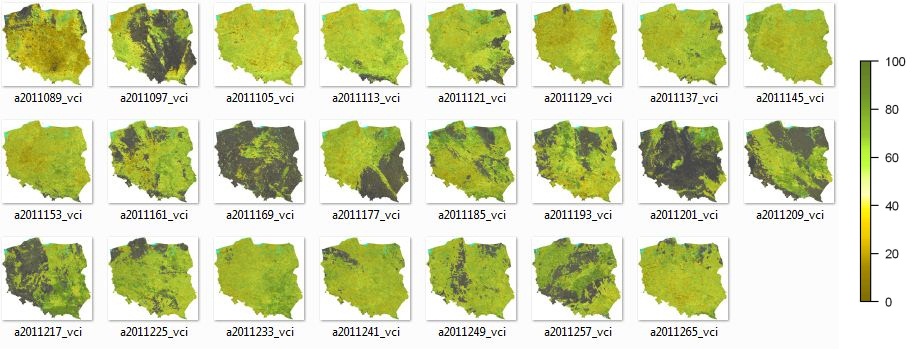
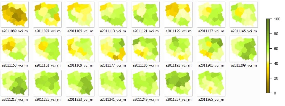
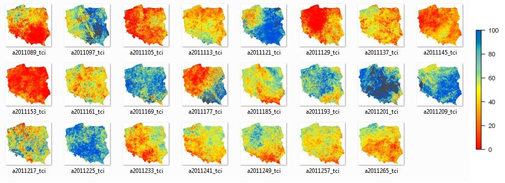
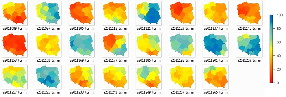
The results for 2011 are presented below. Prepared by: Department of Remote Sensing IGiK
|
8-day NDVI compositions over Poland |
Average NDVI values over Polish voivodeships |
|
8-day VCI compositions over Poland |
Average VCI values over Polish voivodeships |
|
8-day TCI compositions over Poland |
Average TCI values over Polish voivodeships |