Climate changes
Satellite-based system for drought monitoring
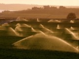
The system for monitoring crop growth conditions has been elaborated at the Remote Sensing Centre, Institute of Geodesy and Cartography. It determines crop conditions with the use of the index based on Terra MODIS satellite images with 1 km2 spatial resolution. The index, called Drought Identification Satellite System – DISS is a function of Temperature Condition Index – TCI and meteorological index characterizing climatic conditions on the territory of Poland (Hydrothermal Coefficient – HTC).
Modelling the carbon balance at wetlands applying Sentinel-1/2/3

The project objective is elaboration of the methodology for carbon balance modelling based on satellite Sentinel-1/2/3 data and insitu measurements of CO2 by chamber method, Leaf Area Index (LAI), soil moisture, PAR, biomass wet and dry (in the laboratory), surface temperature and soil temperature for Biebrza wetlands under changing moisture, biomass and meteorological conditions. The Project is funded by the National Science Centre, Poland (NCN) via OPUS 12 grant no 2016/23/B/ST10/03155.
ADAPTCITY - strategy for adaptation to climate change of Warsaw
 and vegetation condition NDVI (right) over the city of Warsaw in 2018. Credits: IGiK")
The aim of the project, conducted under the contract between the Institute for Sustainable Development and the Institute of Geodesy and Cartography, was to determine the state of the ecosystem of the Capital City of Warsaw in the period from the beginning of 2002 to the end of 2018. The analyses were performed for the needs of the final study in the field of monitoring the environmental problem within LIFE_ADAPTCITY_PL project.
Variability and change of cloudiness diurnal cycle over the past 30 years

The primary goals of the Project are to: 1) develop and validate a method for statistical reconstruction of cloud cover diurnal cycle, 2) create a 30-year global cloud fraction climatology (1°×1°) suitable for trend analysis by correcting the satellite orbital drift issue, 3) quantify global changes in cloud cover distribution and in diurnal cycle of cloud formation over the last 30 years. The project is funded by the National Science Centre, Poland (NCN) via POLONEZ grant no 2015/19/P/ST10/03990.
Analysis of changes of cloudiness in Poland

The main objective of this project is a spatio-temporal analysis of changes in cloud cover distribution and its physical properties in Poland over the last 25 years. The secondary objective is an impact assessment of those changes on solar energy potential. Analyses will be performed on the basis of satellite data acquired by the Advanced Very High Resolution Radiometer (AVHRR) at the resolution of 1 km2.
FINEGRASS - effect of climatic changes on grassland condition

The Project “Effect of climatic changes on grassland growth, its water conditions and biomass” is funded from Polish-Norwegian Research Programme (http://www.ncbir.pl/en/norwaygrants) operated by the National Centre for Research and Development (NCBiR).
WICLAP - effects of winter climate change and air pollution on forests
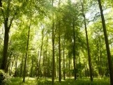
The Project “Ecosystem stress from the combined effects of winter climate change and air pollution - how do the impacts differ between biomes?” is funded from Polish-Norwegian Research Programme (http://www.ncbir.pl/en/norwaygrants) operated by the National Centre for Research and Development (NCBiR).
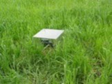
Soil moisture in Poland from SMOS satellite
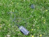
„Application of SMOS data for Biebrza Wetlands and for Wielkopolska agricultural region in Poland”
The objective of the project is the assessment of carbon balance for different biomasses and soil moisture conditions. Study are conducted at the two different test sites: in the Biebrza Wetland and in the Wielkopolska agricultural region.
The objective of the project is the assessment of carbon balance for different biomasses and soil moisture conditions. Study are conducted at the two different test sites: in the Biebrza Wetland and in the Wielkopolska agricultural region.
Remote sensing techniques for the assessment of carbon balance
The objective of the ESA PECS CARBON Project is to assess level of carbon balance with regard to land use, the amount of biomass, the soil moisture and meteorological conditions. The project also assessed the influence of the land use cover on carbon release and sequestration.