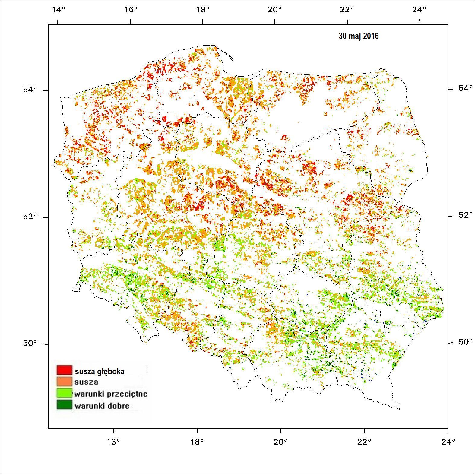
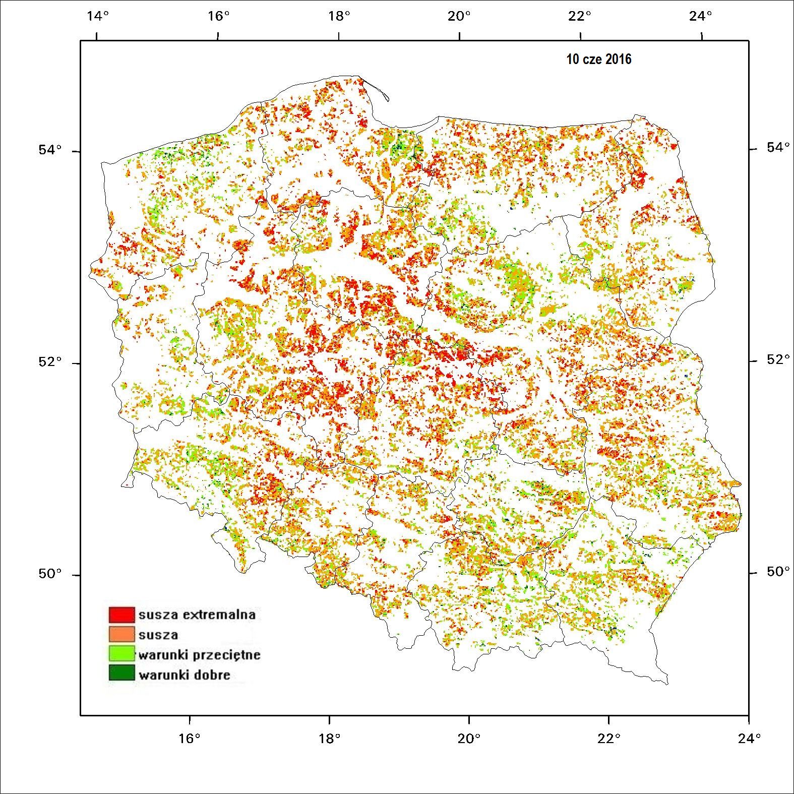
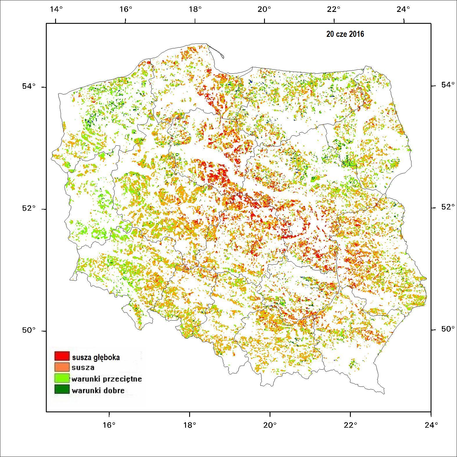
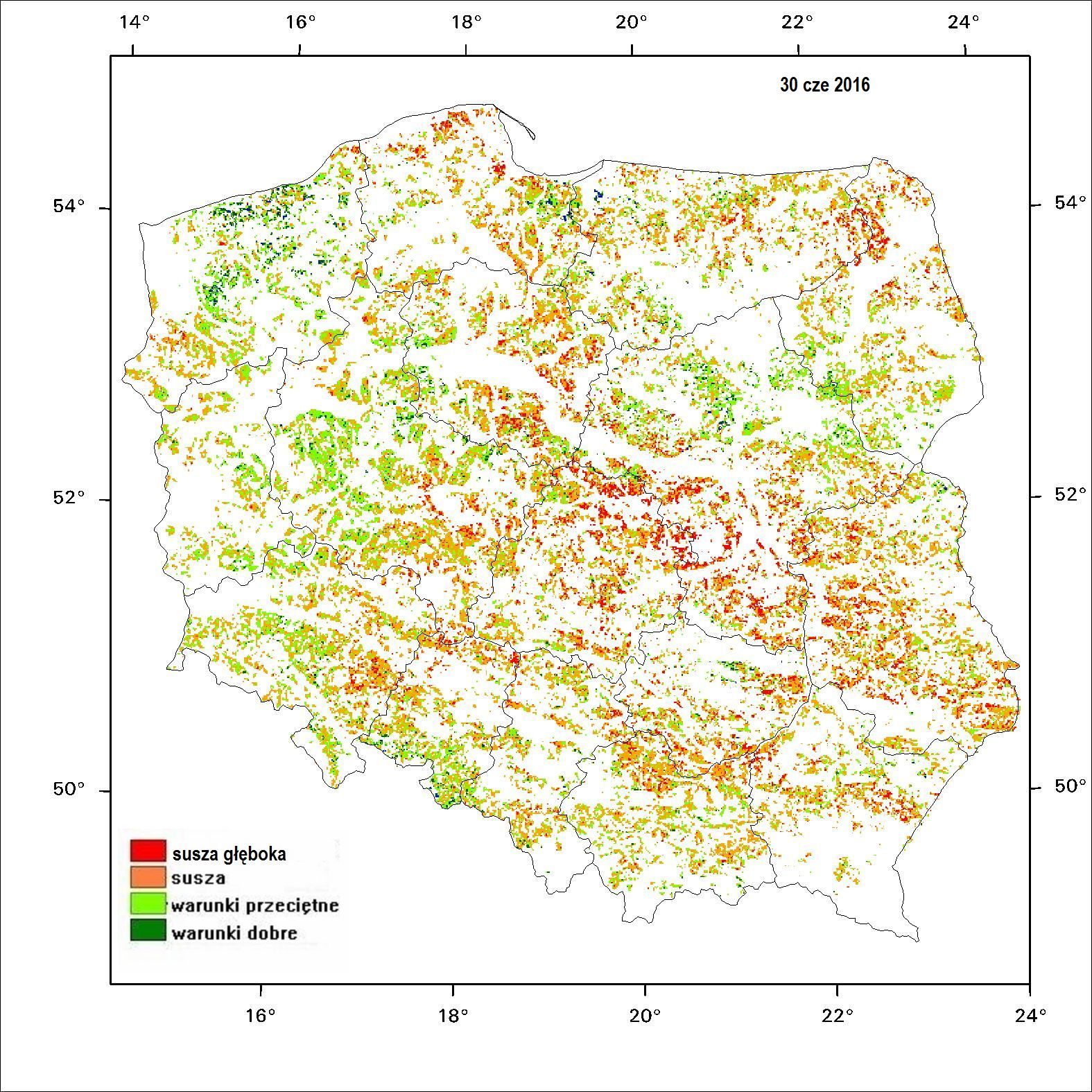
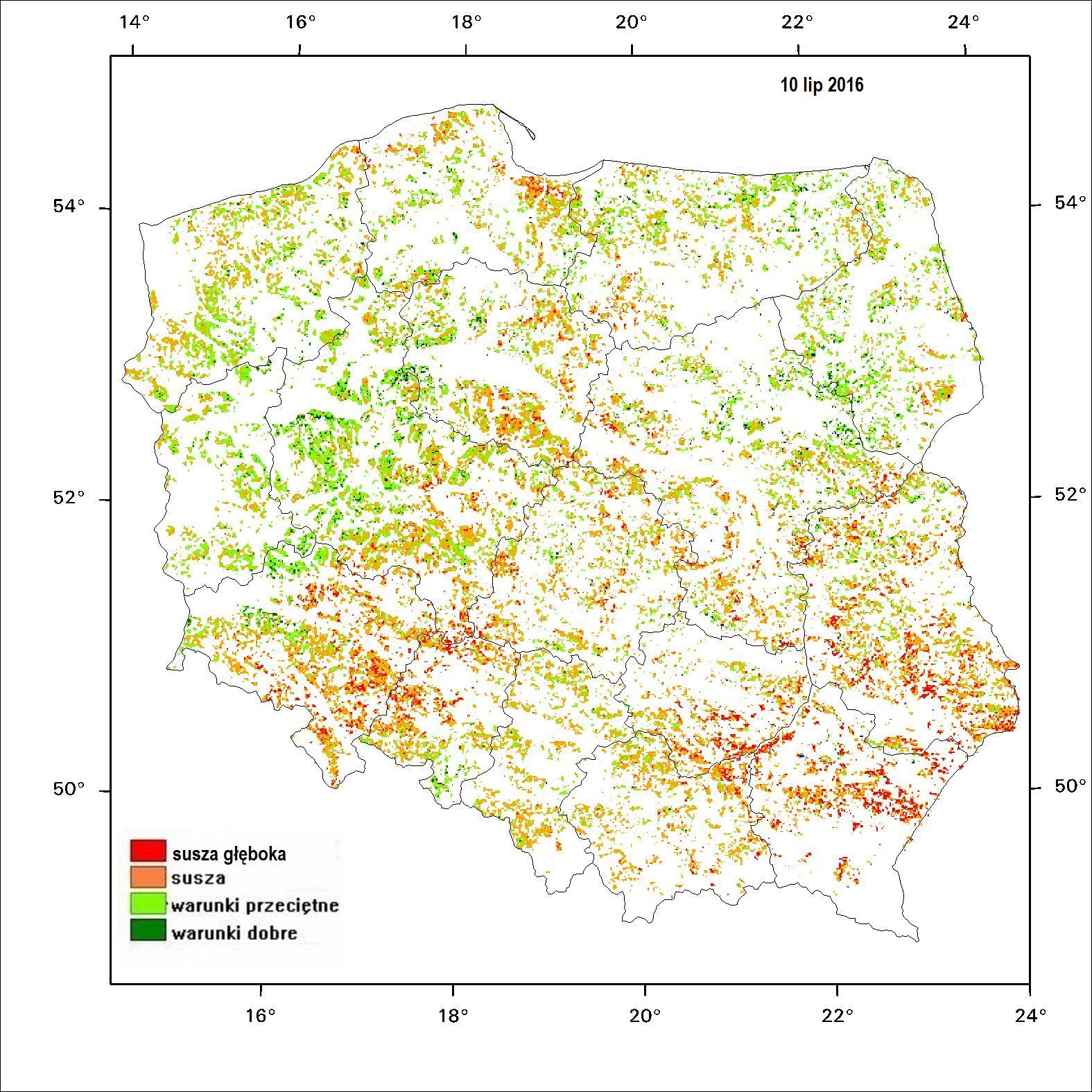
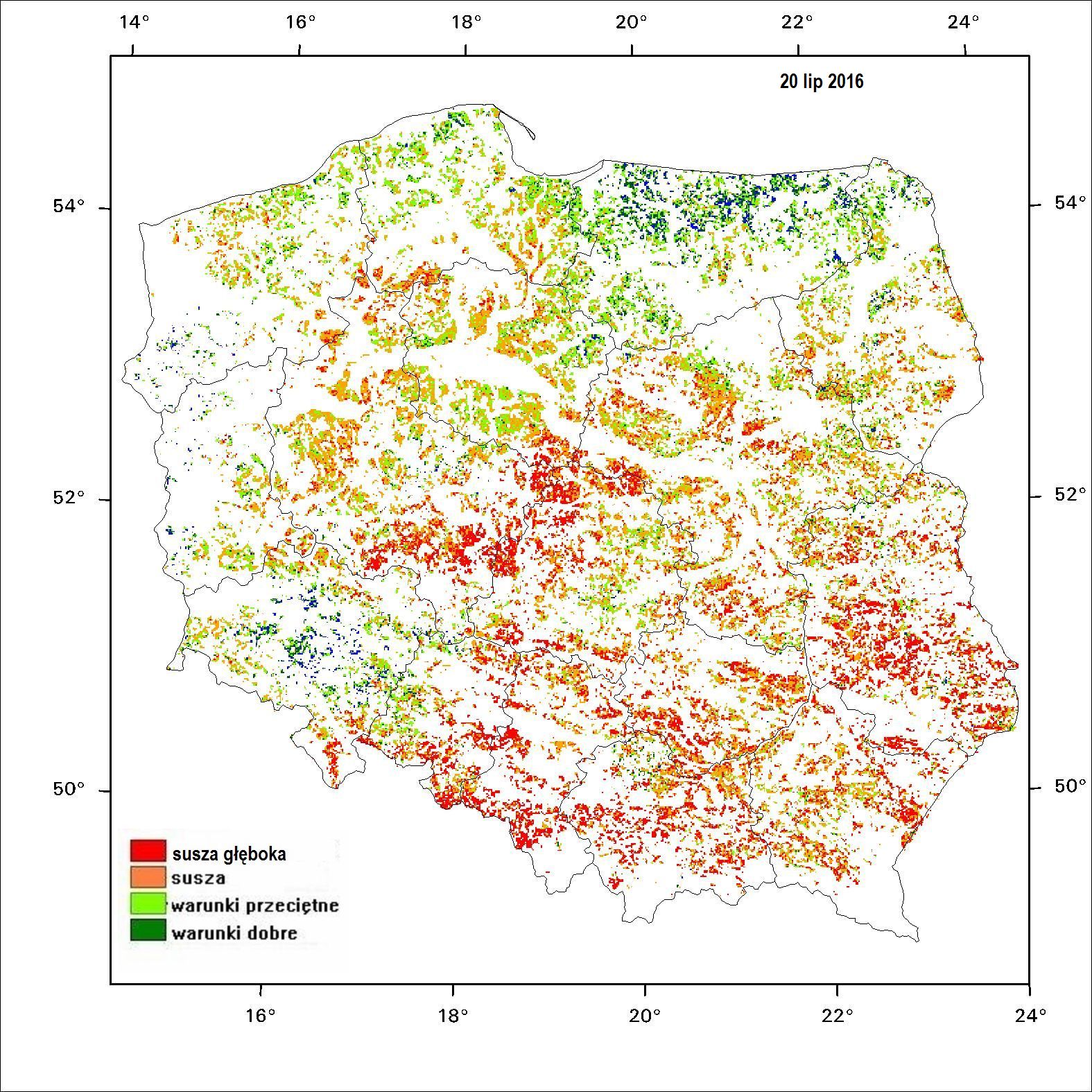
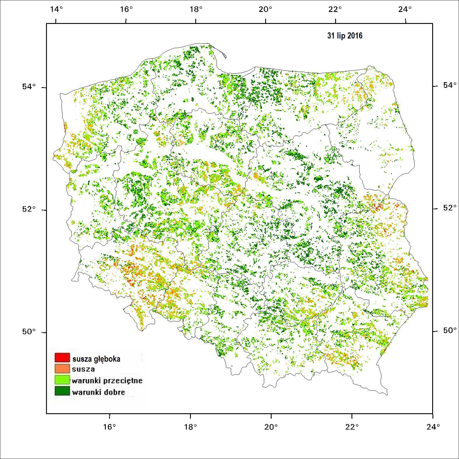
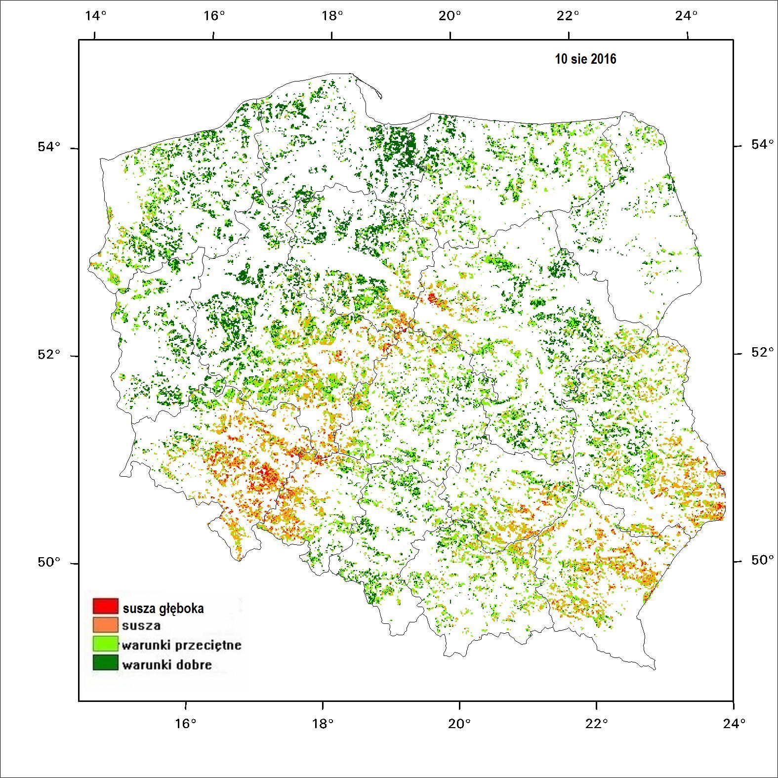
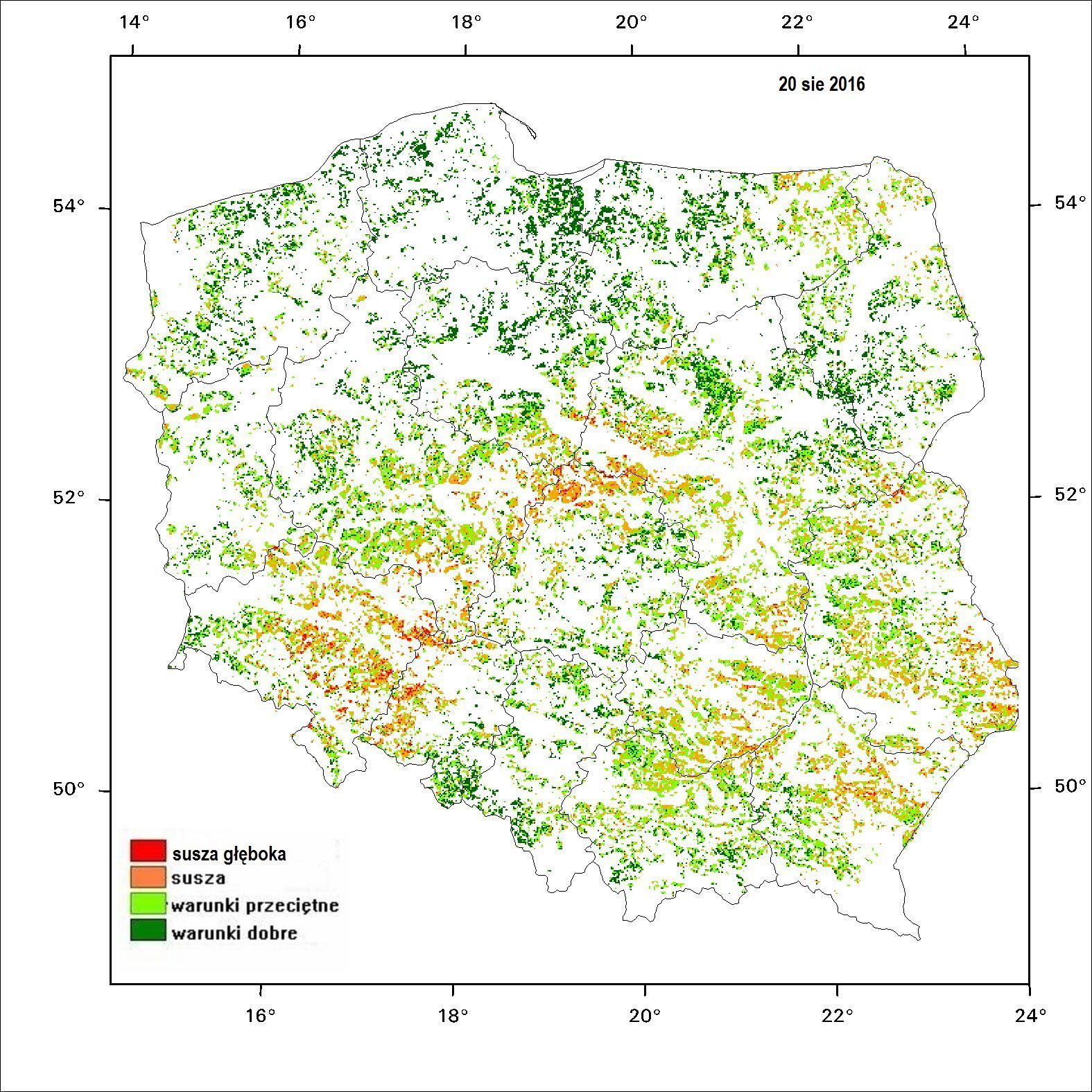
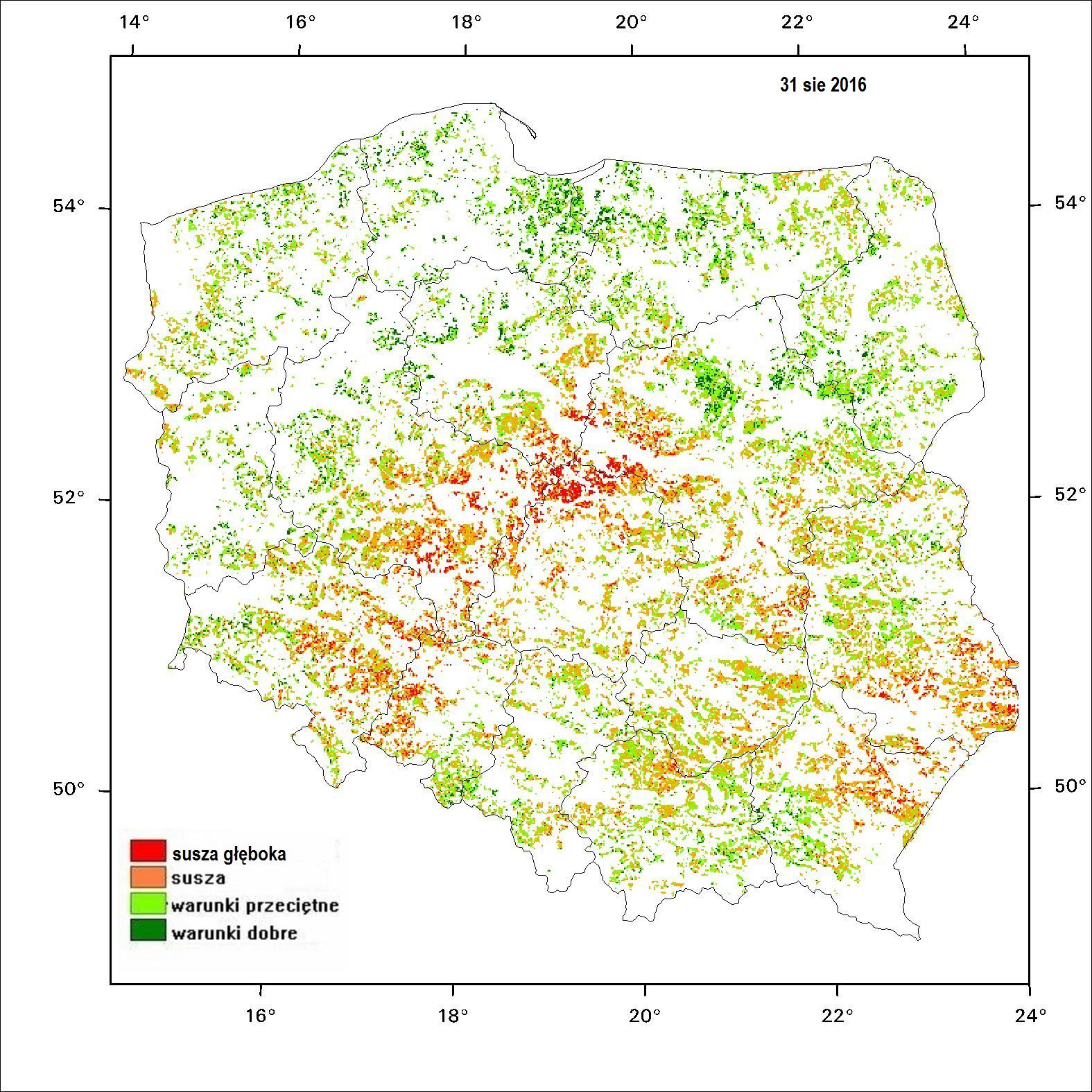
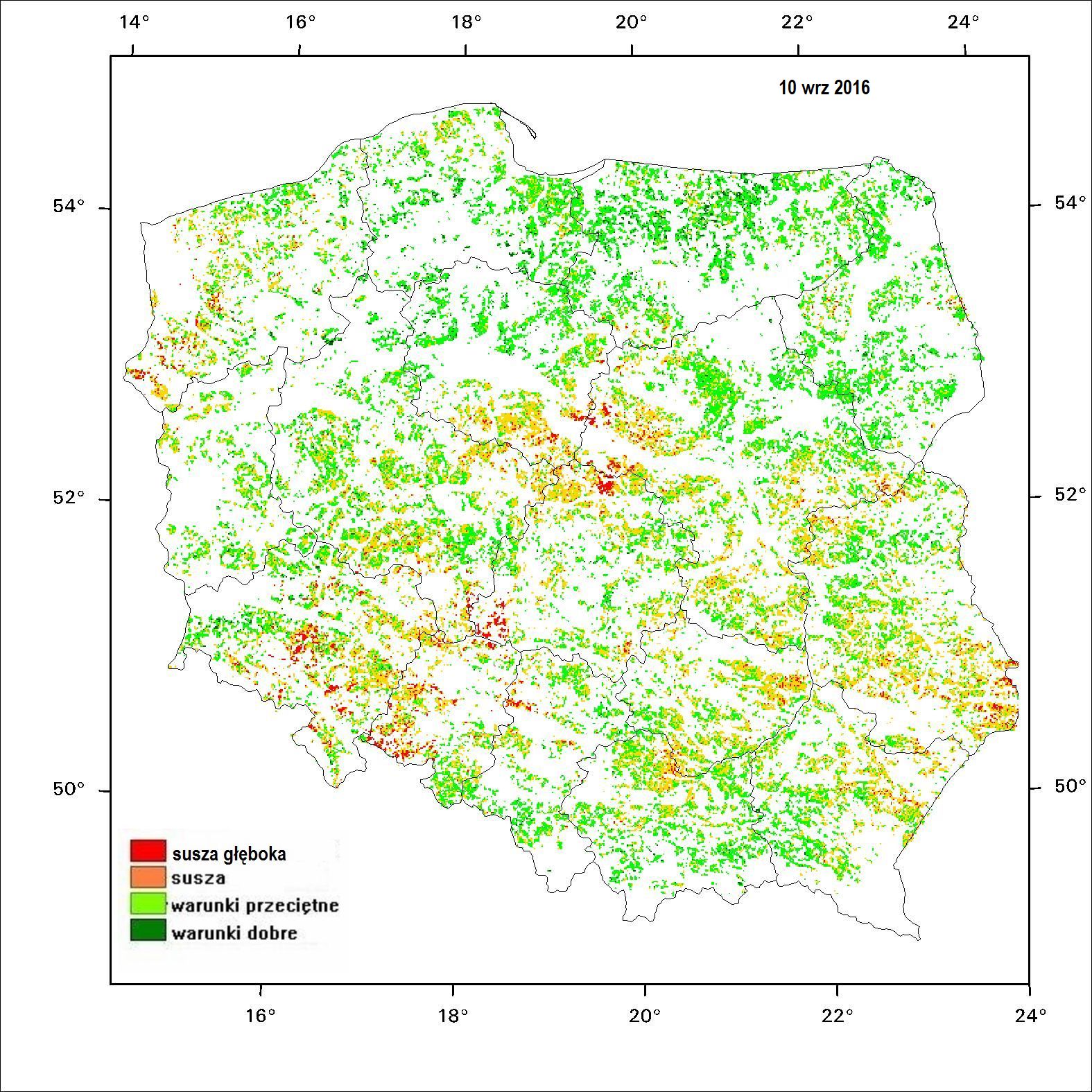
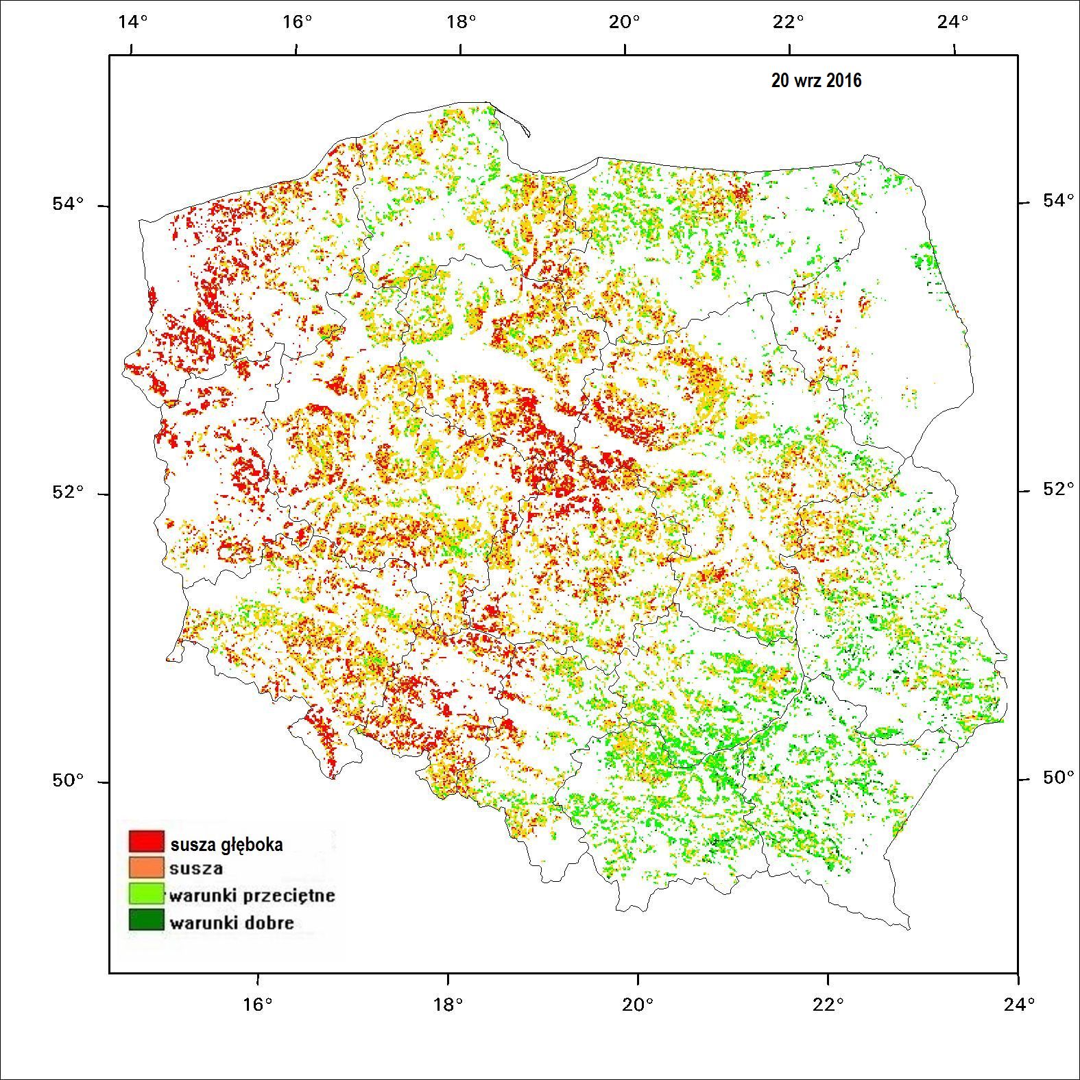
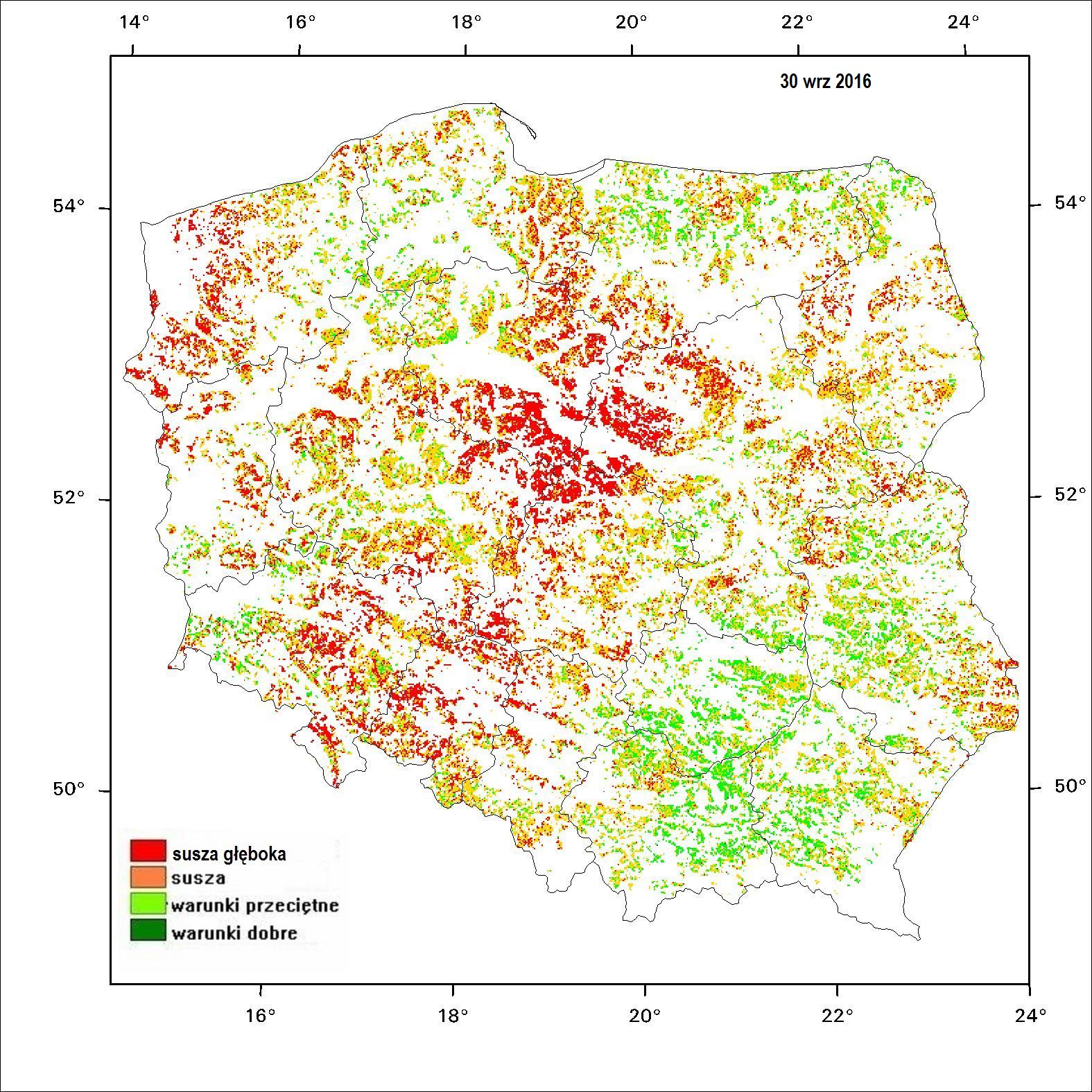
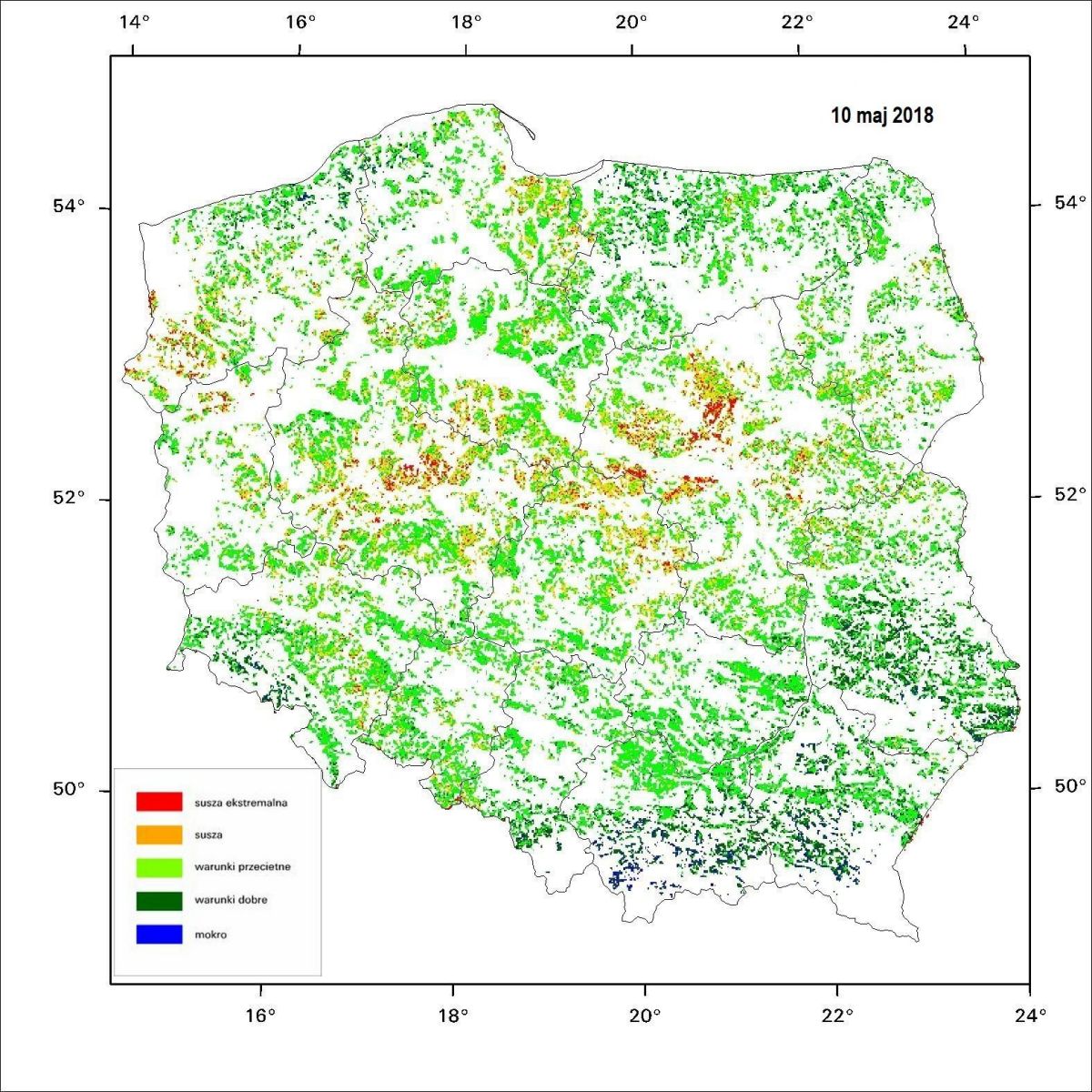
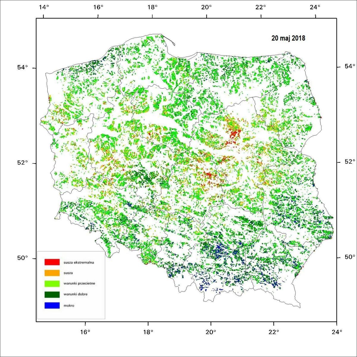
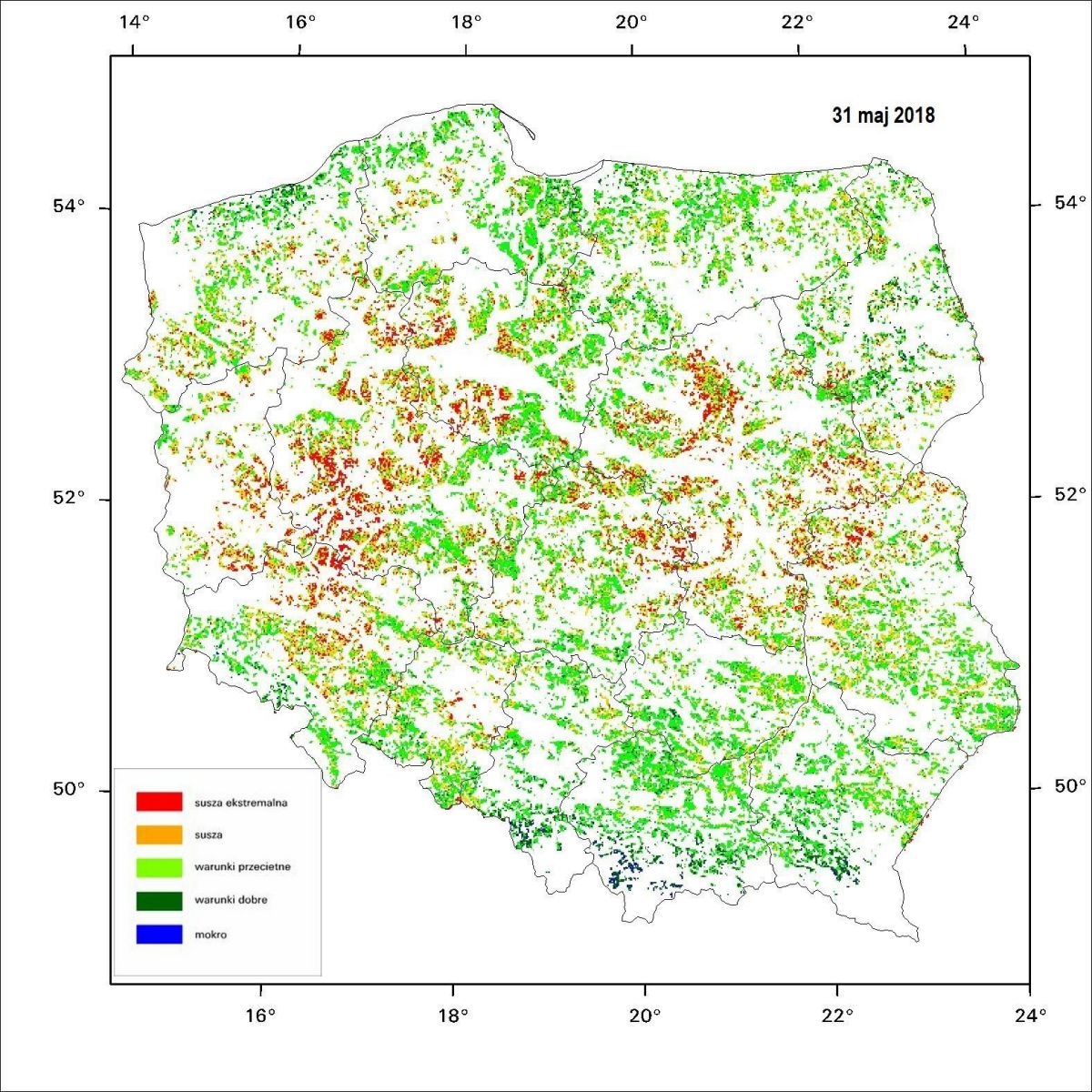
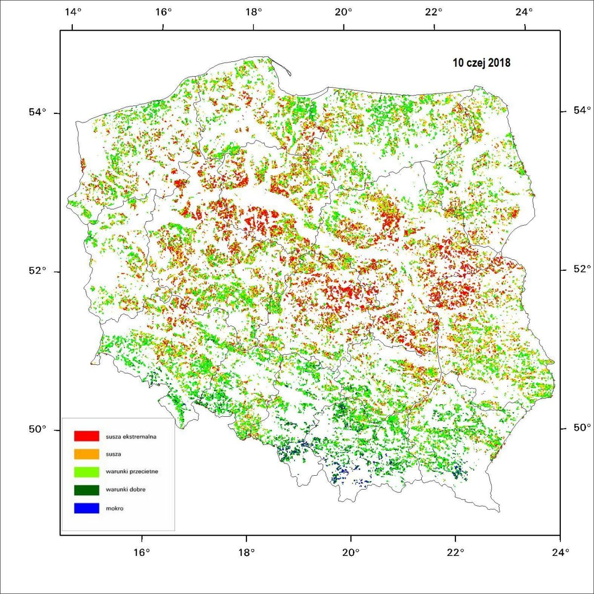
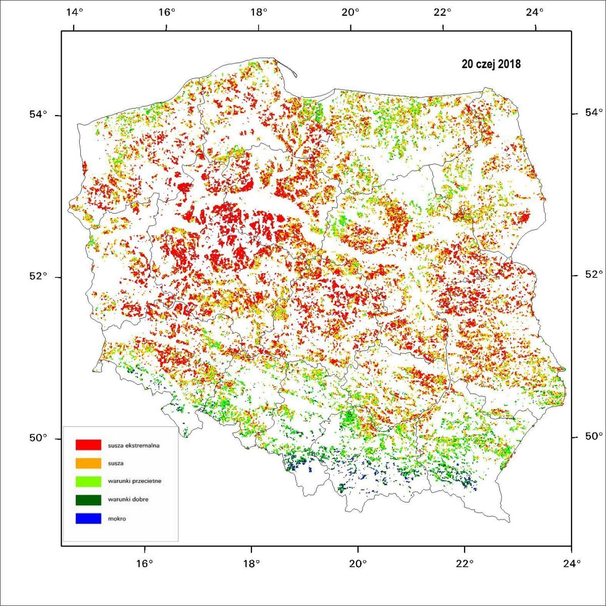
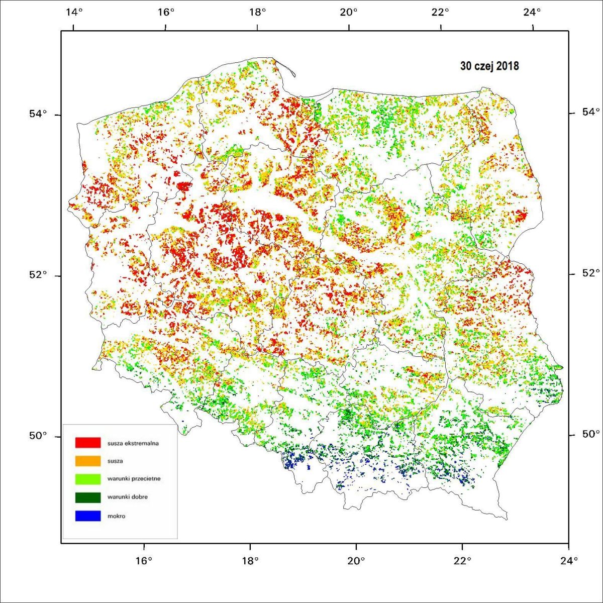
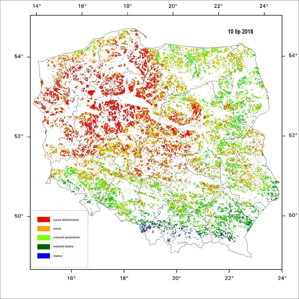
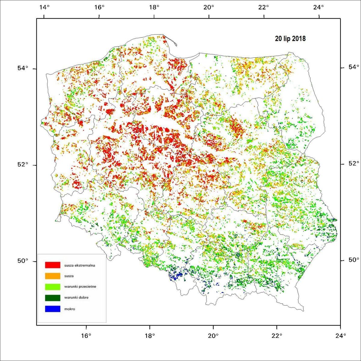
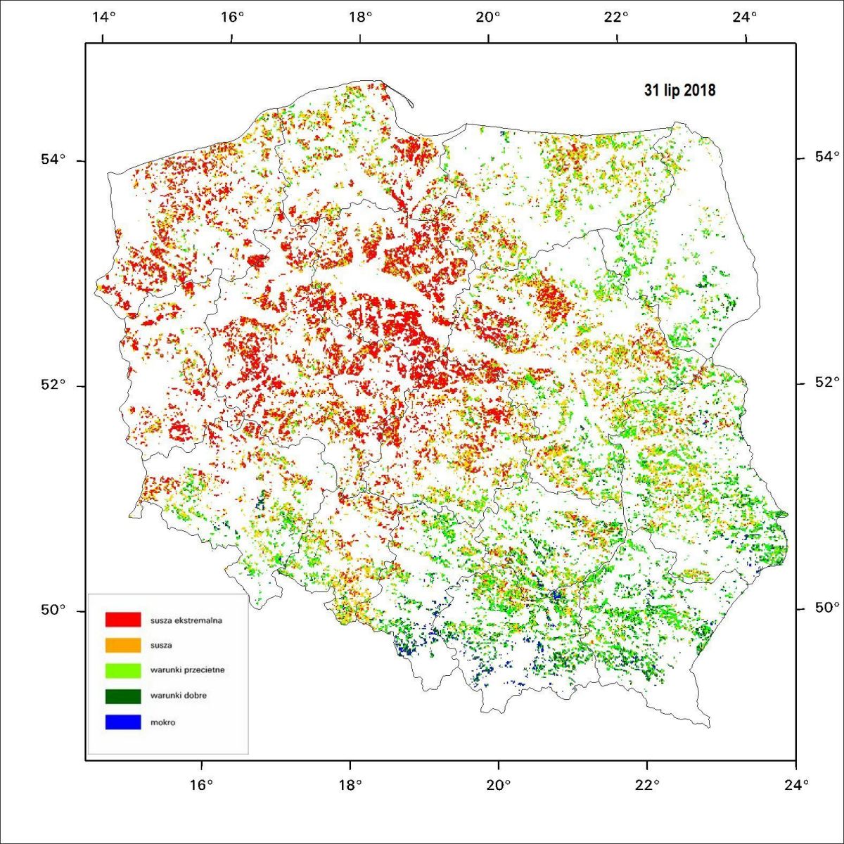
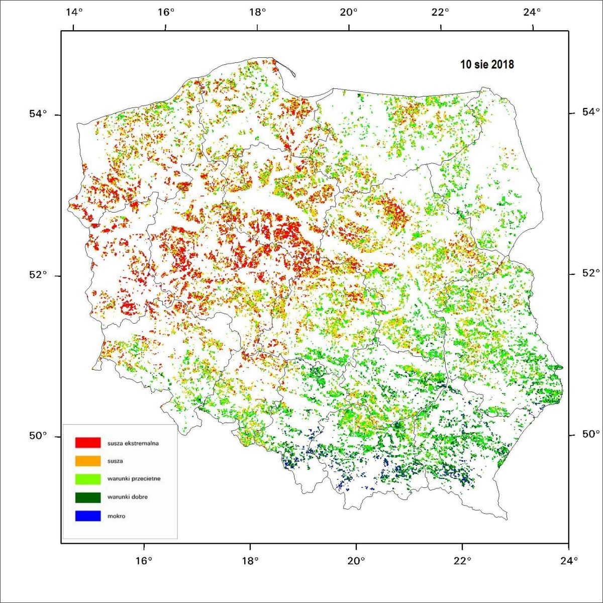
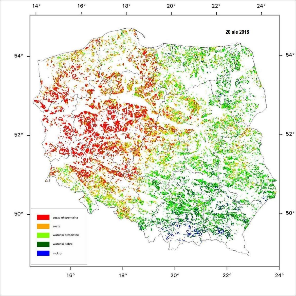
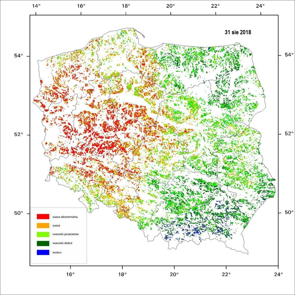
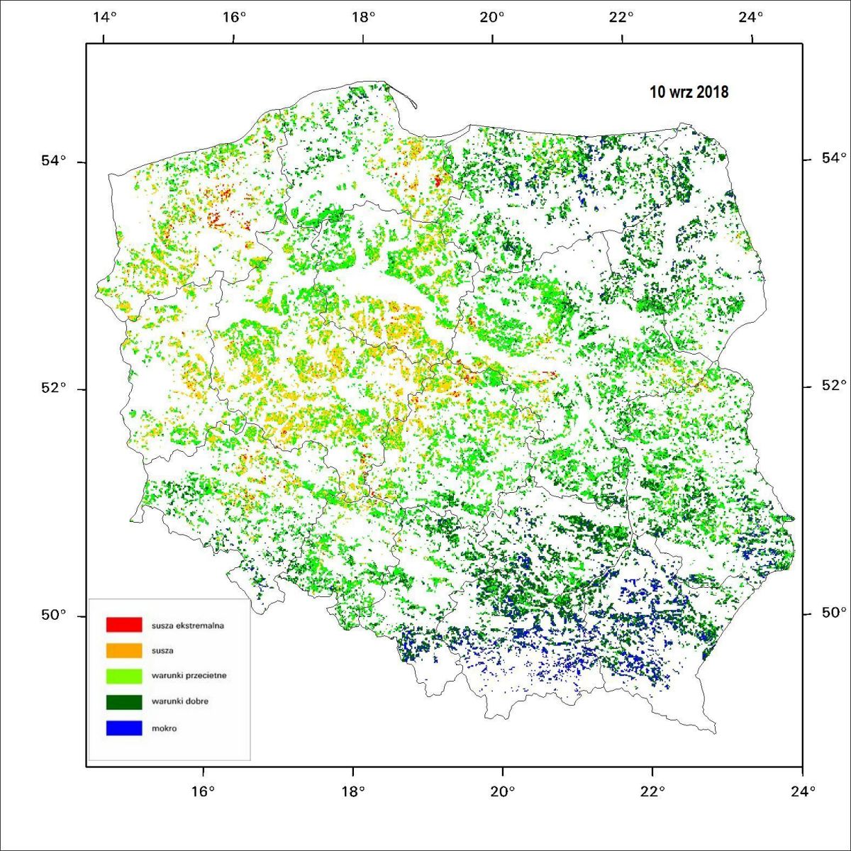
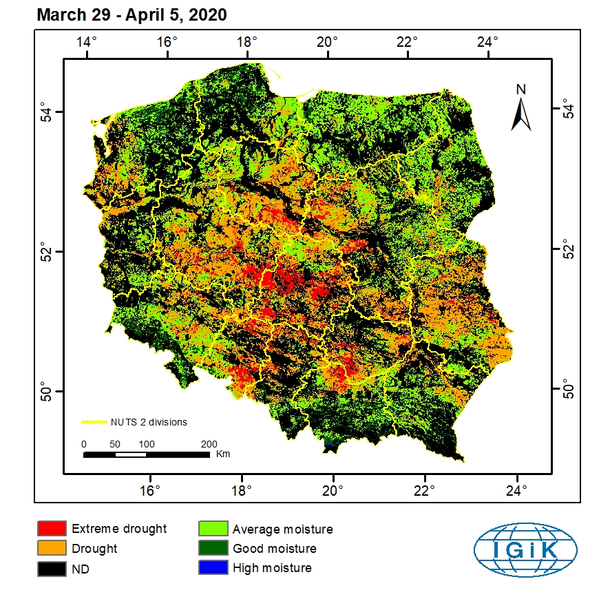
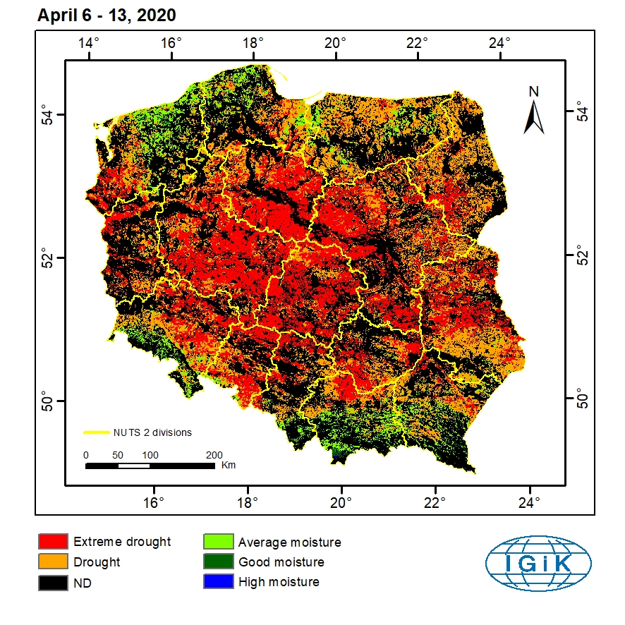
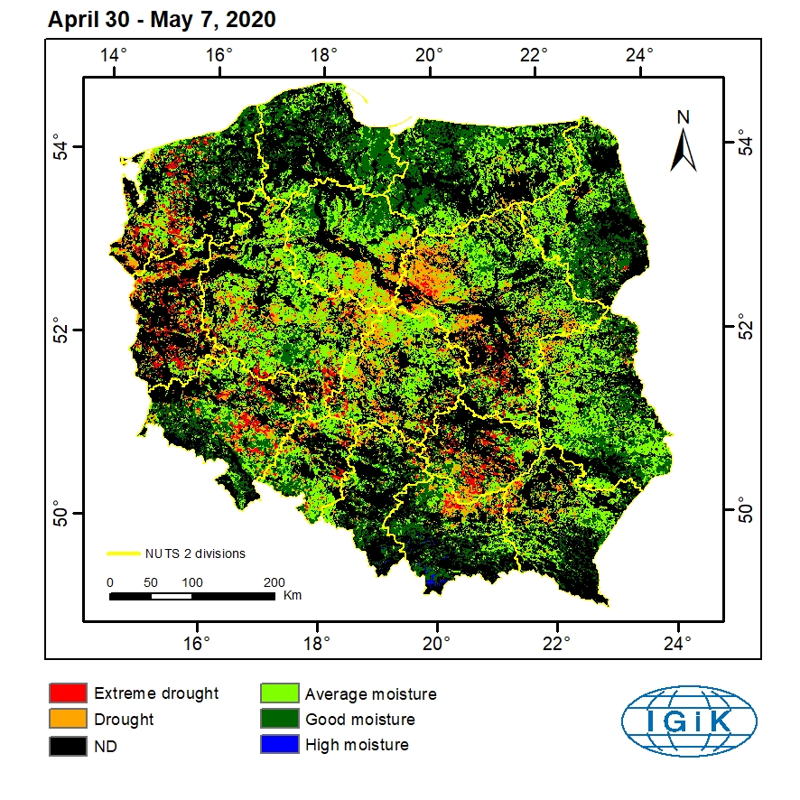
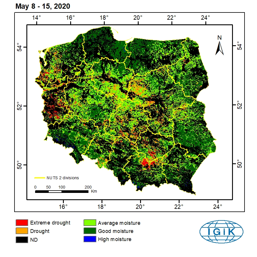
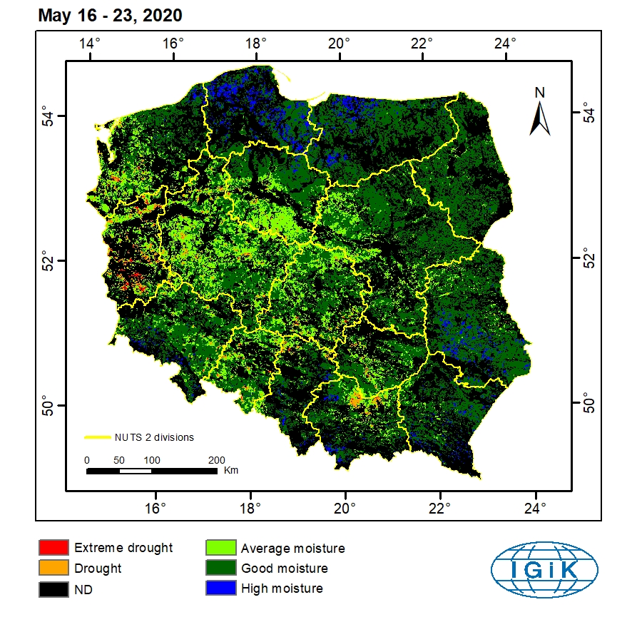
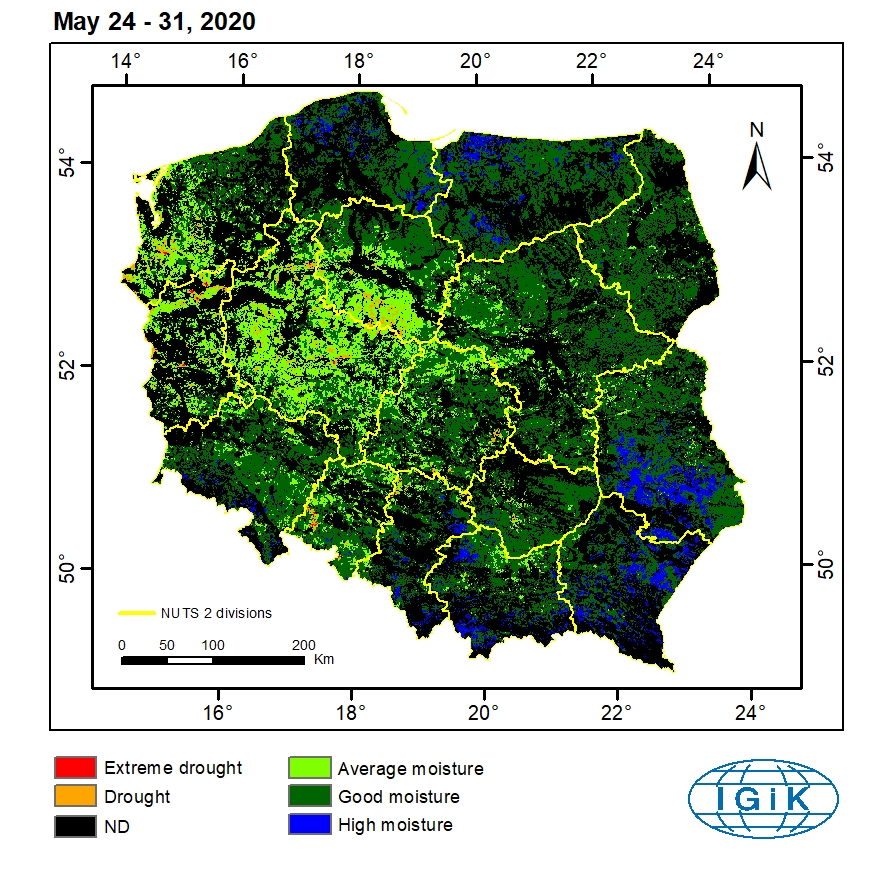
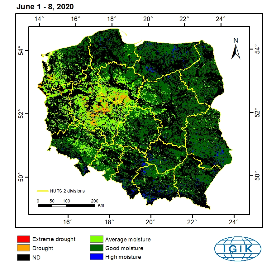
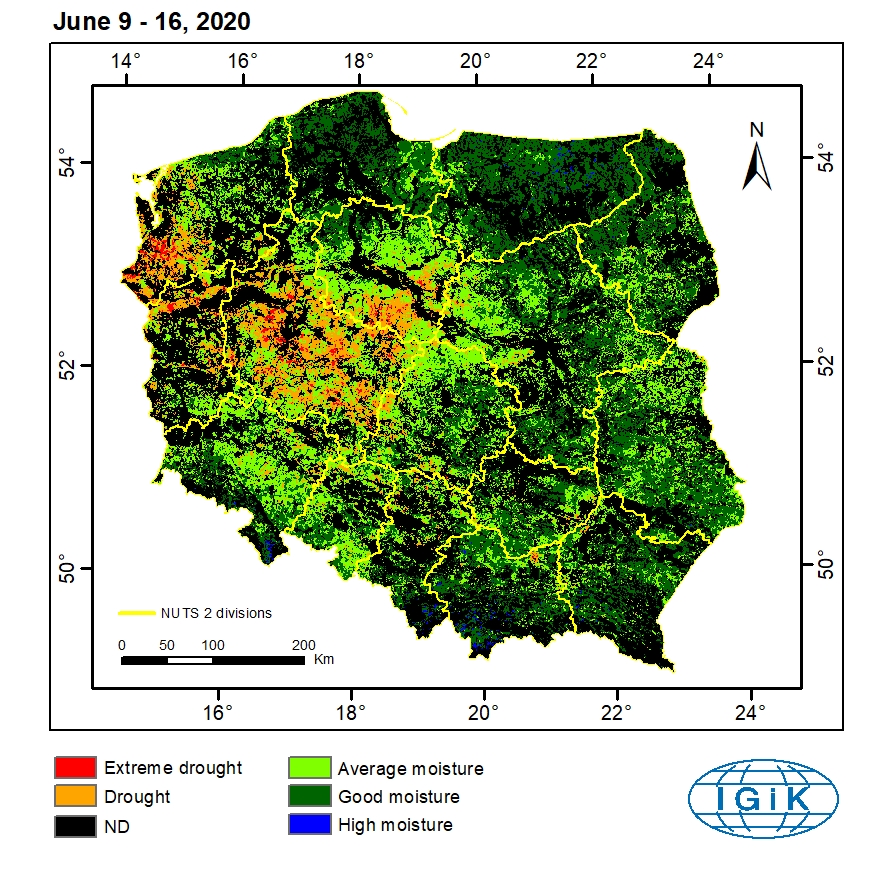
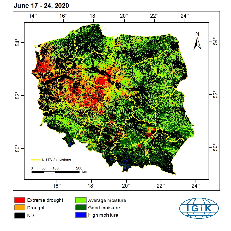
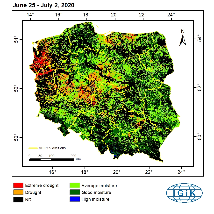
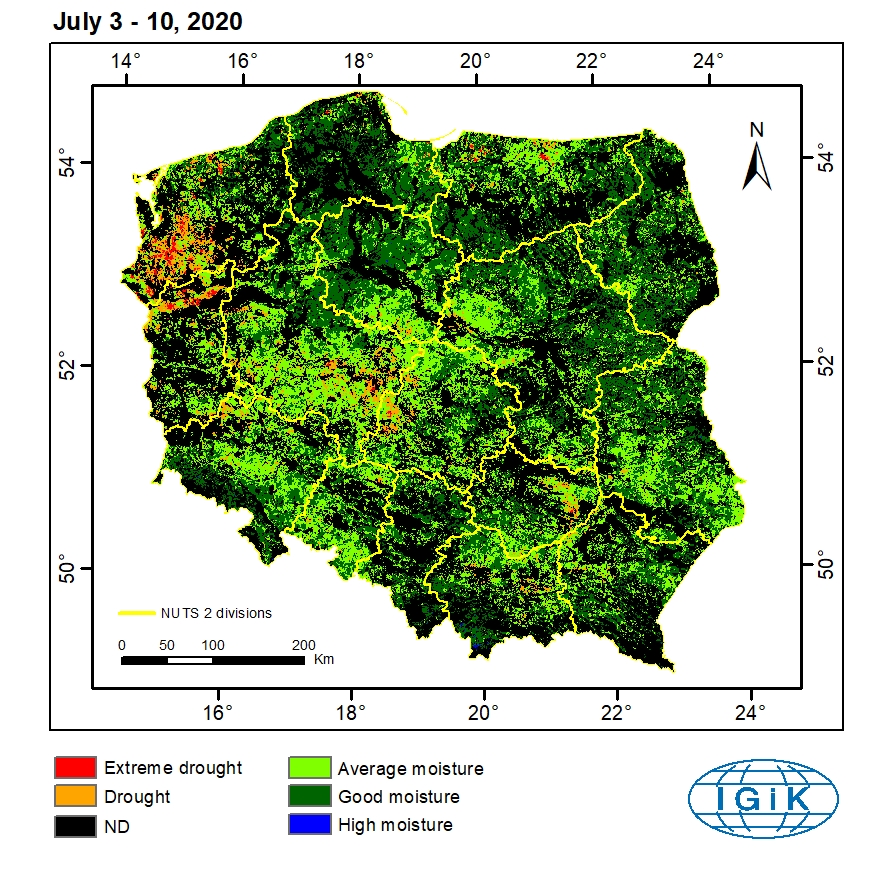
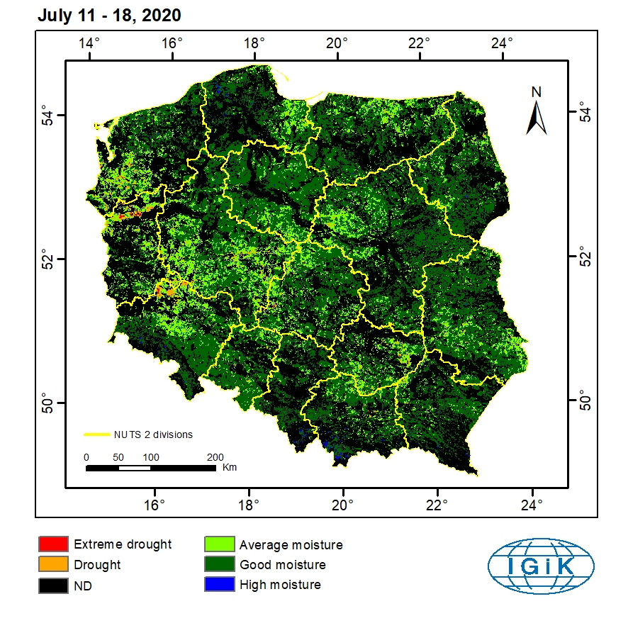
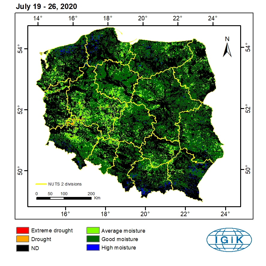
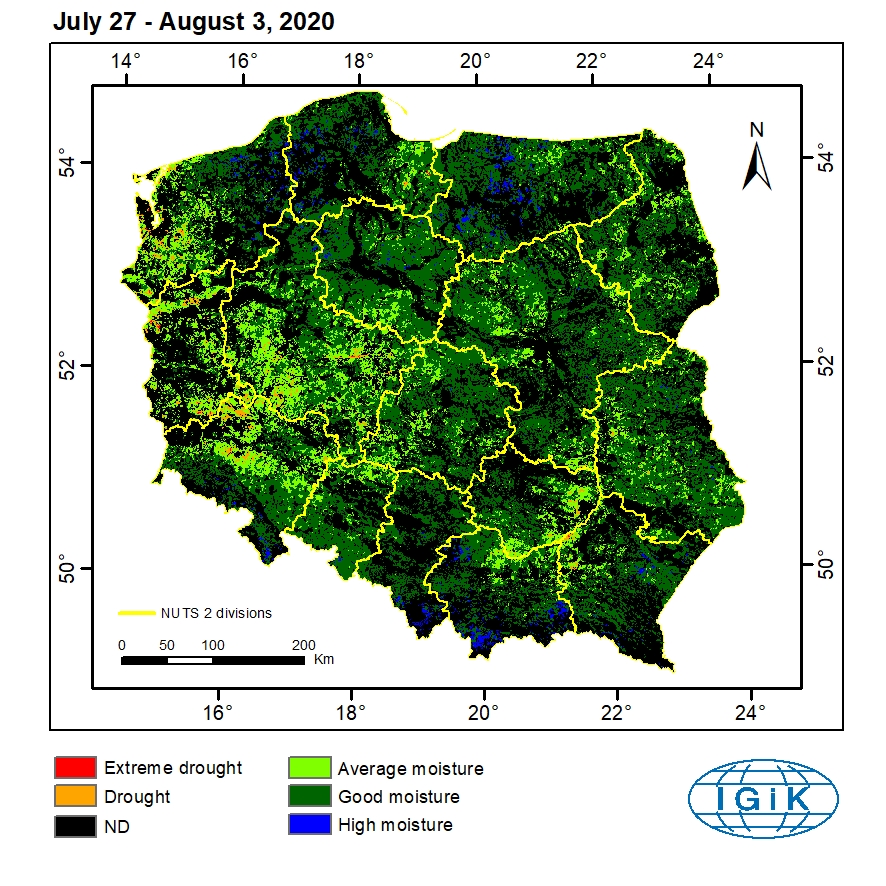
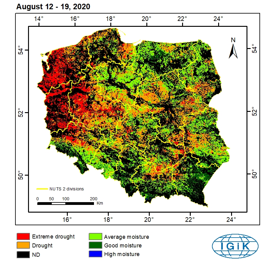
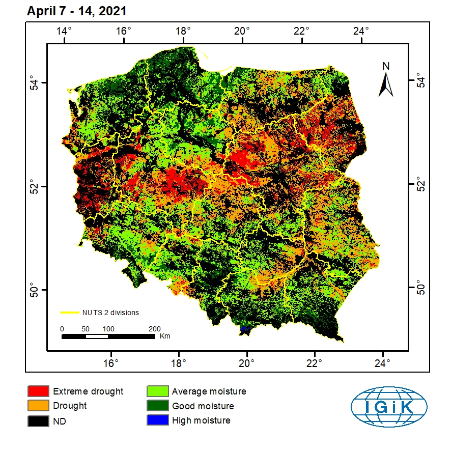
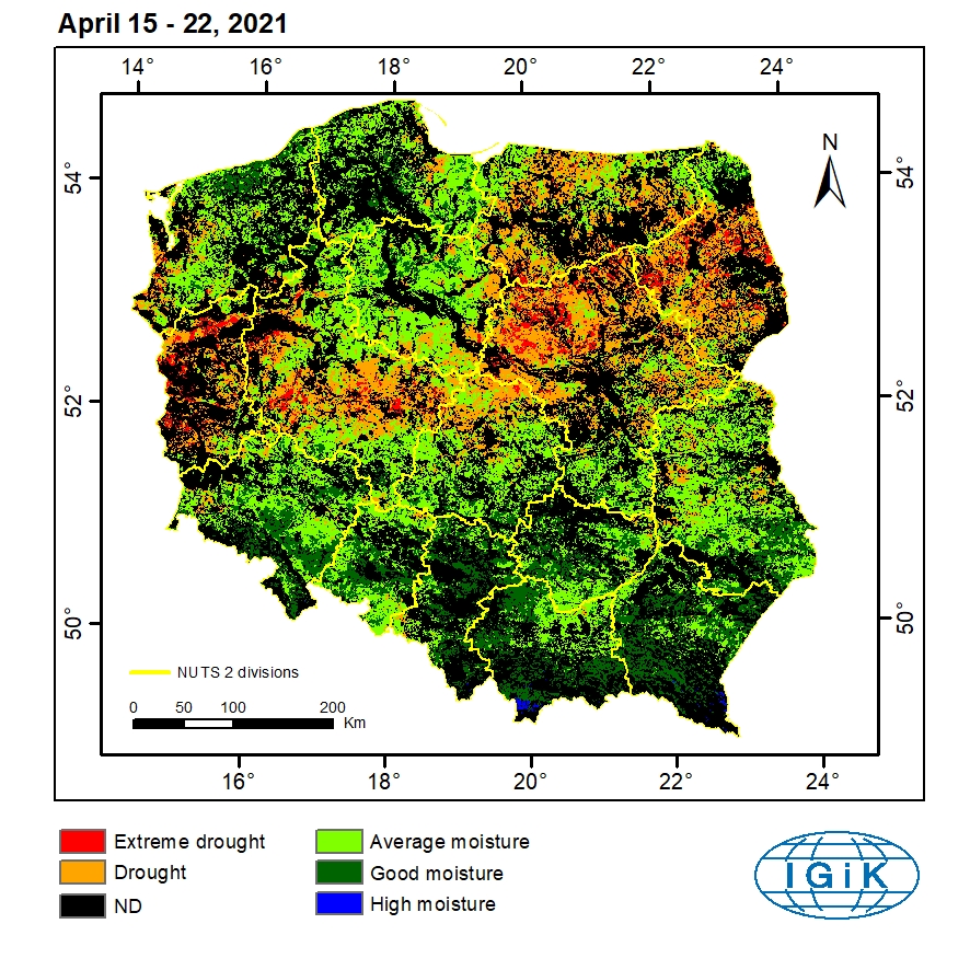
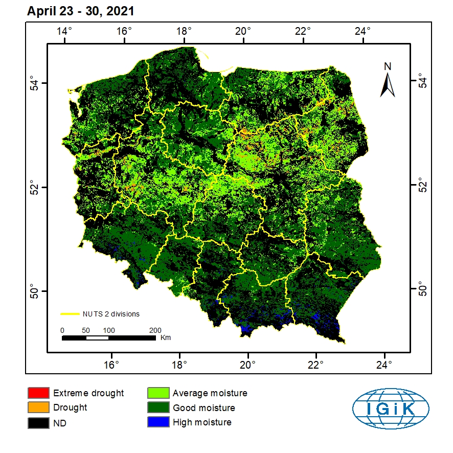
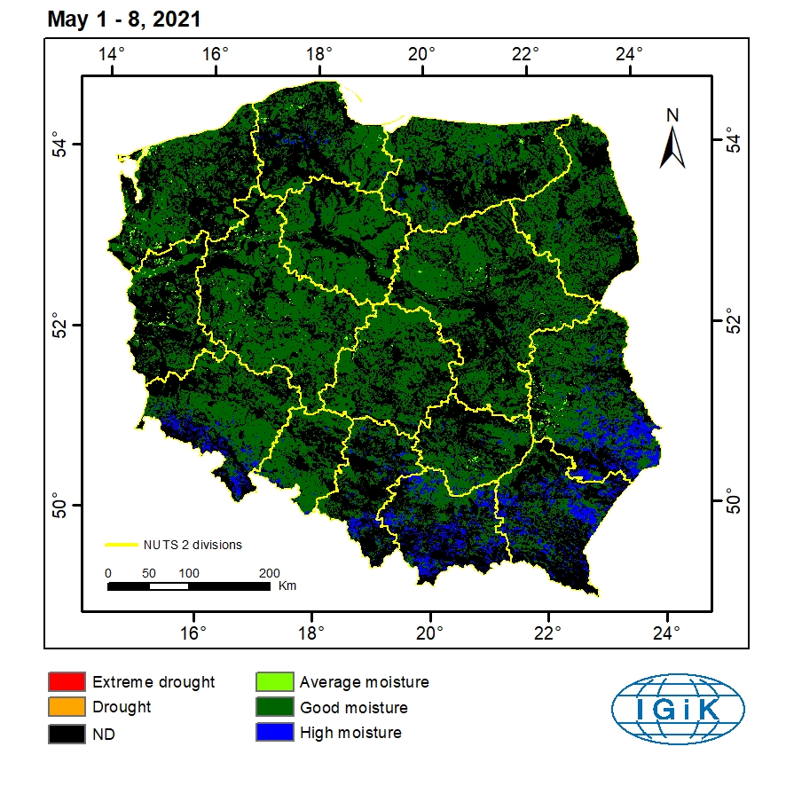
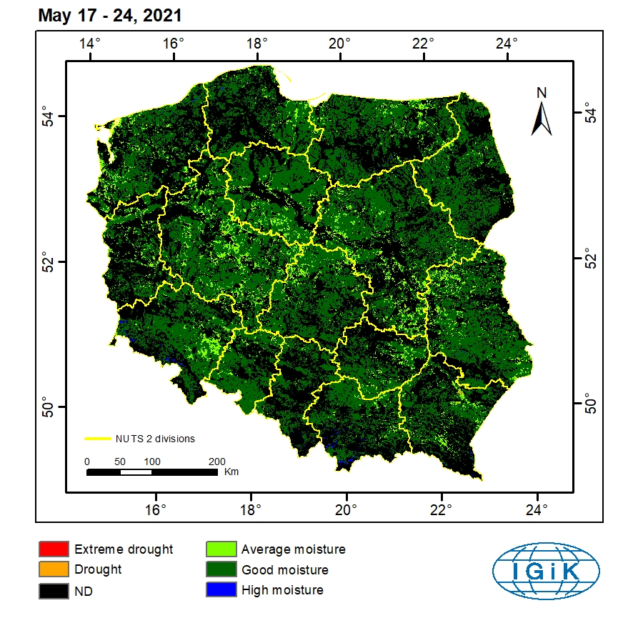
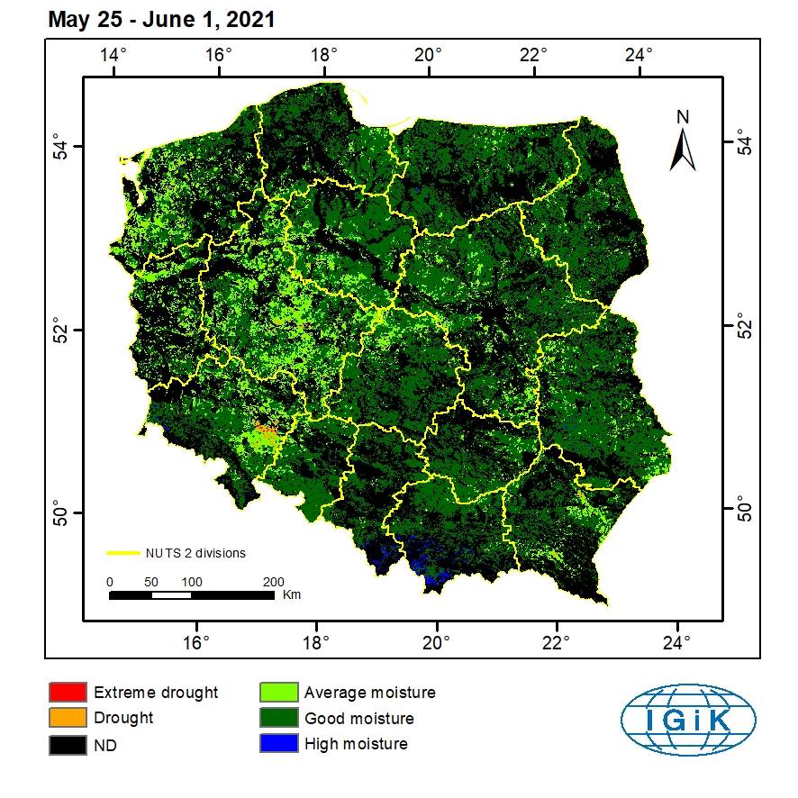
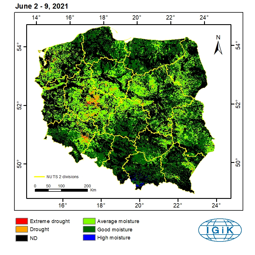
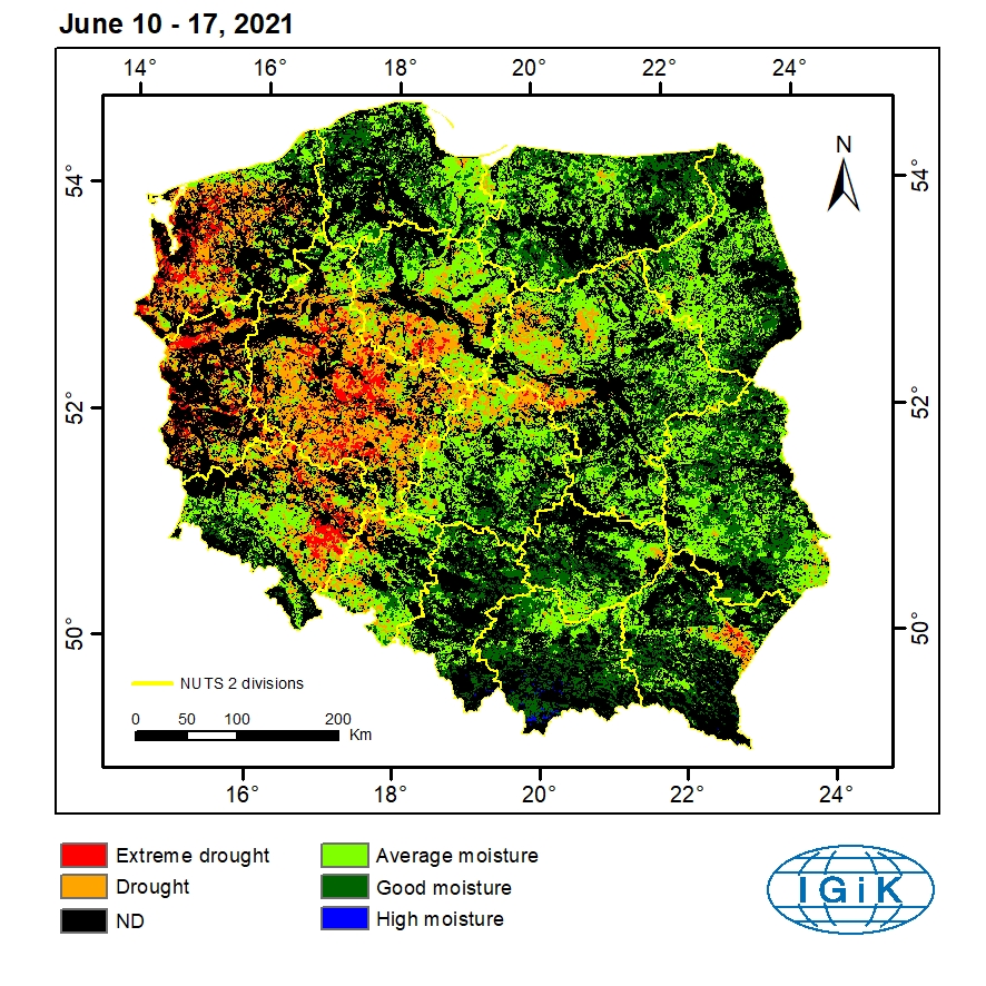
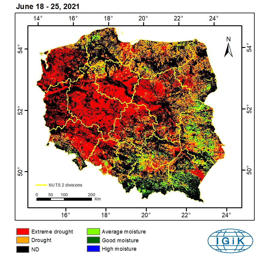
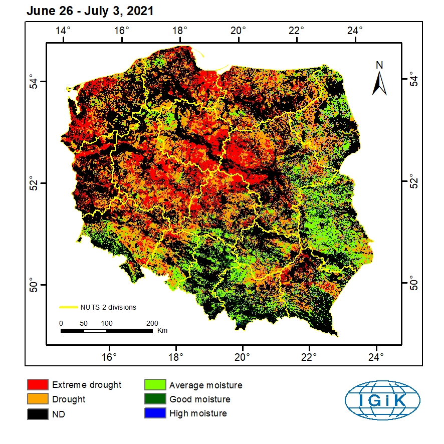
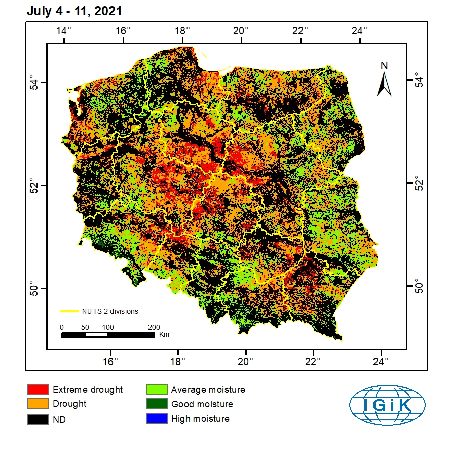
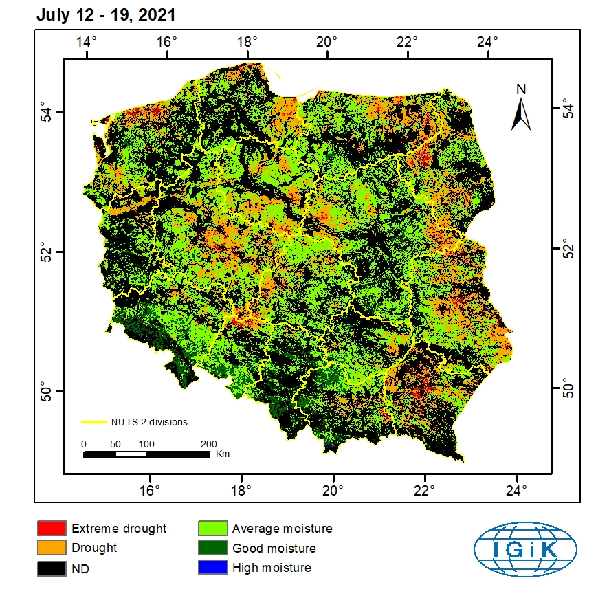
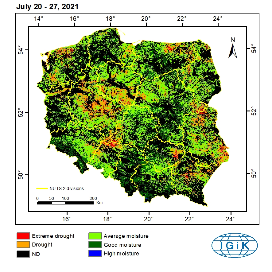
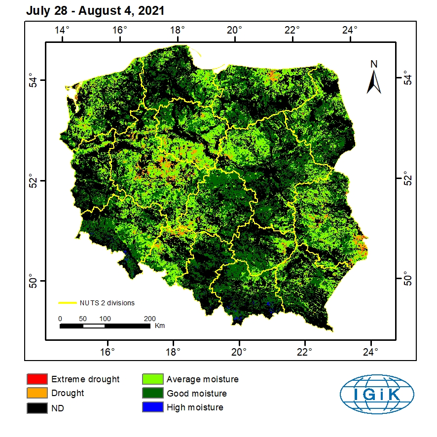
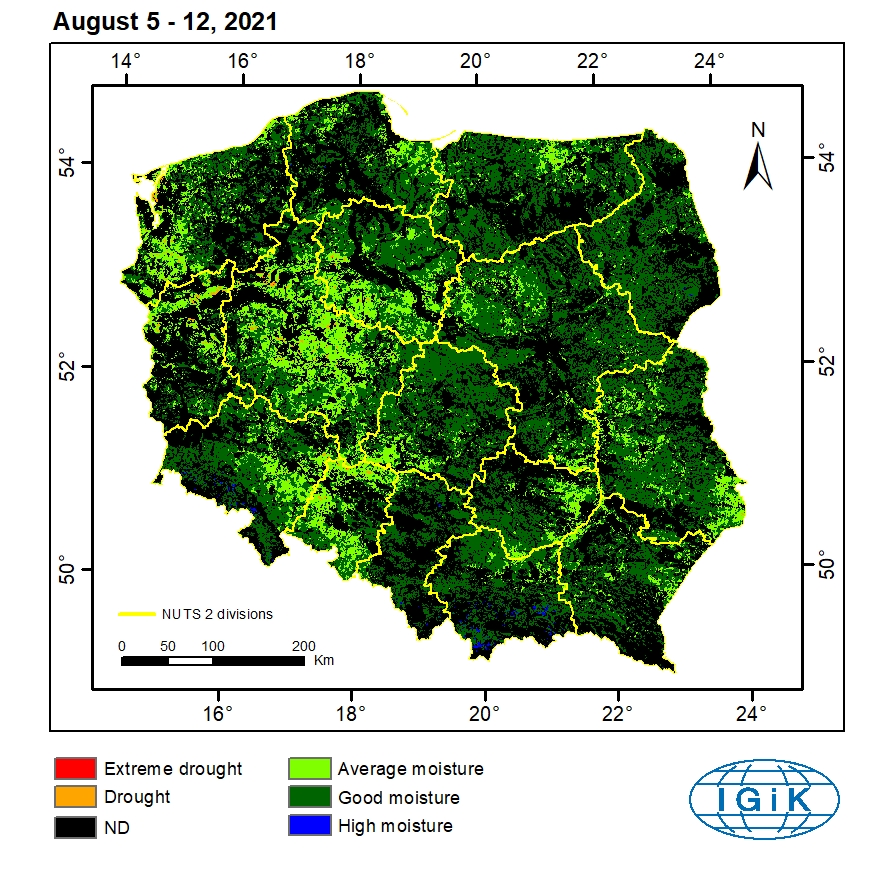
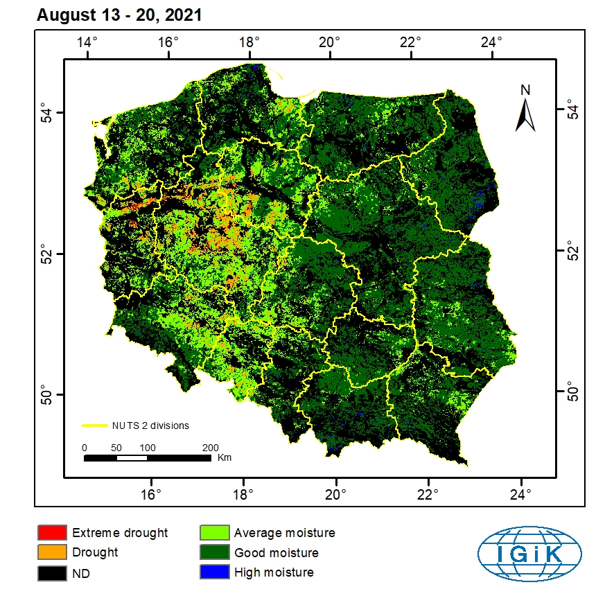
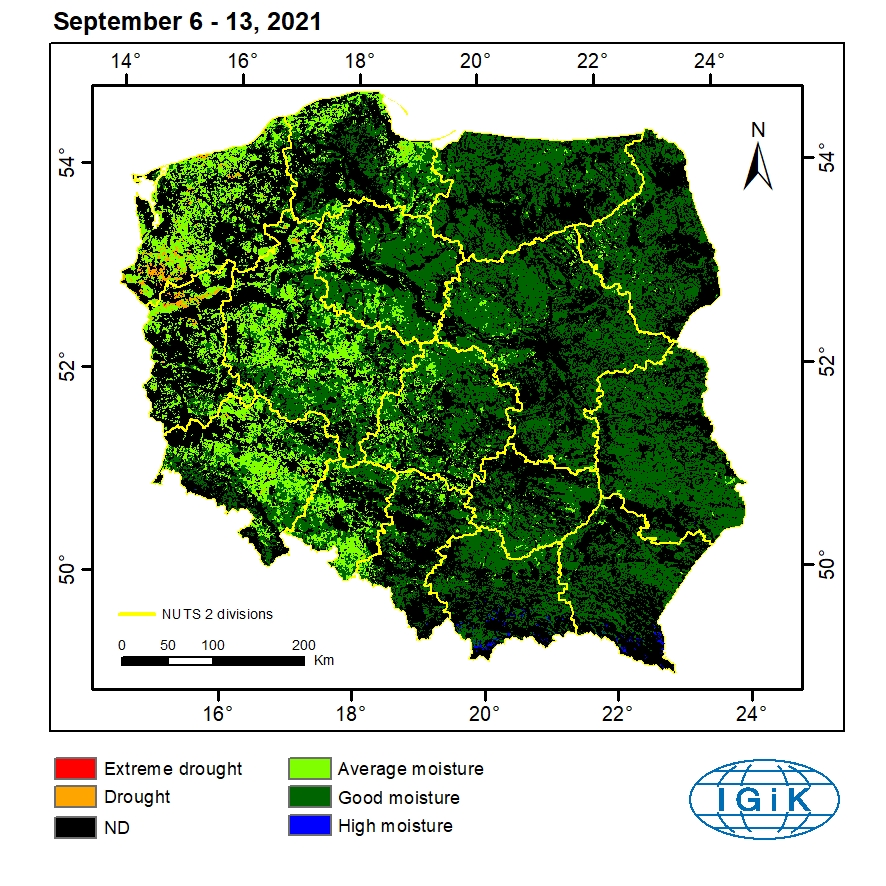
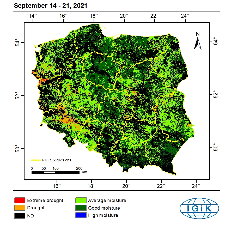
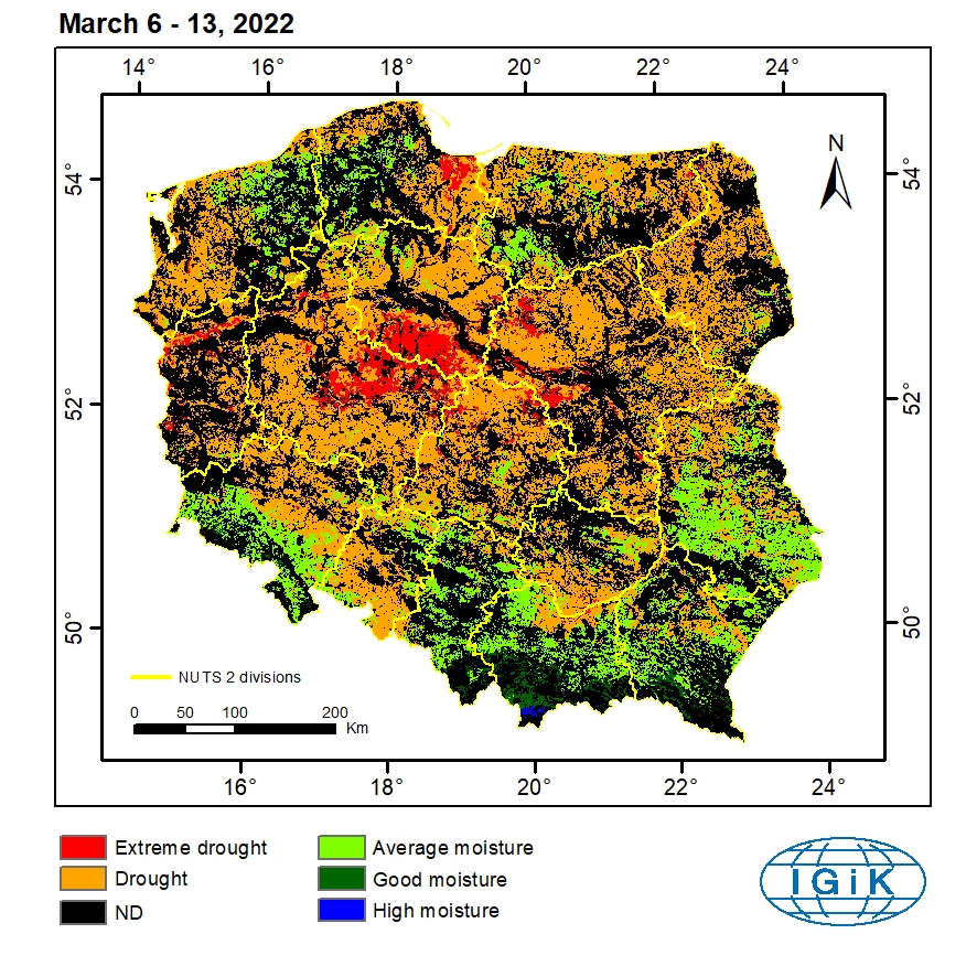
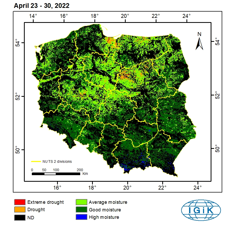
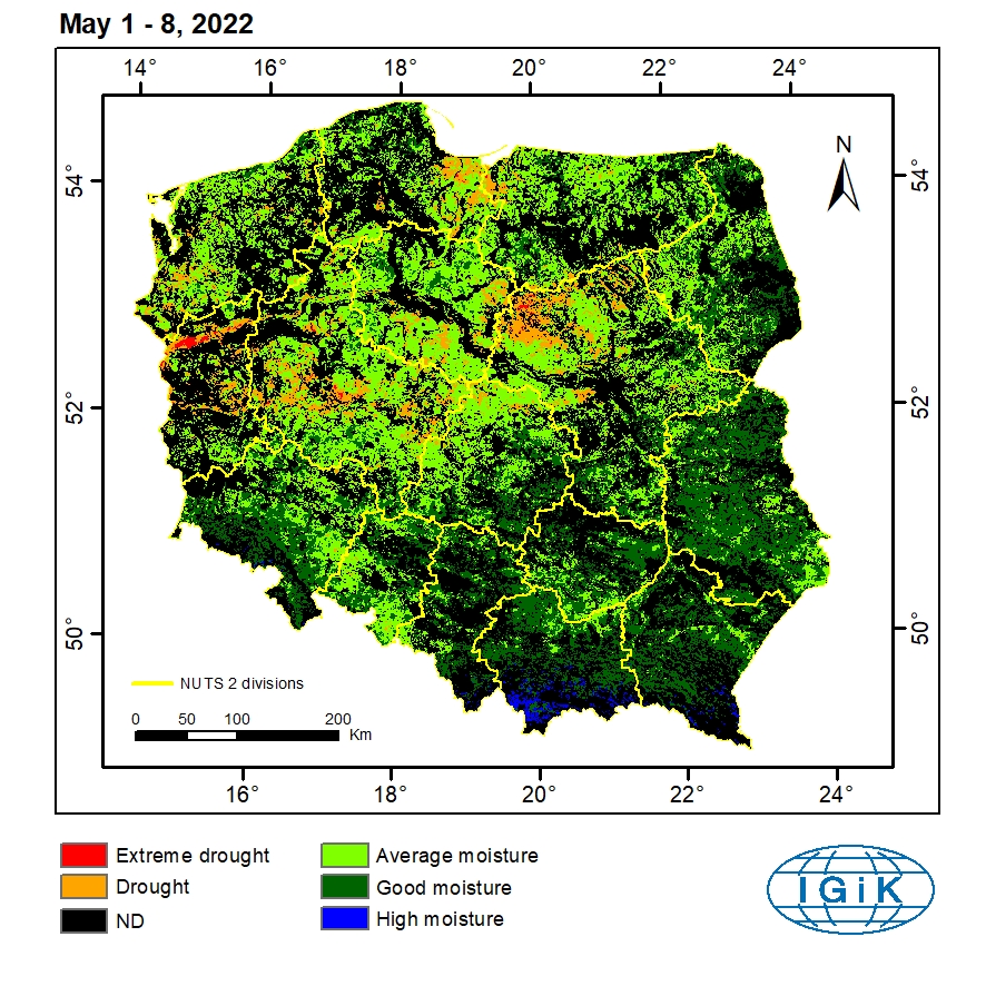
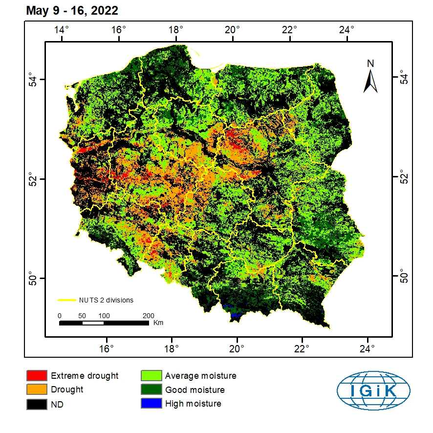
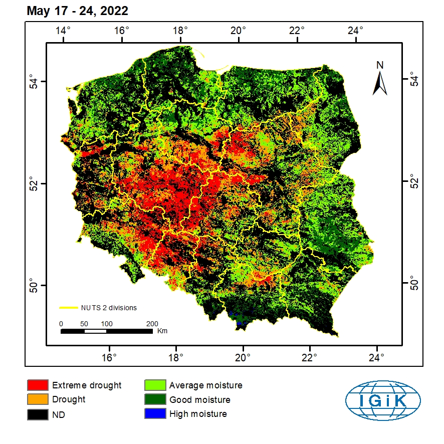
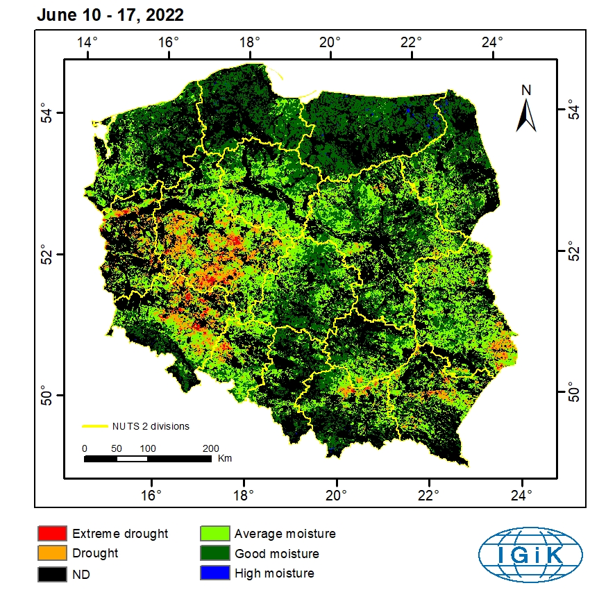
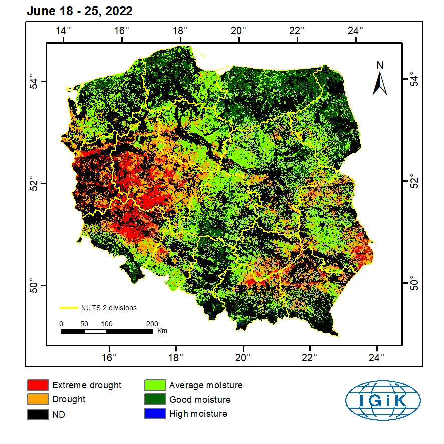
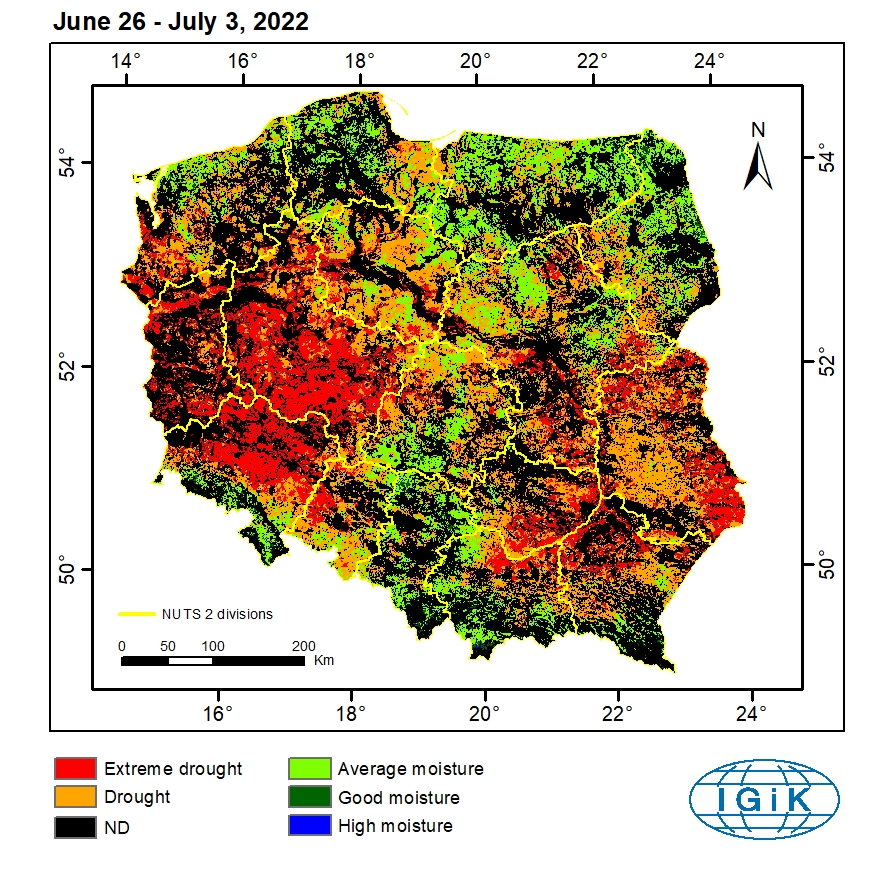
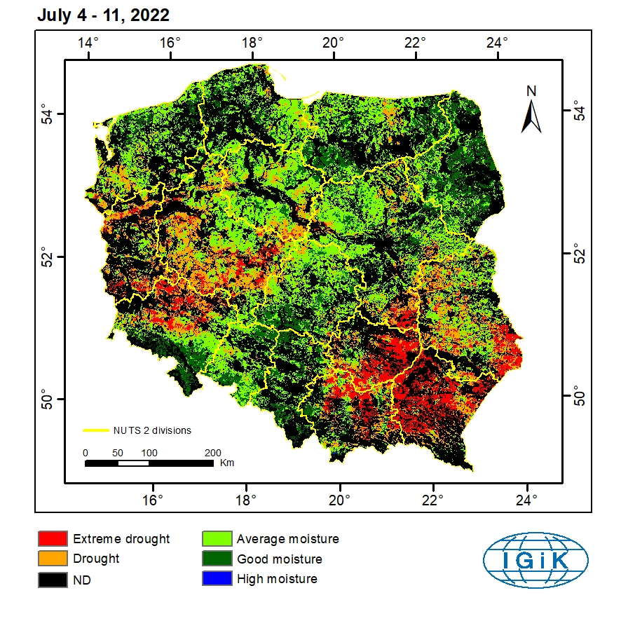
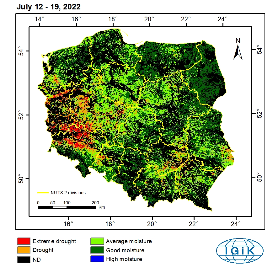
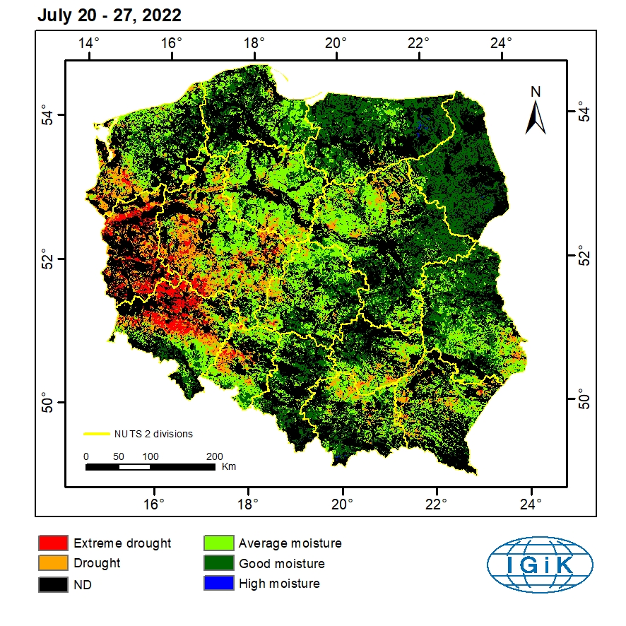
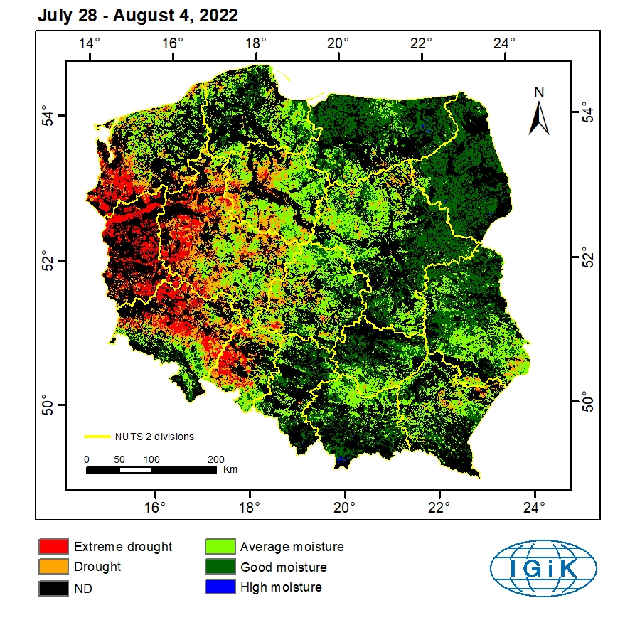
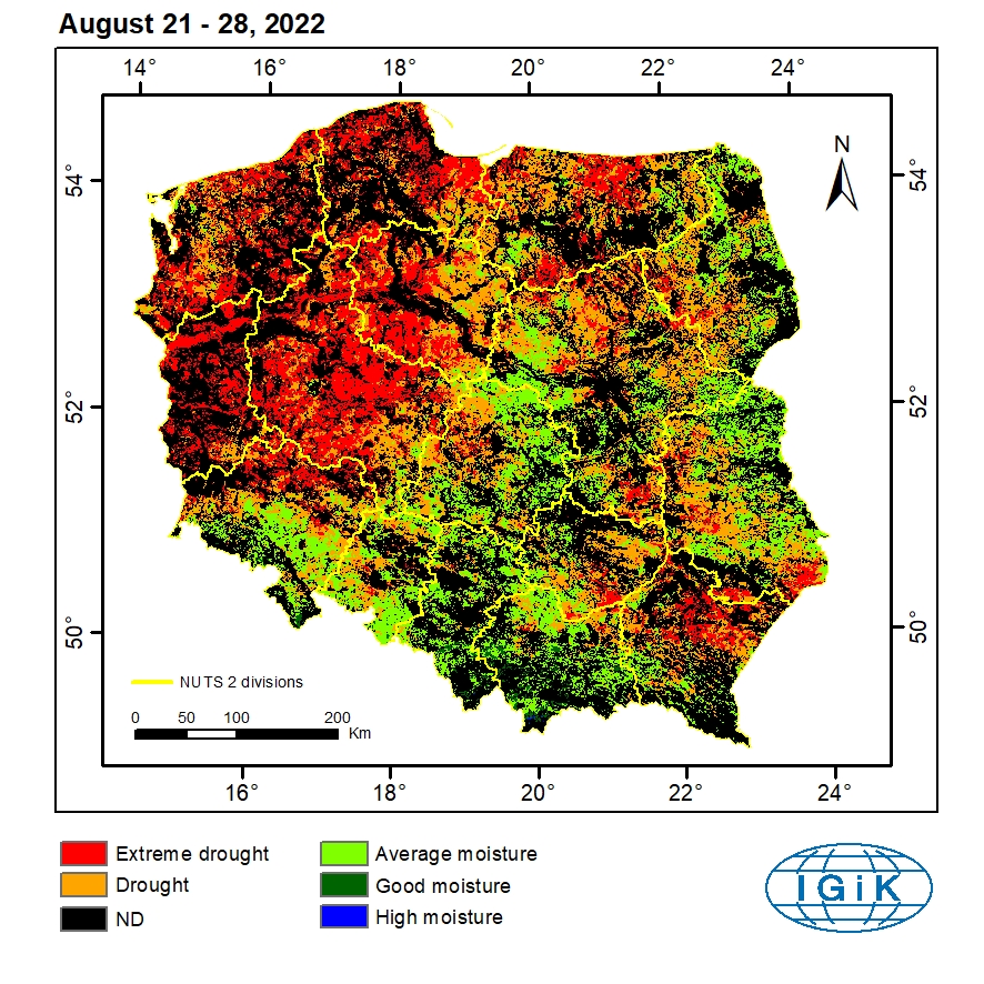
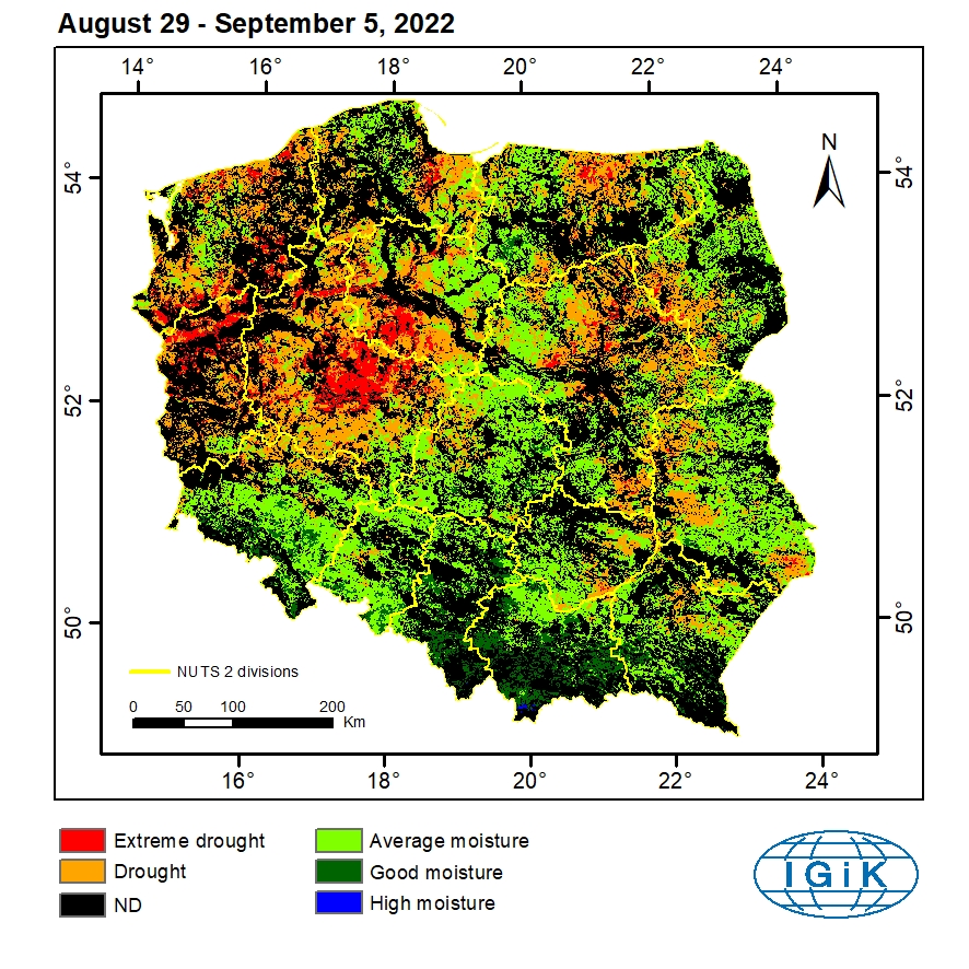
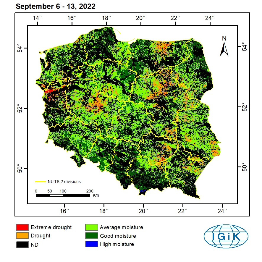
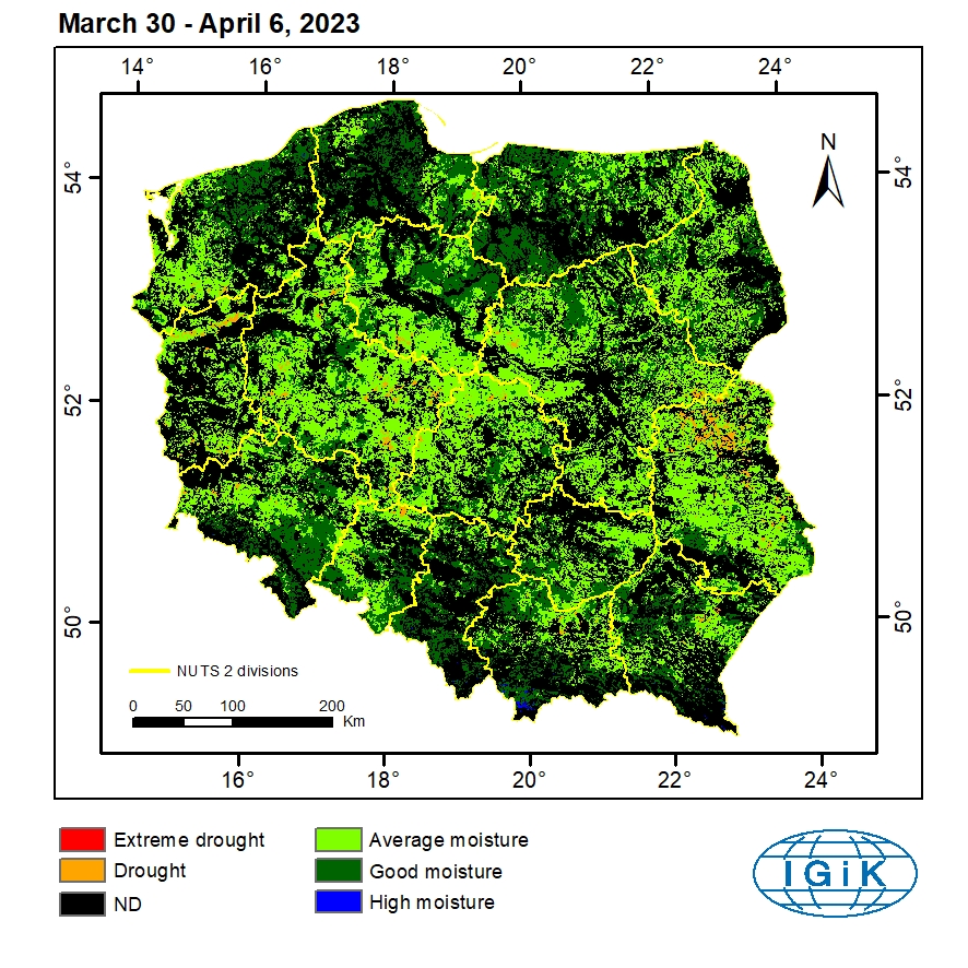
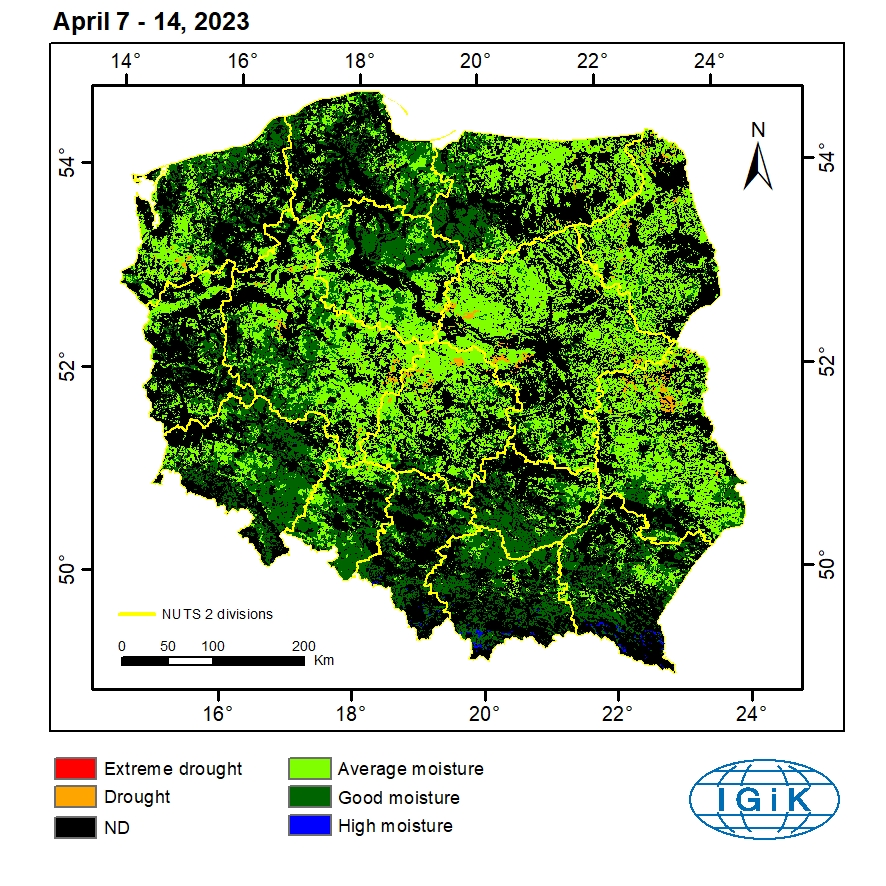
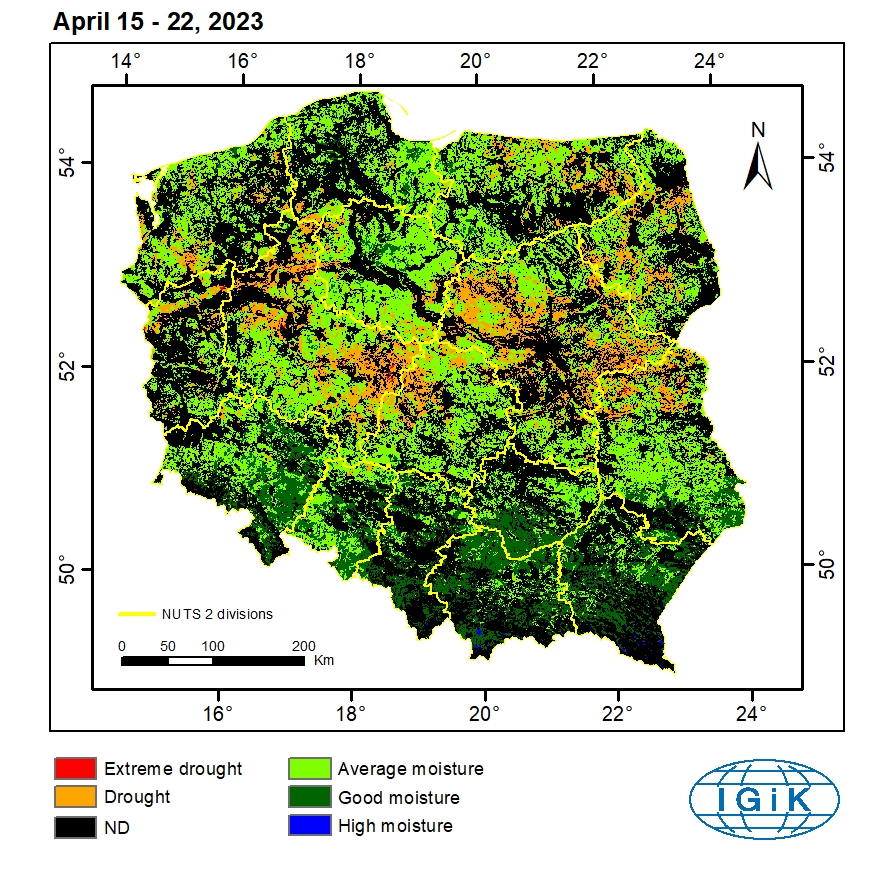
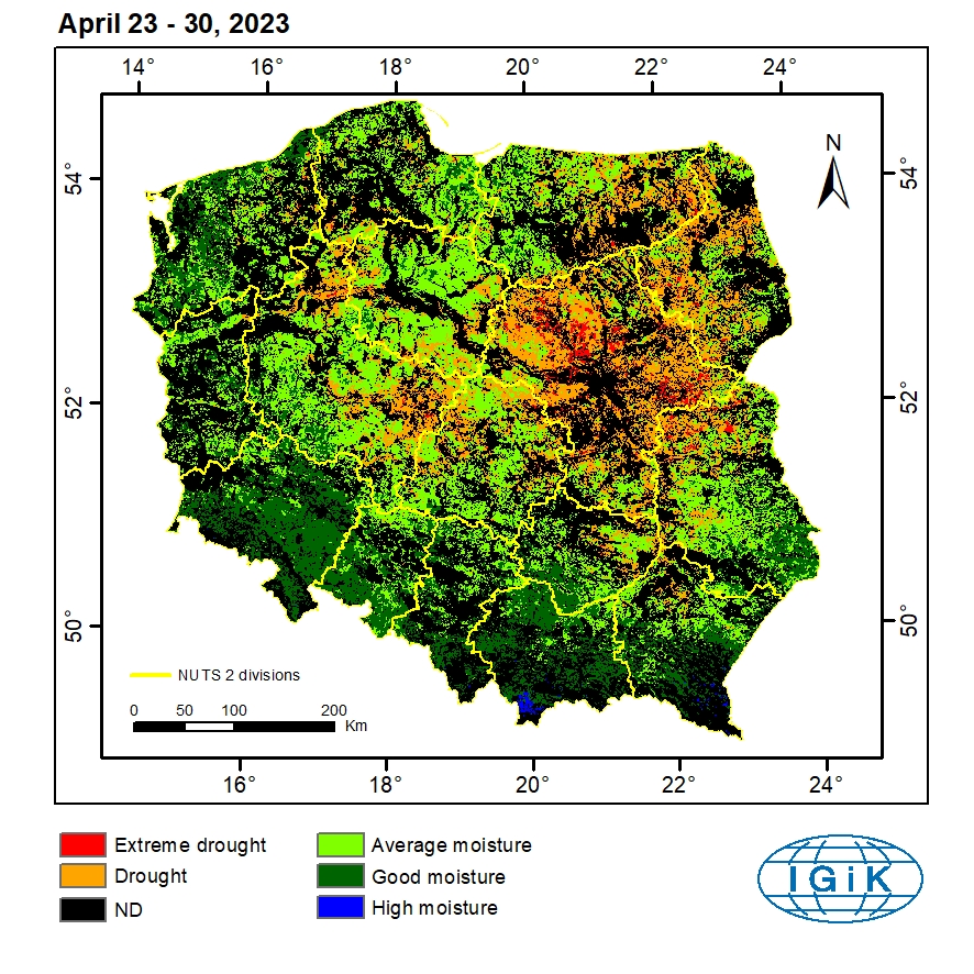
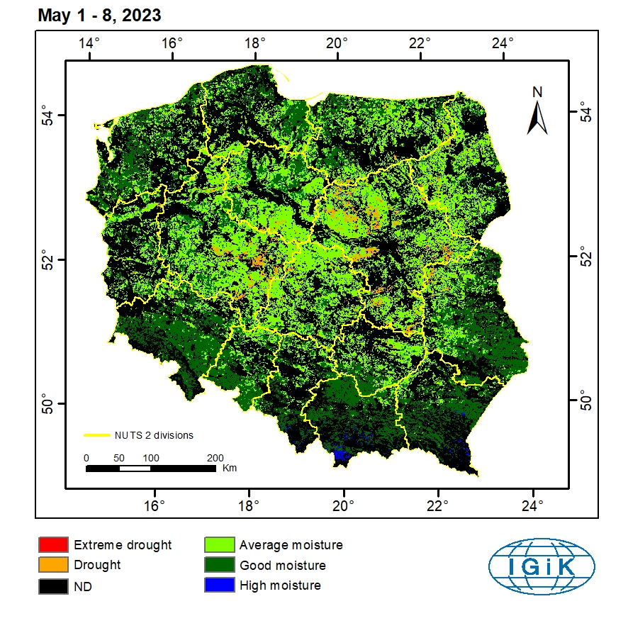
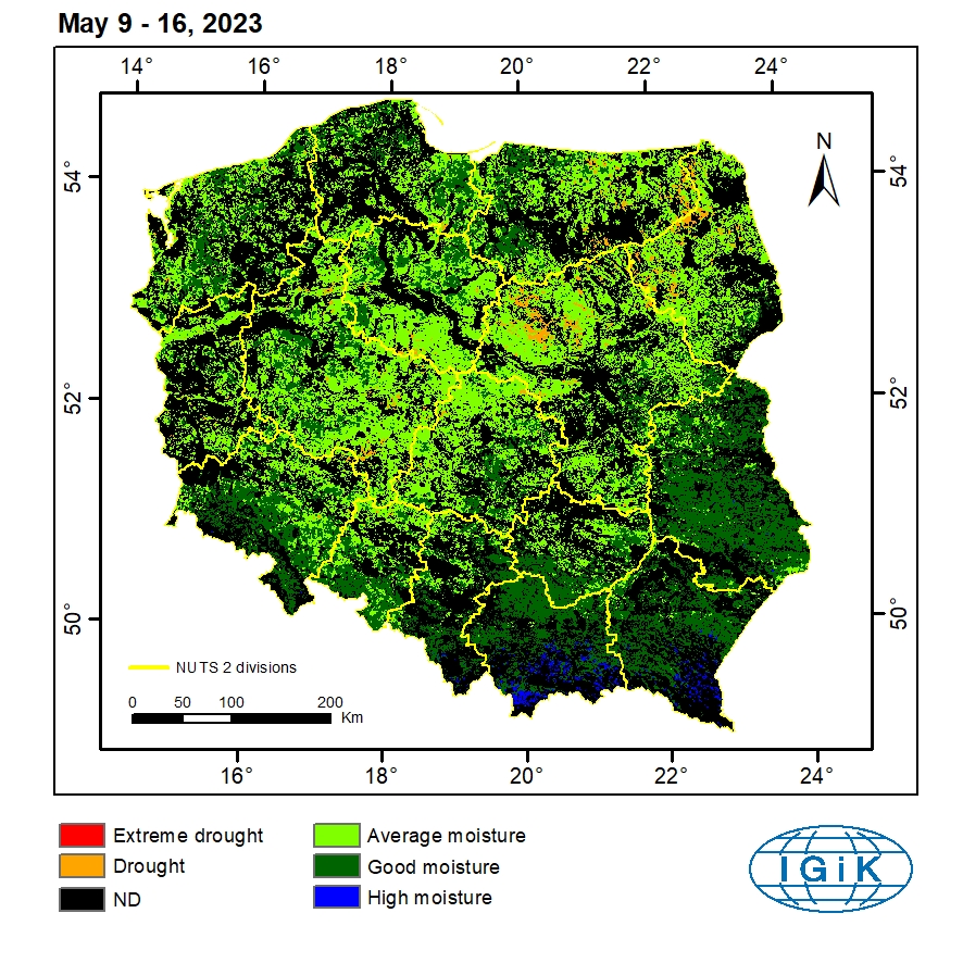
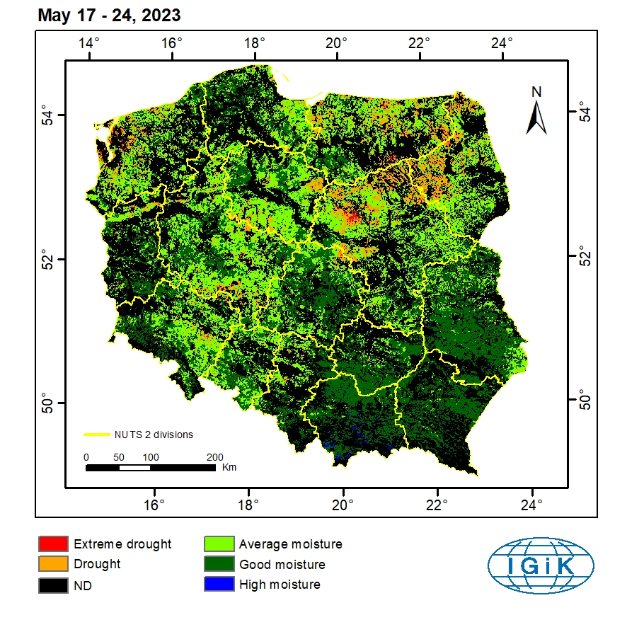
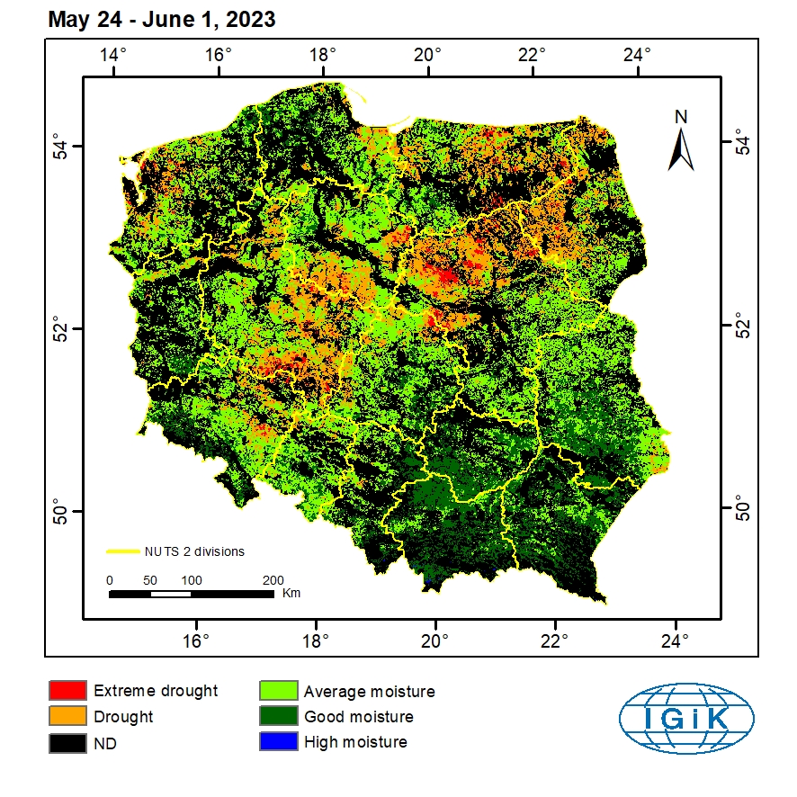
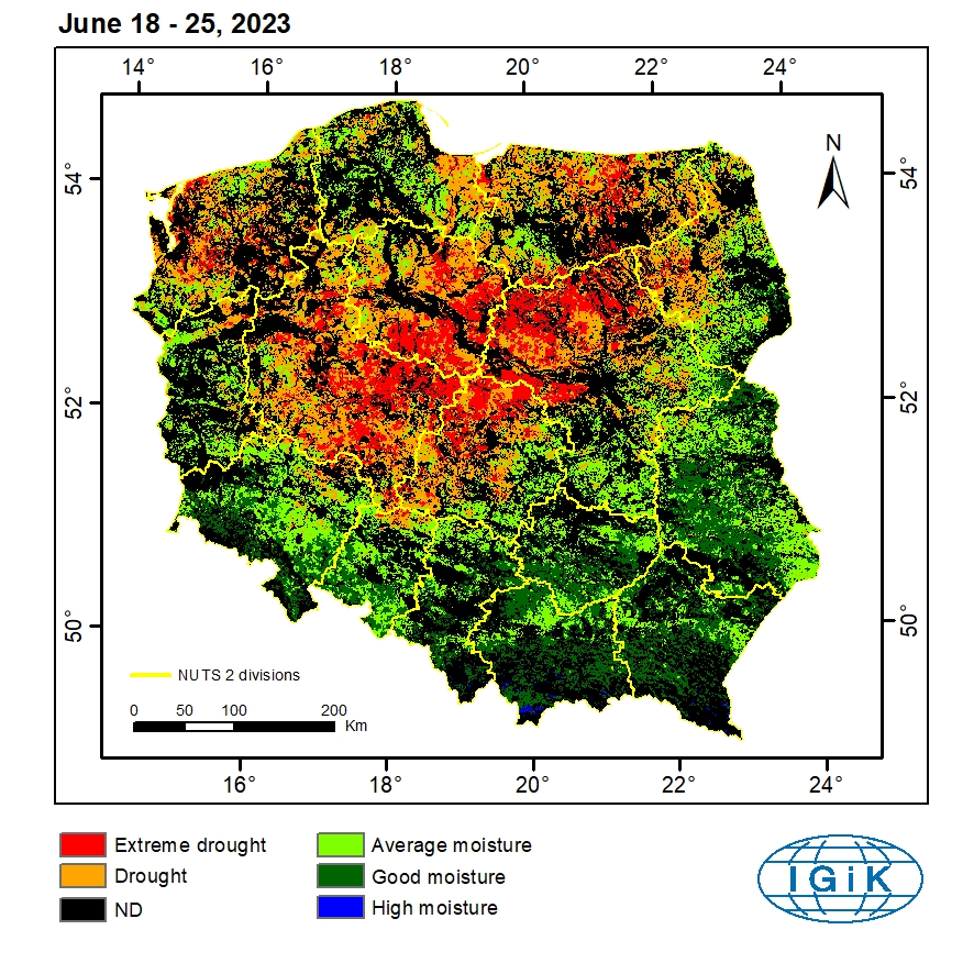
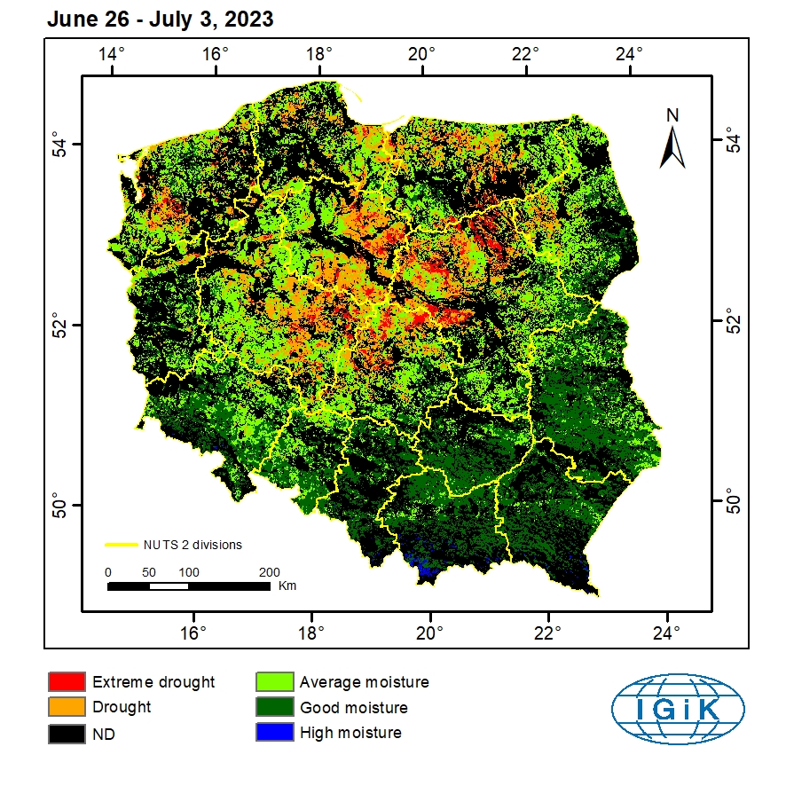
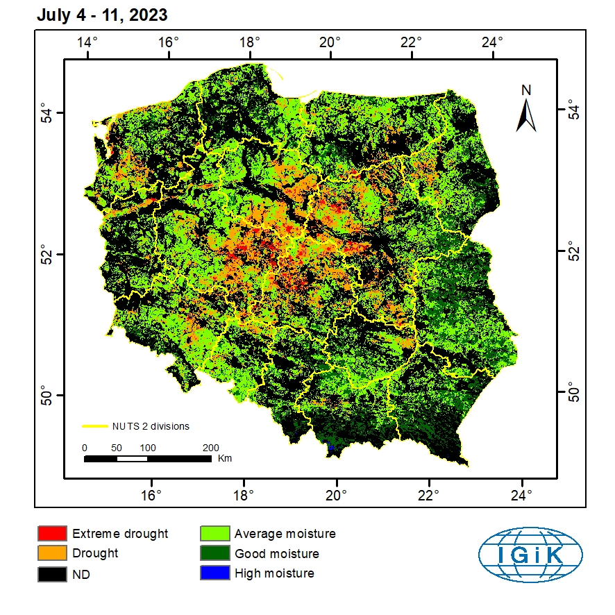
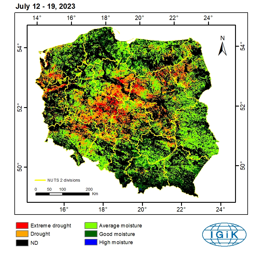
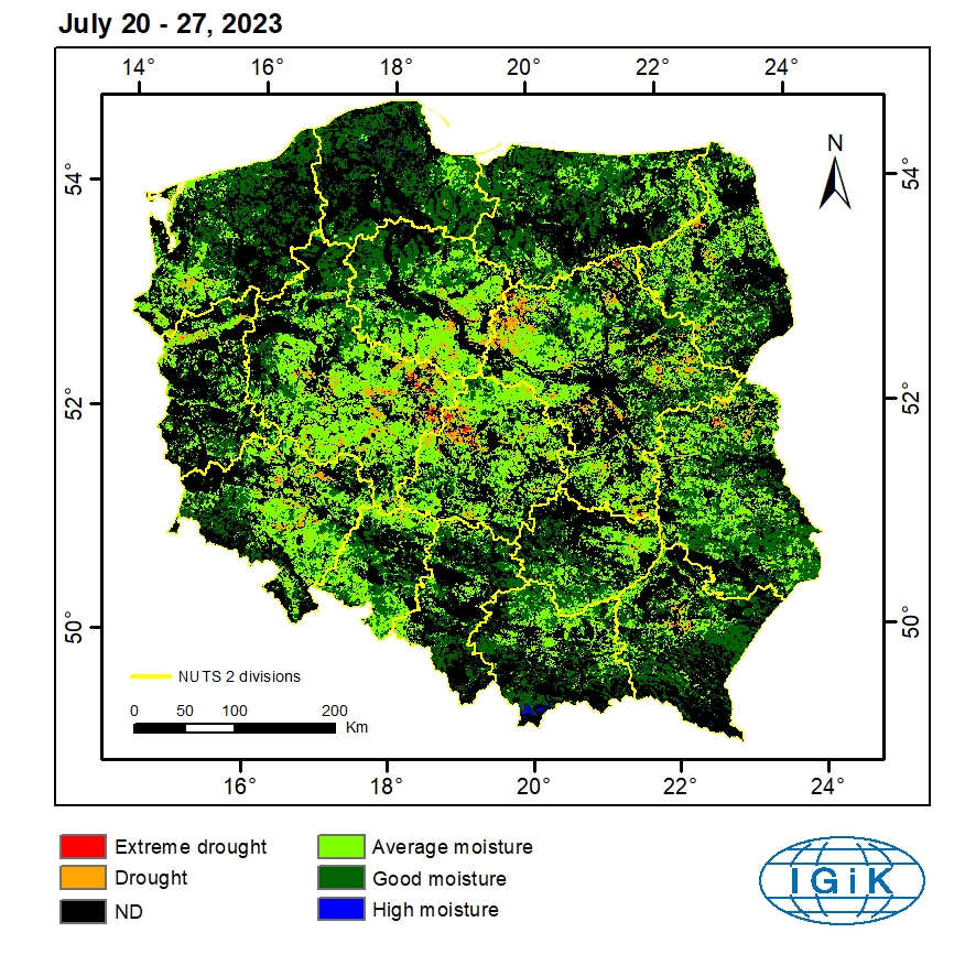
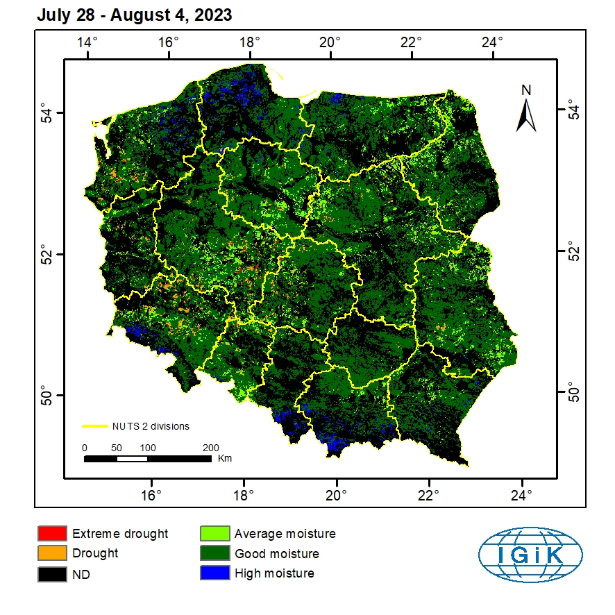
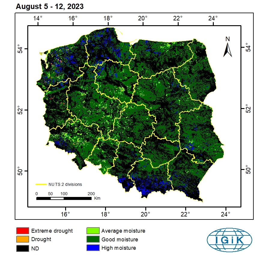
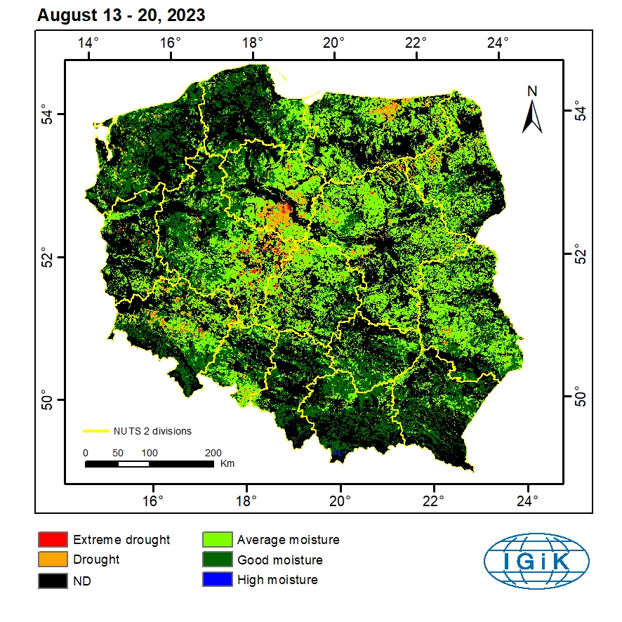
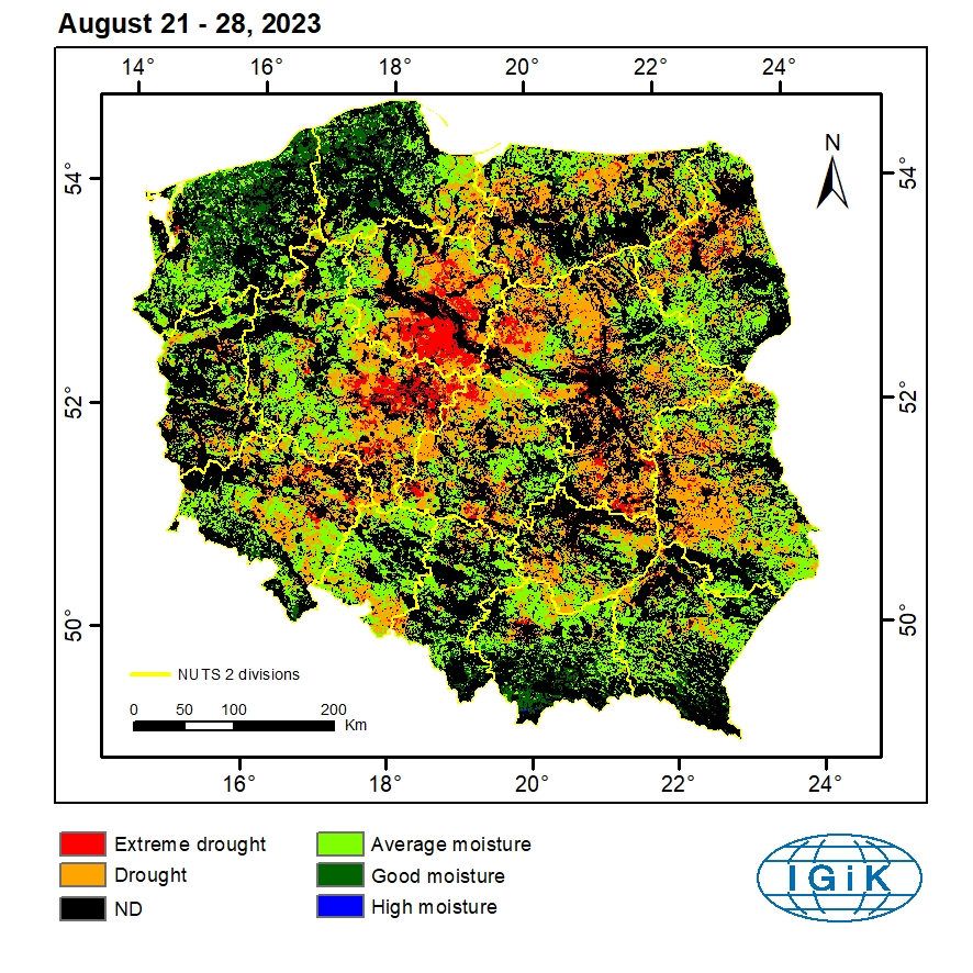
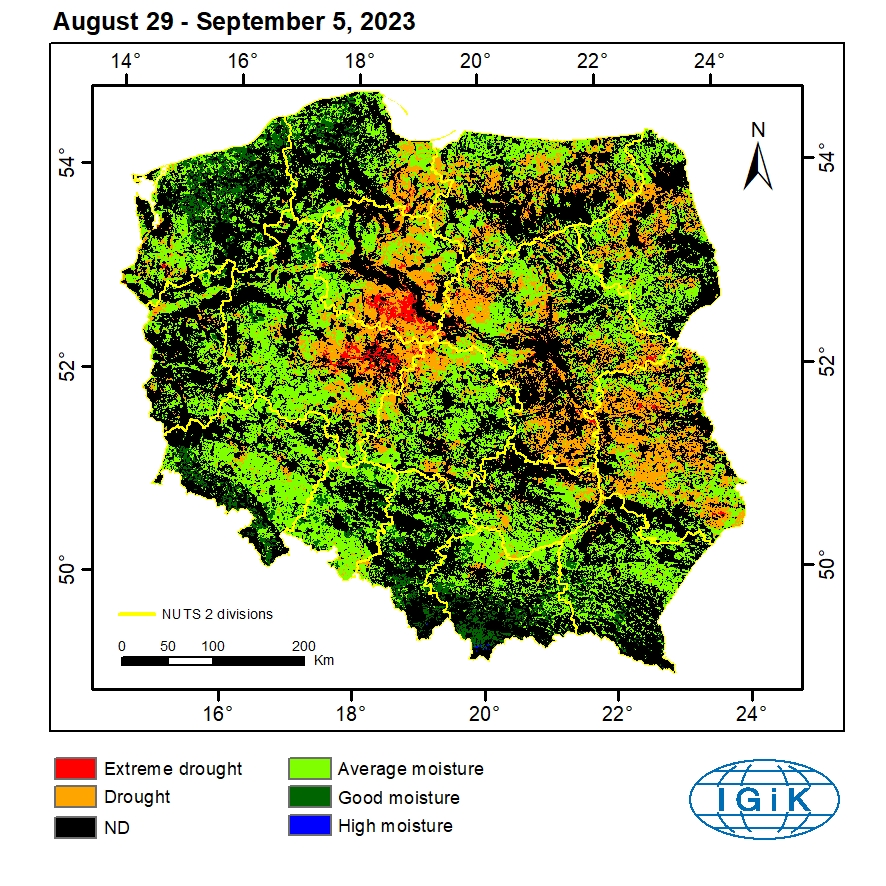
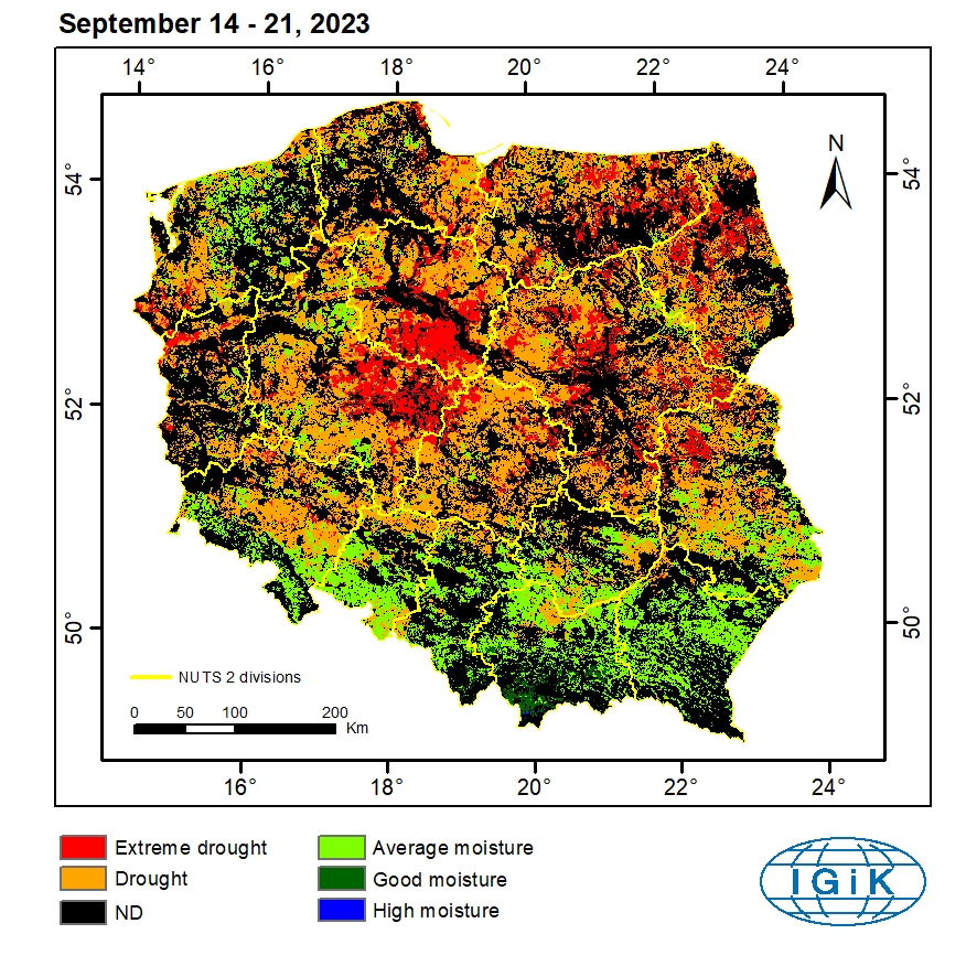
Satellite-based system for drought monitoring
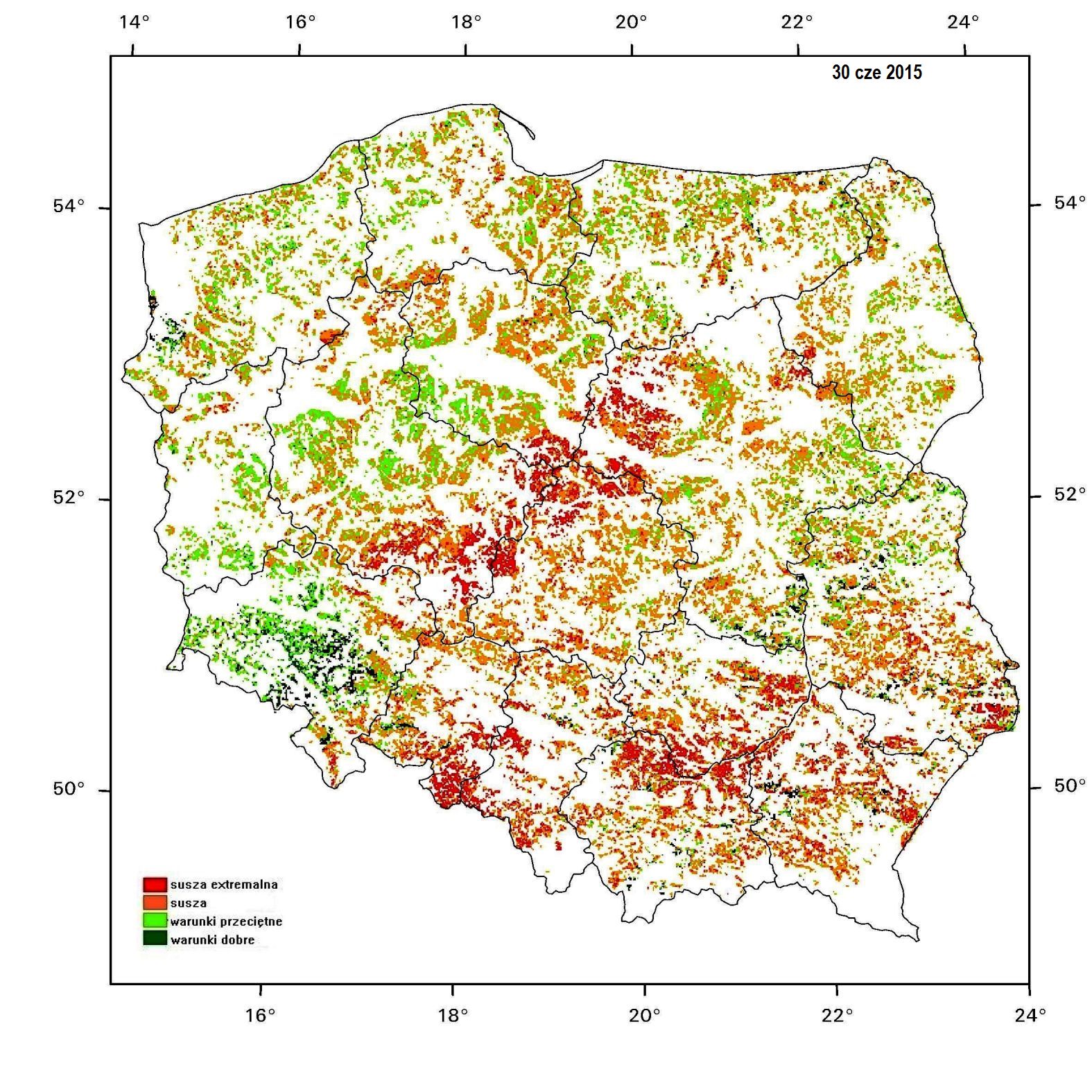
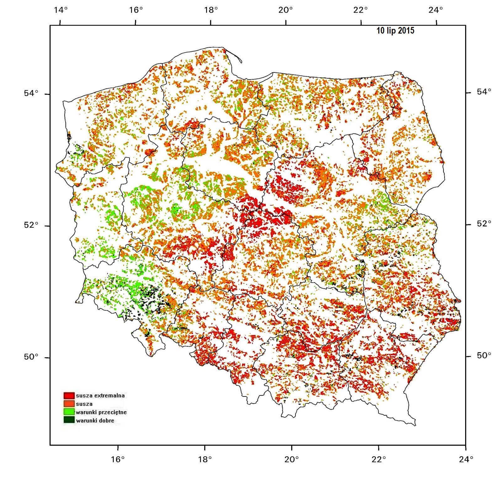
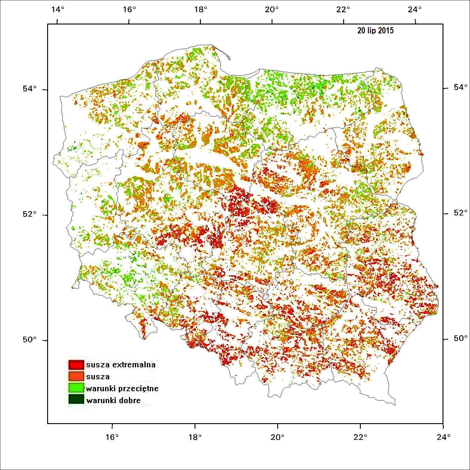
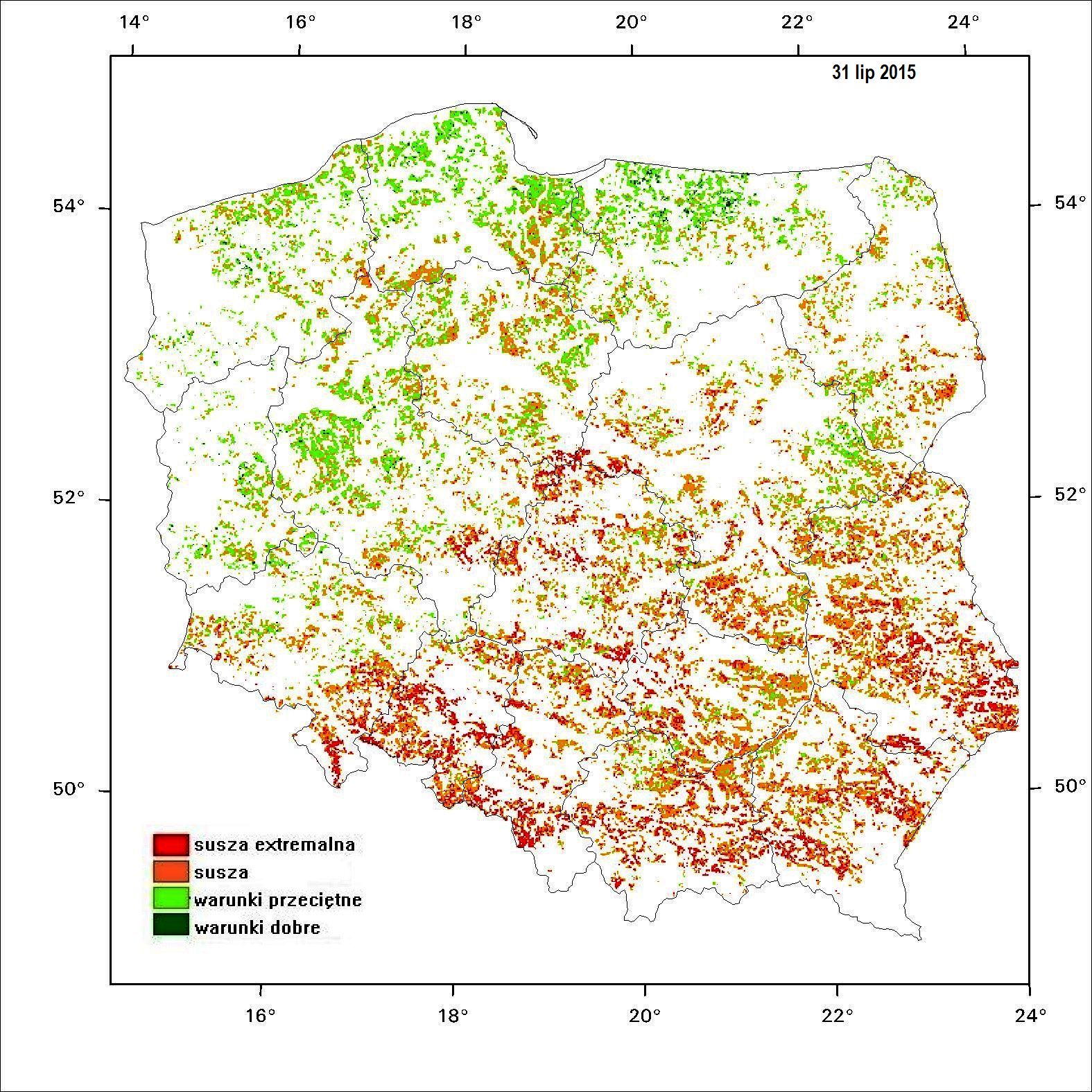
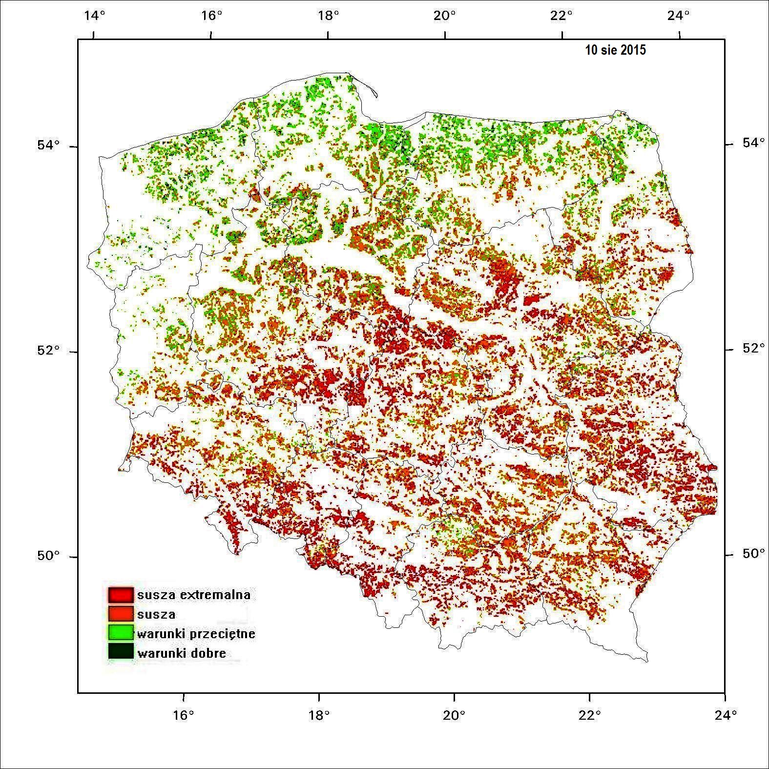
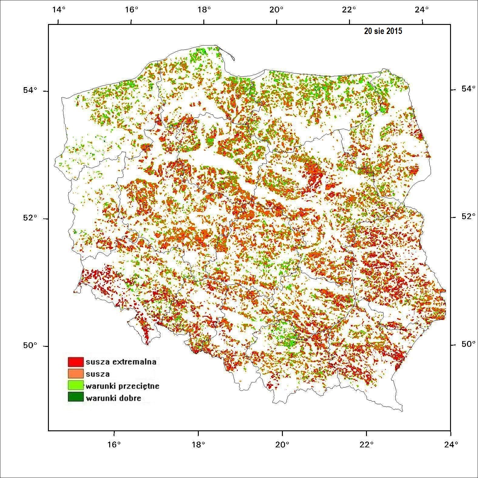
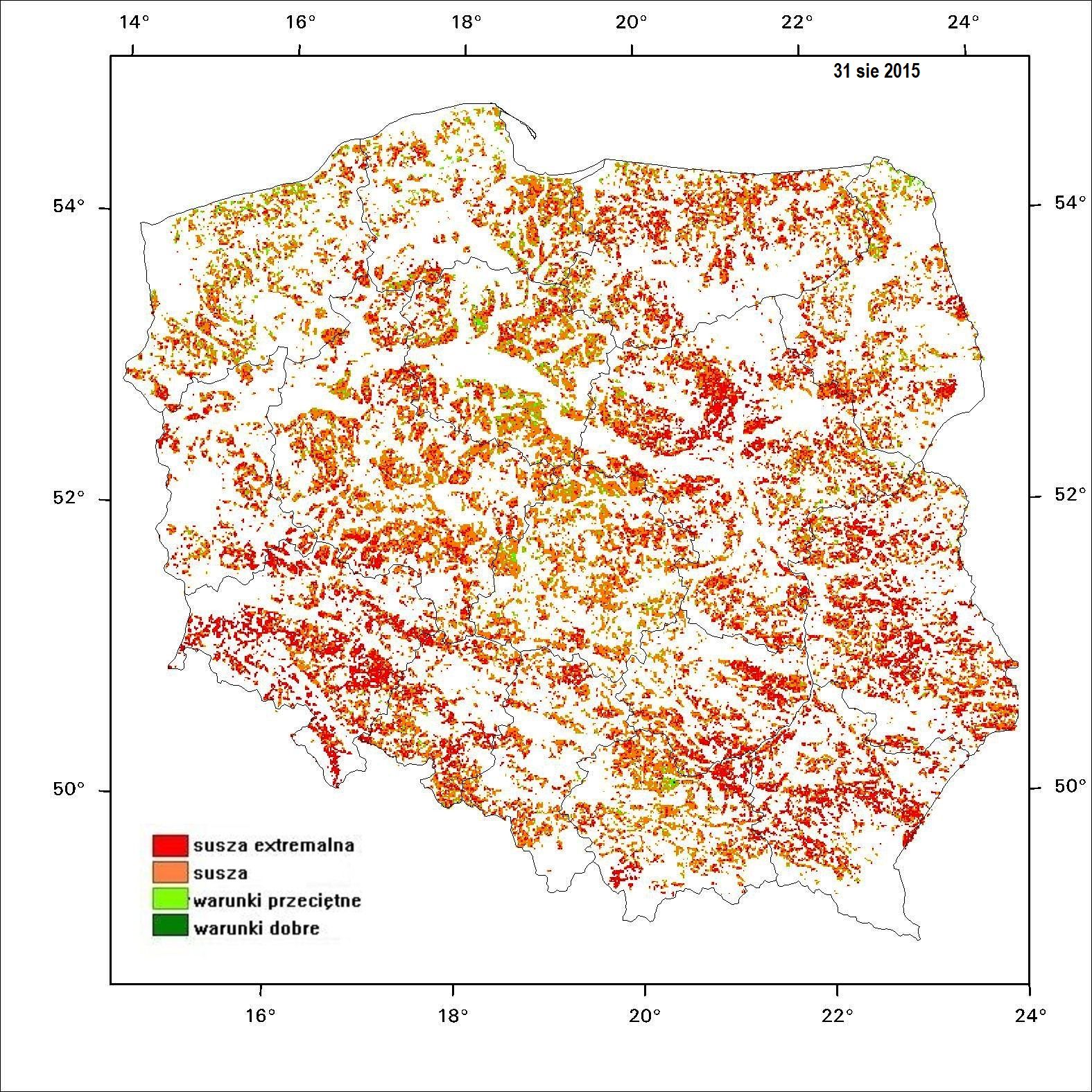
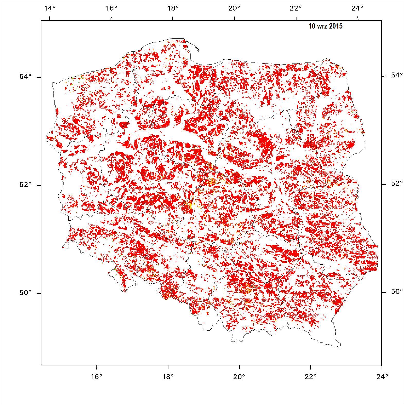
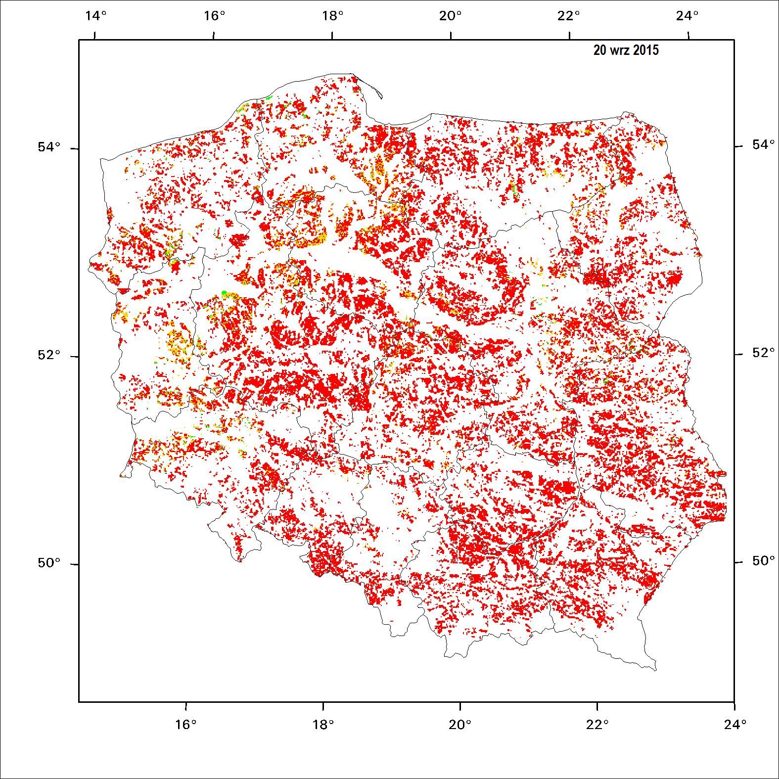
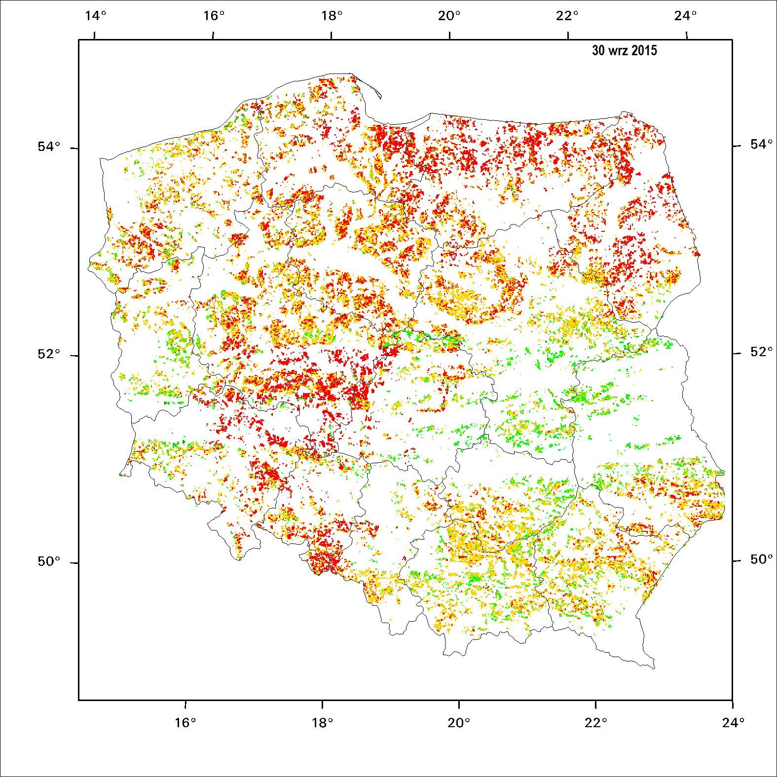
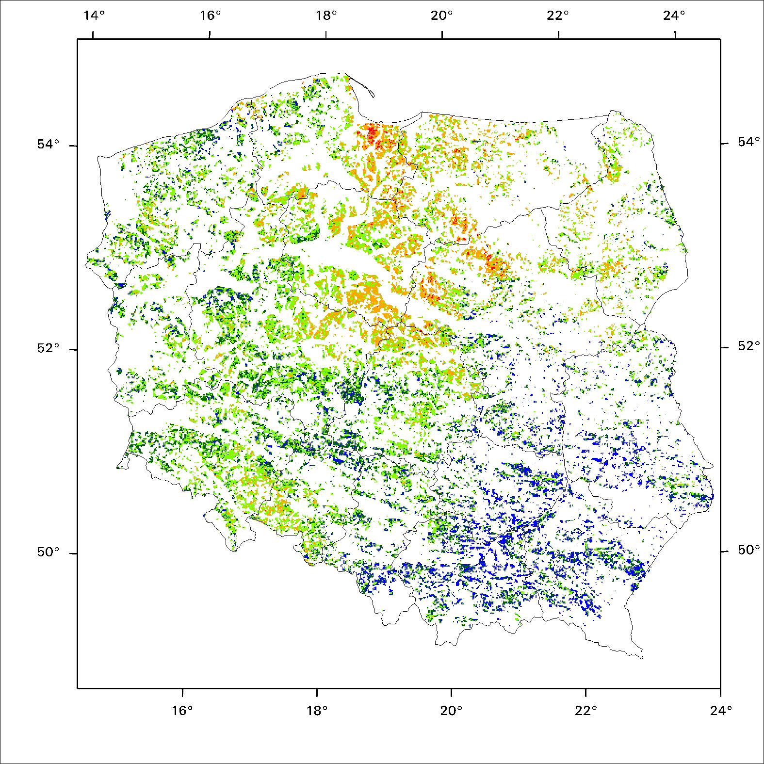
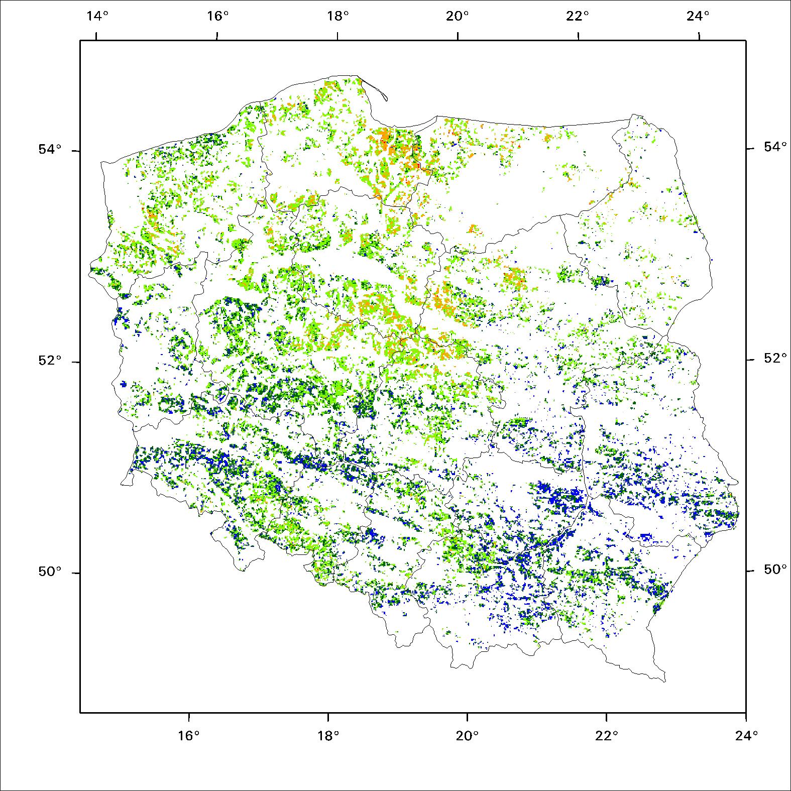
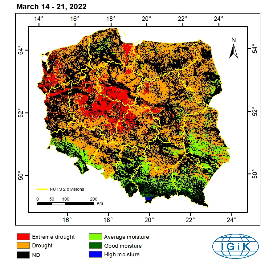
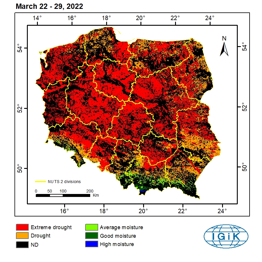
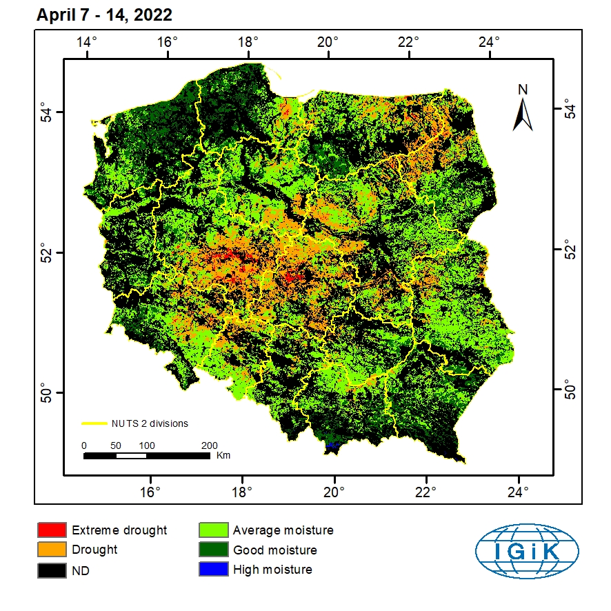
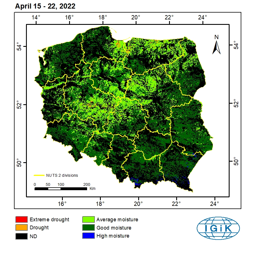
The system for monitoring crop growth conditions has been elaborated at the Remote Sensing Centre, Institute of Geodesy and Cartography. It determines crop conditions with the use of the index based on Terra MODIS satellite images with 1 km2 spatial resolution. The index, called Drought Identification Satellite System – DISS is a function of Temperature Condition Index – TCI and meteorological index characterizing climatic conditions on the territory of Poland (Hydrothermal Coefficient – HTC). DISS drought index is generated at the succeeding eight-day periods within vegetation season, starting from the end of March. Index values are divided into five ranges, characterizing particular level of moisture: extreme drought (red); drought (orange); average moisture (light green); good moisture (dark green) and high moisture (dark blue).


Archive: 2015 . 2016 . 2018 . 2019 . 2020 . 2021 . 2022 . 2023

Remote Sensing Centre utilized several types of satellite data with various spatial resolutions in order to create Comprehensive Agricultural Drought Monitoring System for the declared areas, plots, administrative units. These data were presented in the diagram. Information on drought derived from low-resolution satellite data can be compared with information on crop growth conditions, obtained from analysis of high-resolution satellite images. The picture below presents comparison of condition of corn field in 2016 and 2018 and agricultural drought level.
