Agriculture / Drought
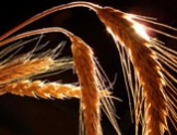
Crop growth monitoring and yield forecasting in Poland
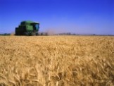
The yield prognosis based on vegetation indices derived from satellite data from NOAA/AVHRR and TERRA/MODIS satellites are made by our specialists.
Satellite-based system for drought monitoring
The system for monitoring crop growth conditions has been elaborated at the Remote Sensing Centre, Institute of Geodesy and Cartography. It determines crop conditions with the use of the index based on Terra MODIS satellite images with 1 km2 spatial resolution. The index, called Drought Identification Satellite System – DISS is a function of Temperature Condition Index – TCI and meteorological index characterizing climatic conditions on the territory of Poland (Hydrothermal Coefficient – HTC).
Implementation of Smart Villages concept in mazowieckie voivodeship

The project has pilot research character and its realization is aimed at preparation of Smart Villages concept for mazowieckie voivodeship and for strengthening collaboration between territorial units and research institutions.
Monitoring of crop growth conditions - project with KOWR

The main goals of the project were to identify agricultural drought on the territory of Poland through monitoring of crop growth conditions within vegetation season and to estimate yield reduction caused by unfavorable conditions. The project’s objectives were achieved through application of the method for identification of crop growth conditions based on the satellite drought index DISS.
Copernicus products and services for forecasting agricultural production

The Action is principally focused on capacity building and raising awareness of the various stakeholders, responsible in Poland as National Action looking internationally for monitoring and management of the environment, on the scope of applications of the Earth Observation data and services developed in the frame of Copernicus products.

South Africa - Poland - crop growth monitoring and yield assessment system

The main goal of the project is to prepare the operational system for crop growth monitoring , based on synergy of new-generation satellite data from the Copernicus Programme, low-resolution satellite data, meteorological data and in-situ observations. The System will deliver information on crop condition within vegetation period, water deficit in the course of crop development, yield forecast and early warning related to crop hazards.
Services for Earth Observation-based statistical information for agriculture

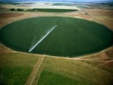
System for irrigation of potato fields based on Earth Observation data

The goal of the project is to create pre-demonstration System for Irrigation of crop (potato) fields based on Earth Observation (EO) and in-situ data. The detailed objectives are: 1) to develop and calibrate a model of soil moisture assessment based on S1 and S2 data using in situ results; 2) to validate the SM model using an independent set of measurements, and assess its accuracy, applicability and limitations; 3) to develop the model of irrigation factor value calculation throughout the growth period; 4) to establish a soil moisture and irrigation factor as pre-demonstrator product and present it for validation and provide dissemination between users from agriculture market.
Service for drought monitoring applying satellite data

The goal of the project is to create multi-level information System for Drought Monitoring based on Earth Observation (EO) and in-situ data, delivering its services in an operational way for water demanding industry, such as: energy sector, agriculture, environment as surface waters, forest.
ALOS-2 PALSAR-2 for biomass and soil moisture assessment

The objectives of the proposal is to develop the method to deliver innovative information on wetlands, forest and crops and their biomass and moisture conditions with high spatial and temporal resolution of ALOS-2 and Sentinel-1 microwave data with different polarization and incidence angle. The optical data from Sentinel-2 will be added and the synergy of information will be designed in order to depict the soil - vegetation features. The vegetation biomass, density, height, soil moisture, vegetation moisture, LAI, APAR, chlorophyll will be measured at the ground during the satellite overpass.
Satellite observations of autumn conditions for winter crops
The map of agricultural condition in september-october period in Poland on the satellite data NOAA/AVHRR.
Satellite-based monitoring crop damages
Observations of areas with frozen winter cereals are made at the Remote Sensing Centre. There are applied optical images registered from satellites NOAA, TERRA and WorldView-2.
Estimation of crop yields in Europe

Within CROP CIS, Geoland2 Global Crop Monitoring module Institute of Geodesy and Cartography has been conducted works related to inter-comparison of various methods for estimating crop acreages and yields in global / regional scale, which are based on multi-temporal remote sensing derived information.
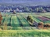
Crops identification by using satellite images
The Earth is being monitored continuously by satellites. Data derived from those satellites allows us to monitor agriculture areas and to analyse the conditions of various crops recognition.
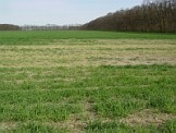
Observations of snow cover from satellites
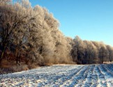
Analysis of snow cover in country or regional scale is the important element needed for evaluation of crop development conditions. Range and period of covering agricultural areas with snow implies conditions of surviving winter cereals through winter time, as well as it determines water capacity of soils at the beginning of growing season, influencing acceleration or delay in crop development.
Agricultural water pollution derived from remote sensing data
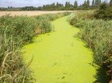
Within the framework of PECS project we estimate agricultural influence over the quality of water.